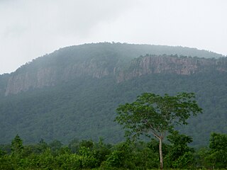
Khammam formally (Khammam Mettu) is the city in Khammam district of the Indian state of Telangana. It is the Third largest city in the state. It is the headquarters of the Khammam district and Khammam mandal also. It is located about 193 kilometres (120 mi) east of the state capital, Hyderabad, 61 kilometres (38 mi) from Suryapet, 120 kilometres (75 mi) from Warangal and also it is located about 121 kilometres (75 mi) North of the Andhra Pradesh state capital, Amaravathi. The river Munneru flows on the western side of the city. As of 2011 census of India, Khammam urban agglomeration has a population of 313,504. However, on 19 October 2012, the civic body of Khammam was upgraded to Municipal corporation Post upgradation to corporation Khammam population is approximated to be 3,07,000. Present population nearly 6,00,000 as on 31012023

Khammam district is a district in the eastern region of the Indian state of Telangana. The city of Khammam is the district headquarters. The district shares boundaries with Suryapet, Mahabubabad, Bhadradri districts and with Eluru and NTR districts in Andhra pradesh state.

Hanumakonda district, is a district located in the northern region of the Indian state of Telangana. The district headquarters are located at Hanumakonda. The district borders the districts of Jangaon, Karimnagar, Warangal, Bhupalpally and Siddipet.

Suryapet(listen) is a city in the Indian state of Telangana. It is a municipality and the headquarters of its eponymous district. The Government of India announced Suryapet to be developed under the Atal Mission for Rejuvenation and Urban Transformation (AMRUT) scheme. Suryapet has been awarded the "Cleanest city" in South India by the Ministry of Urban development in Swachh Survekshan 2017. It is also known as "Gateway of Telangana". It is located about 134 kilometres (83 mi) east of the state capital, Hyderabad and also it is located about 138 kilometres (86 mi) West of Vijayawada.
Bheemavaram is a village in Khammam district of the Indian state of Telangana. It is located in Yerrupalem mandal of Khammam revenue division.
Sathupalli is a town in Khammam district of the Indian state of Telangana. It is a Municipality in Sathupally mandal of Khammam revenue division. It is situated approximately 276 km (171 mi) east of Hyderabad, 80 km (50 mi) from Khammam and 200 km (120 mi) from Warangal. It is about 135 km (84 mi) north of Amaravati, the state capital of Andhra Pradesh, and 126 km (78 mi) west of Rajahmundry.
Kakarla may refer to: Kakarla is a surname in which is predominant in higher caste( Yadav, kapu,balija,khamma, bhrahmin, and reddy) in the Indian states of Andhra Pradesh and Telangana.
Janakipuram is a village in Chandrugonda mandal, Khammam district, Telangana, India.
Ramasgar is a village in the southern state of Telangana, India.It is one of the largest crop producer in Telangana
Madhira Assembly Constituency is a scheduled caste reserved constituency of Telangana Legislative Assembly, India. It is one among 10 constituencies in Khammam district. Madhira is a place in Khammam District. It comes unders Khammam Lok Sabha Constituency.
Palair Assembly constituency is a constituency of Telangana Legislative Assembly, India. It is one of 10 constituencies in Khammam district. It is part of Khammam Lok Sabha constituency.
Vanam Vari Krishnapuram is an Indian village in Mudigonda mandal, Khammam district in the Indian state of Telangana.

Munneru is a left tributary of the Krishna River. It originates in Warangal District of Telangana, India and flows in the districts of Khammam District and Krishna District. The river is named after Rishi Maudgalya, who is said to have created this river with his spiritual power and performed a penance ritual in Khammam.
Dachapuram is a village in Telangana, India. It is located in the Wyra mandal of Khammam District.

Taliperu is a river in the Godavari system originating in the Bijapur District of Chhattisgarh. It is a left-bank tributary of Godavari River, draining into it through a confluence located near Cherla in the Khammam District in Telangana.
Etapaka revenue division is an administrative division in the East Godavari district of the Indian state of Andhra Pradesh. It is one of the 7 revenue divisions in the district which consists of 4 mandals under its administration. Etapaka is the divisional headquarters.
Khammam revenue division is an administrative division in the Khammam district of the Indian state of Telangana. It is one of the 2 revenue divisions in the district which consists of 14 mandals under its administration. Khammam is the divisional headquarters of the division.
Khammam (urban) mandal is one of the 46 mandals in Khammam district of the Indian state of Telangana. It is under the administration of Khammam revenue division and has its headquarters at Khammam. The mandal is bounded by Kamepalli, Enkuru, Konijerla, Khammam (rural) and Chintakani mandals.
National Highway 365BB is a national highway in India. It is a secondary route of National Highway 65. NH-365BB traverses the states of Telangana and Andhra Pradesh in India. It starts at Suryapet and ends at Kovvur(Rajamahendravaram).Major cities on this route are Suryapet, Khammam and Rajamahendravaram.
Palair or Paleru is a village in Kusumanchi tehsil, Khammam district, in the state of Telangana, India. It is located on the Khammam to Suryapet road. It is location about 30 km (19 mi) from the district headquarters of Khammam, on the banks of the Paleru lake. As of the 2011 Census of India, Palair has a population of 5,143 of which 2,625 were males while females numbered 2,518.


