Amphitheater Mountain is located in the Lewis Range, Glacier National Park in the U.S. state of Montana. Amphitheater Mountain is a descriptive name given to the peak because of its resemblance to the Greek Amphitheater. The mountain's Blackfoot name is Three Horns or Niuóxkai-ozkina for a Blackfoot warrior who captured a Nez Perce woman as was able to live happily ever after. The mountain has also been named Whalen Mountain for a former park ranger.

Apikuni Mountain is located in the Lewis Range, Glacier National Park in the U.S. state of Montana.
Bad Marriage Mountain is located in the Lewis Range, Glacier National Park in the U.S. state of Montana. The mountain was named by Superintendent E. T. Scoyen for a Blackfoot Indian leader Bad Married. Bad Marriage Mountain became the accepted colloquial name. At one time, the summit was called Elk Tongue by J.W. Schultz, an early chronicler of park geography and activities. Because no Blackfoot equivalent to Elk Tongue was found, the English name was dropped and Bad Marriage Mountain became the official name.
Bearhead Mountain is located in the Lewis Range, Glacier National Park in the U.S. state of Montana. The mountain is named for kyáiyótokan, a Piegan warrior known for his war against the dreaded Assiniboine White Dog. kyáiyótokan was also a survivor of the Marias Massacre and the brother of Chief Heavy Runner a confidant of Glacier author James Willard Schultz.
Curly Bear Mountain is located in the Lewis Range, Glacier National Park in the U.S. state of Montana. Curly Bear Mountain is easily seen from the village of Saint Mary, Montana rising just west of Divide Mountain. The peak was named after Blackfoot warrior and historian Curly Bear (Kyáiyo-xusi).

Divide Mountain is located in the Lewis Range, Glacier National Park in the U.S. state of Montana. Divide Mountain is located south of Saint Mary, Montana on the border of Glacier National Park and the Blackfeet Indian Reservation.

Redhorn Peak is located in the Livingston Range, Glacier National Park in the U.S. state of Montana. Redhorn Peak is situated along the Continental Divide.
Sarcee Mountain is located in the Lewis Range, Glacier National Park in the U.S. state of Montana. Sarcee Mountain is in the northeastern region of the park.

Seward Mountain is located in the Lewis Range, Glacier National Park in the U.S. state of Montana.
Shaheeya Peak is located in the Livingston Range, Glacier National Park in the U.S. state of Montana. Shaheeya Lake is just east of the peak and Wahseeja Lake is to the northwest.

Sherburne Peak is a 8,578-foot-high (2,615 m) mountain located in the Lewis Range, Glacier National Park in the U.S. state of Montana. Sherburne Peak has two summits: the higher one being in Glacier National Park and the lower summit is located within the Blackfeet Indian Reservation.

Stoney Indian Peaks are located in the Lewis Range, Glacier National Park in the U.S. state of Montana. Consisting of several summits, the mountain is in the northeastern region of Glacier National Park, less than 2 miles (3.2 km) south of Mount Cleveland. Stoney Indian Lake is south of the peaks.
Summit Mountain is located in the Lewis Range, Glacier National Park in the U.S. state of Montana. Summit Mountain towers to the north of Marias Pass and is situated along the Continental Divide.

White Calf Mountain is located in the Lewis Range, Glacier National Park in the U.S. state of Montana. White Calf Mountain is south of Divide Mountain and just west of the Blackfeet Indian Reservation boundary.

Yellow Mountain is located in the Lewis Range, Glacier National Park in the U.S. state of Montana. Yellow Mountain forms a high ridge and connects Sherburne Peak in the east to Seward Mountain to the west.
Salvage Mountain is located in the Lewis Range, Glacier National Park in the U.S. state of Montana.

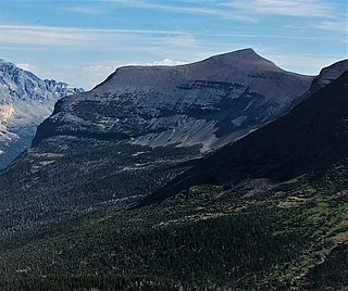
Singleshot Mountain is located in the Lewis Range, Glacier National Park in the U.S. state of Montana. The mountain is easily seen from Saint Mary, Montana and was named after the single-shot fired from a rifle by George Bird Grinnell when dispatching a Bighorn sheep while hunting for food in 1885 during park explorations. The sedimentary layers of the Appekunny Formation are clearly displayed on the southeastern cliffs of Singleshot Mountain.
Napi Rock is located in the Lewis Range, Glacier National Park in the U.S. state of Montana. Napi Rock is a pinnacle on the eastern end of Singleshot Mountain and is easily seen from Saint Mary, Montana. Napi Rock is named for Napioa also known as Nah-pee, a fictional creation myth figure of the Blookfoot who was believed to have created the earth and everything on it.
Otokomi Mountain is located in the Lewis Range, Glacier National Park in the U.S. state of Montana. Named for George Bird Grinnell's part-Blackfoot hunting partner named Otokomi which means "yellowfish'. Otokomi Mountain is north of the Rising Sun Auto Camp and Saint Mary Lake.

Altyn Peak is located in the Lewis Range, Glacier National Park in the U.S. state of Montana. Altyn Peak is situated just north of Swiftcurrent Lake and the Many Glacier Hotel and is easily seen from both locations. The peak is named after Dave Greenwood Altyn who was a financial backer of a local mine in the late 1800s; the mining town of Altyn was at the junction of Canyon Creek and Swiftcurrent Lake. The peak was known as Crow Feet Mountain after the last chief of the Blackfeet confederacy of tribes.


