
An industrial park, also known as industrial estate or trading estate, is an area zoned and planned for the purpose of industrial development. An industrial park can be thought of as a more heavyweight version of a business park or office park, which has offices and light industry, rather than heavy industry. Industrial parks are notable for being relatively simple to build; they often feature speedily erected single-space steel sheds, occasionally in bright colours.

Kutch district, officially spelled Kachchh, is a district of Gujarat state in western India, with its headquarters (capital) at Bhuj. Covering an area of 45,674 km2, it is the largest district of India. The area of Kutch is larger than the entire area of other Indian states like Haryana (44,212 km2) and Kerala (38,863 km2), as well as the country of Estonia (45,335 km2). The population of Kutch is about 2,092,371. It has 10 talukas, 939 villages and 6 municipalities. The Kutch district is home to the Kutchi people who speak the Kutchi language.

Coonoor, is a taluk and a municipal town of the Nilgiris district in the Indian state of Tamil Nadu. As of 2011, the town had a population of 45,494. The town sits at the south-east corner of the Nilgiri plateau, and at the head of the Coonoor Ghat, the principal pass connecting the Nilgiris to the plains. It is 363 miles (584 km) by rail from Chennai and 12 miles (19 km) from Ooty. The town is built within the picturesque Jackatalla valley (Jagathala), surrounded by wooded hills.

Navsari is an administrative district in the state of Gujarat in India, with its headquarters at the city of Navsari. The district covers an area of 2,211 square kilometres and was formed in 1997 after Valsad district was split into Valsad and Navsari districts. It is the largest producer of chikoos in India.

Gandhidham, initially known as Sardarganj, located in the eastern part of Kutch district, in the state of Gujarat. It is the largest and most populous city in (Kachchh) Kutch District, Gujarat, India. It was created in the early 1950s for the resettlement of Sindhi Hindu refugees from Sindh, Pakistan, in the aftermath of the partition of India. The city was named after M K Gandhi. An economic capital of Kutch, Gandhidham is a growing area for families and retirees. According to the 2011 Census, Gandhidham is Gujarat's 8th most populous city. It is a popular destination for conventions, business, and meetings.

Rajkot district is one of the 33 districts of the Indian state of Gujarat. Located in Saurashtra peninsula, Rajkot city is the administrative headquarters of the district. It is the third-most advanced district in Gujarat and the fourth most populus.

Veraval is a city and the headquarters of Gir Somnath district in the Indian state of Gujarat. Somnath temple, a place of pilgrimage due to its importance as Jyotirlinga site dedicated to Hindu deity Shiva, is located here. It is also known for the hub of fishing industries in India.

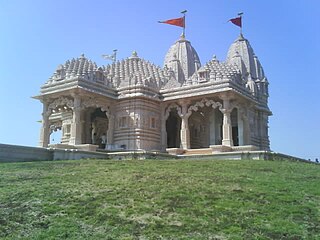
Adalaj is a census town in Gandhinagar district located in the western Indian state of Gujarat. With a population of roughly 12,000 residents within the town limits as of 2011, Adalaj is known for its semi-arid climate and its historic and religious establishments. The town sits in a generally flat area covering about 18 sq. km.
Bavla is a town, and a municipality, in Ahmedabad district, in the state of Gujarat, India.

Kallakurichi is a Municipality in the Indian state of Tamil Nadu and the administrative headquarters of Kallakurichi district in Tamil Nadu. As of 2019, the town had a population of 73528.
Katthivakkam is an residential and industrial area located in the northern part of Chennai. It is a part of zone 1 in Greater Chennai Corporation. It is under Thiruvottiyur taluk in Chennai district. It is a part of Thiruvottiyur(state assembly constituency) and Chennai North. Formerly a town and a municipality of Thiruvallur district in the Indian state of Tamil Nadu, it has now been absorbed by Chennai city in September 2011 and within Chennai District limit since January 2018. The neighbourhood is served by Katthivakkam railway station. As of 2011, the town had a population of 36,617.
Mundra is a census town and a headquarter of Mundra Taluka of Kachchh district in the Indian state of Gujarat. Founded in about the 1640s, the town was an important mercantile centre and port throughout its history. Mundra Port is the largest private port in India.
Phalodi is a city in Phalodi district in the Indian state of Rajasthan. It is the headquarters for Phalodi district. Phalodi is also called the "salt city" due to the salt industry in Rin. Phalodi is in the buffer zone of Thar Desert and often subject to extreme temperature conditions due to its arid climate. The highest temperature in the history of Phalodi is 51°C, which is the highest ever verified temperature in the country.

Adani Ports and Special Economic Zone Limited (APSEZ) is an Indian multinational port operator and logistics company, part of Adani Group. APSEZ is India's largest private port operator with a network of 12 ports and terminals, including India's first port-based SEZ at Mundra and the first deep water transshipment port at Thiruvananthapuram. The company has attracted controversies for cronyism, alleged stock manipulation and violation of environmental norms.
Maraimalai Nagar is a municipality town in South Chennai at Chengalpattu district, Tamil Nadu, India. Lying in the southern part of the Chennai metropolitan area, it is a satellite town of Chennai, the state capital, around 50 km from Downtown Chennai (Egmore) and about 15 km from Vandalur. It was developed by the CMDA in 1980. Many heavy industries are located in Maraimalai Nagar. The Ford India and BMW car factories are located within a mile from Maraimalai Nagar and the Indian software giant Infosys also has an office within eight kilometers of Maraimalai Nagar. SRM University has its main campus in the neighboring Potheri. As of 2011, Maraimalai Nagar had a population of 81,872.
Goluwala is a city in Hanumangarh district of Rajasthan, India. It belongs to Bikaner division. It is divided into two suburbs– Niwadan (24JRK) and Sihagan (22JRK). It is an industrial town located some 31 km west of Hanumangarh and around 51 km off to Sri Ganganagar. Total Population of Goluwala Niwadan(24JRK) & Sihagan(22JRK) is 14960 (9753+5207) in 2011 census. Goluwala can be reached from Pilibangan, the nearest railway station. It is 18 km off National Highway 62 (India) and 431 km from State capital Jaipur.It is popular as name "Goluwala the Golden City".

Bramhapuri is a town and eponymous headquarters of Bramhapuri taluka in Chandrapur district in the state of Maharashtra, India.

Mundra Port is India's first private port, largest container port and largest commercial port, located on the northern shores of the Gulf of Kutch near Mundra, Kutch district, Gujarat. Formerly operated by Mundra Port and Special Economic Zone Limited (MPSEZ) owned by Adani Group, it was later expanded into Adani Ports & SEZ Limited (APSEZ) managing several ports. In FY 2020–21, Mundra Port handled 144.4 million tonnes of cargo. The port currently handles over 155 MT, which constitutes nearly 11 per cent of India’s maritime cargo. The port also handles nearly 33 per cent of India’s container traffic.

Kumbhariya is a village of historical, archaeological and religious importance with cultural heritage in Danta Taluka of Banaskantha district, Gujarat, India.

