In ancient history, Western India was divided into three great states according to Hwen Thsang, namely Sindh (which comprised the whole valley of the Indus from the Punjab to the sea, including the Delta and the island of Kutch), Gurjara (which comprised Western Rajputana and the Indian Desert), and Balabhi (which comprised the peninsula of Gujarat, with a small portion of the adjacent coast).[12] Before the partition of India, the now-Pakistani territories of Sindh and Balochistan were also included in this region. In art history, the term normally covers just Gujarat and Rajasthan, which tend to move together in terms of style.[13] Western India has the second-largest gross domestic product of any region in India.
The region consists of the predominantly arid to semi-arid region of Saurashtra and Kutch in the North. The region South of that of Cambay and Southern Gujarat makes the northern semi arid region and the southern humid region submerge. The Western Ghats lie along the coast of South Gujarat, Maharashtra and Goa. The Deccan Plateaus of the Vidarbha, Marathwada in central and eastern Maharashtra define the rest of the region. The vegetation varies from tropical rainforests along the Konkan coast to thorny bushes and shrubs in northern Gujarat. The rivers in this region are the Mahi, Narmada, Tapi, Godavari, Zuari, Mandovi, Krishna, Ghaggar, Chambal and many other smaller tributaries of other rivers.
The climate varies between tropical monsoon, tropical savanna, semi arid and desert. The coastal regions experience little seasonal variations although the temperatures range between 20°C to 38°C. Mumbai and northern Konkan regions experience cooler winters with minimum temperatures hovering around 12°C. Interior Maharashtra experiences hot summers with maximum temperatures averaging 40°C and mild winters with minimum temperatures averaging about 10°C. Pune, a city in the western region experiences temperatures around 35–40°C in the summer and 7–12°C in the winter. Gujarat also has a warm climate with hot summers and cool winters.
Demographics
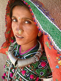
A Meghwal woman in the Hodka village, north of Bhuj
The majority follow Hinduism and there are significant minority who follow Islam and smaller number who follow Christianity. There are also a few indigenous Jews called the Bene Israel who speak Marathi. The Parsees who settled in Gujarat made Mumbai and Surat their home. Significant percentages of Jains and Buddhists can be found too. Most Christians live in the state of Goa.
Overall, 83.66% of the population is Hindu, 10.12% Muslim, 4% Buddhist with Christians in Goa and Maharashtra making up the majority of the remainder.[citation needed]
Language
Marathi, is the most widely spoken language in Western India with about 73 million speakers, followed by Gujarati with about 46 million speakers and Konkani 2.5 million speakers, all of which are Indo-Aryan languages.[16] As in other parts of India, a high level of multilingualism is seen with English and Hindi being spoken as additional languages in urban areas.[17]
The average literacy rate of West India is around 76%, higher than the national average of 70.5%.[18] The population density is around 290 per square km. The average fertility rate is about 2.2, while the average household size is about 4.7.[18]
Culture
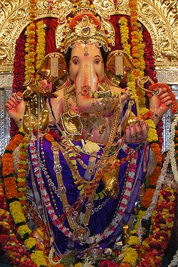
Ganesh Chaturthi, a popular festival in Maharashtra, Gujarat and Konkan region
Maharashtrian culture derives from the ancient HinduVedic culture influenced deeply by the Maratha Empire. Maharashtrians take great pride in the Maratha Empire, and many places in Maharashtra are named after the founder of the Empire, Shivaji. Marathi literature and cinema are popular in the state as well as across India. Bollywood has had a huge impact on the lifestyle and culture of this part of India as the industry is primarily located in Mumbai.
Gujarati culture is a blend of Indian culture and foreign influence. It has been influenced by the Parsis, who migrated to Gujarat from Persia about a 1000 years ago. Gujarat also saw Turkic and Mughal conquests, as well as a constant stream of back and forth migrations to and from Sindh and Rajasthan, which helped shape the unique cultural landscape of the state. Cultural Events like Rann Utsav, International Kite Festival and Global Garba festivals have been started in Gujarat to showcase its culture internationally.
The cuisine of Western India is diverse. Maharashtrian cuisine is diverse and ranges from bland to fiery hot. Pohay, Shrikhand, Pav bhaji and Vada pav are good examples of Maharashtrian cuisine. Goan cuisine is dominated by the use of rice, coconut, seafood, kokum and cashew-nuts. With its distinct spices and medium of cooking as coconut oil, both vegetarian as well as non-vegetarian cuisine is equally popular.[citation needed]
Gujarati cuisine is almost exclusively vegetarian. Gujarat is one of three states in India, with prohibition on alcohol, along with Mizoram and Manipur.[19] In contrast, Maharashtra has some of the best vineyards in India, with Nashik and Sangli districts being the country's biggest grape-producing districts.[20]
Economy
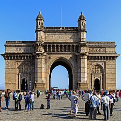
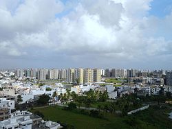
Mumbai, the financial capital of India
The region generates 24.00% of the national GDP of the country, with an annual growth rate of 14.5% as of 2006.[21] The states generate about 23% of the tax revenues of the country. More than 85% of the households have access to electricity with about 55% owning a television. Agriculture employs most people in the region, while services have largest share in the total GDP.
↑Blurton, T. Richard, Hindu Art, p. 187, 1994, British Museum Press, ISBN0 7141 1442 1; Michell, George (1990), The Penguin Guide to the Monuments of India, p.262, Volume 1: Buddhist, Jain, Hindu, 1990, Penguin Books, ISBN0140081445
This page is based on this Wikipedia article Text is available under the CC BY-SA 4.0 license; additional terms may apply. Images, videos and audio are available under their respective licenses.