Korea's provinces have been the primary administrative division of Korea since the mid Goryeo (Koryo) dynasty in the early 11th century, and were preceded by provincial-level divisions dating back to Unified Silla and Balhae during the Northern and Southern States period, in the 7th century.

During most of the Joseon dynasty, Korea was divided into eight provinces. The eight provinces' boundaries remained unchanged for about 480 years from 1413 to 1895, and formed a geographic paradigm that is still reflected today in the Korean Peninsula's administrative divisions, dialects, and regional distinctions. The names of all eight provinces are still preserved today, in one form or another. These eight historical provinces form both North and South Korea, and are not to be confused with the provinces that make up South Korea or North Korea.

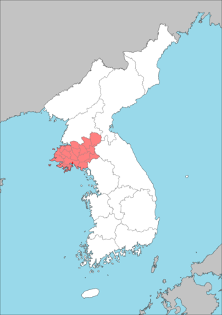
Hwanghae Province was one of the Eight Provinces of Korea during the Joseon era. Hwanghae was located in the northwest of Korea. The provincial capital was Haeju. The regional name for the province was Haeseo.
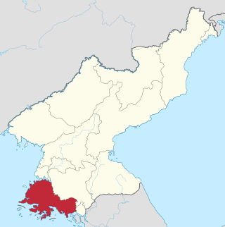
South Hwanghae Province is a province in western North Korea. The province was formed in 1954 when the former Hwanghae Province was split into North and South Hwanghae. The provincial capital is Haeju.

South Pyongan Province is a province of North Korea. The province was formed in 1896 from the southern half of the former Pyongan Province, remained a province of Korea until 1945, then became a province of North Korea. Its capital is Pyongsong.

Ongjin County (Korean: 옹진군) is a county in Incheon Metropolitan City, South Korea. It consists of a group of islands in the Yellow Sea.
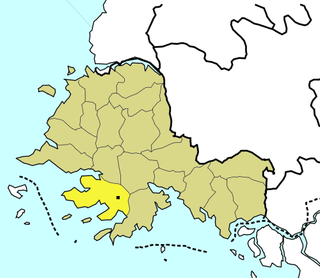
Ongjin County (Korean: 옹진군) is a county in southern South Hwanghae Province, North Korea. a It is located on the Ongjin Peninsula, which projects into the Yellow Sea.

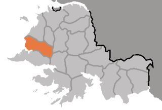
Ryongyŏn County is a county in western South Hwanghae province, North Korea. Its Yellow Sea coast is known for its natural environment and as an important habitat for plants and birds. Ryongyŏn was the first place in which Protestant Christianity was established in Korea, in the late 19th century.

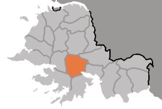
Chaeryŏng County is a county in South Hwanghae province, North Korea.

Sinch'ŏn County is a county in South Hwanghae Province, North Korea.
Changyŏn County is a county in South Hwanghae province, North Korea.
Ongjin Airport(옹진비행장) is an airport in Ongjin, Hwanghae-namdo, North Korea.
Pyŏksŏng County is a county in South Hwanghae province, North Korea.

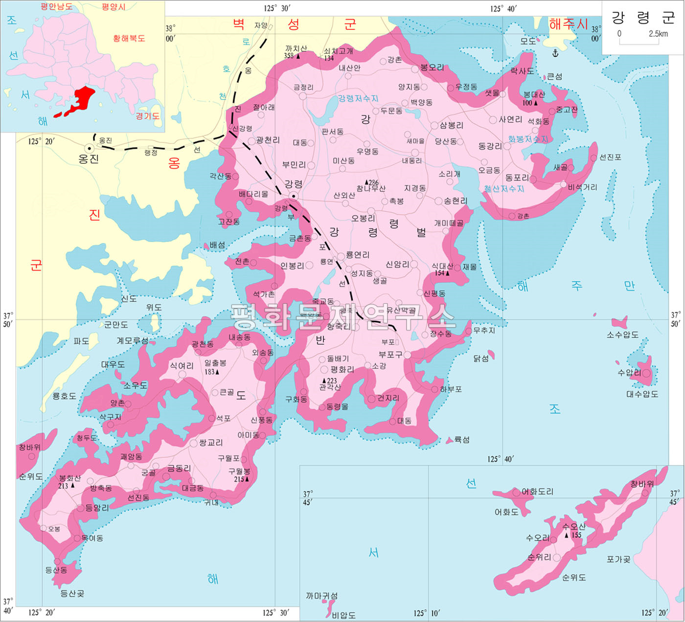
The Pup'o Line is a non-electrified standard-gauge secondary railway line of the Korean State Railway in Kangryŏng-gun, South Hwanghae Province, North Korea, running from Sin'gangryŏng on the Ongjin Line to Pup'o.

The Ongjin Bay Important Bird Area(옹진재두루미살이터) lies on the western coast of North Korea on the Yellow Sea, in Ongjin County, South Hwanghae. It comprises 3500 ha of wetlands, including rice paddies, and encompasses a 1000 ha protected area. It has been identified by BirdLife International as an Important Bird Area (IBA) because it supports significant populations of various birds, including swan geese, bean geese, greater white-fronted geese, Oriental storks, black-faced spoonbills, white-naped cranes, red-crowned cranes, long-billed plovers and Far Eastern curlews. It is threatened by aquacultural development.

Kangryong Field(강령흰두루미살이터) is a 1200 ha wetland site in South Hwanghae Province of North Korea. It has been identified by BirdLife International as an Important Bird Area (IBA) because it supports populations of Oriental storks, black-faced spoonbills, Chinese egrets, red-crowned cranes and spoon-billed sandpipers.
Hwanghae dialect is a dialect of Korean spoken in North Hwanghae Province, South Hwanghae Province in North Korea, as well as the islands of Baengnyeongdo, Yeonpyeongdo and Daecheongdo in Ongjin County in South Korea. It may also be spoken among former Korean War refugees in cities such as Incheon.
Kōkai-dō, alternatively Kōkai Province, was a province of Korea under Japanese rule. Its capital was at Kaishū. The province consisted of what is now the Hwanghae Province of North Korea.

