Kwail County 과일군 | |
|---|---|
| Korean transcription(s) | |
| • Hanja | 과일郡 |
| • McCune-Reischauer | Kwail-kun |
| • Revised Romanization | Gwail-gun |
 | |
| Coordinates: 38°23′34.26″N124°58′21.75″E / 38.3928500°N 124.9727083°E | |
| Country | North Korea |
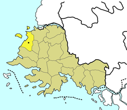
| Province | South Hwanghae Province |
| Administrative divisions | 1 ŭp, 24 ri |
| Area | |
• Total | 374 km2 (144 sq mi) |
| Population (2008 est.) | |
• Total | 89,895 |
Kwail is a kun, or county, in South Hwanghae province, North Korea. It faces the Yellow Sea to the west.
Contents
The economy of the county is based on the production of fruit. Kwail was created in 1967 from part of Songhwa County, with the intention of making the entire cultivated area of the county into "100 li of blooming orchards". [1] The name Kwail is a Korean word meaning "fruit," and doesn't correspond to any Chinese characters. This makes Kwail County one of the few counties in Korea whose name cannot be written in hanja; for another such county, see Saebyŏl. Marshal Kim Jong Un visited Kwail county in September 2017. [2]
