
Kızkalesi is an island castle situated on a small island in Mersin Province of Turkey.

Atatürk Cultural Center is a building complex for cultural events in Mersin, Turkey. Its full name is "Yenişehir Municipaty Atatürk Cultural Center". Yenişehir is a central municipality in Mersin. Together with Mersin Halkevi and Mersin Congress and Exhibition Center this complex is used for the cultural activities in Mersin.

Babadıl Islands are two small Mediterranean islands in Turkey. They are named after the former name of the village Sipahili in the mainland facing the islands. According to the British captain Francis Beaufort who was tasked to map the Mediterranean coasts of Turkey in 1811–12, the names of the islands were Papadoulae, in the antiquity. Modern scholarship identifies the island group with Akonesiai, and the northern island with ancient Crambusa or Krambousa (Κράμβουσα).

Yediadalar is the name of a group of small islands of Turkey. They are Aegean islands in the Gökova bay. Administratevly, they are a part of Marmaris ilçe (district) of Muğla Province at 36°52′N28°02′E. They are uninhabited.

Aydıncık Islands are two small Mediterranean islands in Turkey. Their former name was Gilindire, which comes from the name of the former Roman port Kelenderis which is now Aydıncık.
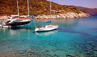
Bozyazı Island is a small Mediterranean island in Turkey.

Taşucu Seka Harbor is a harbor in Turkey. Taşucu is a town in Silifke ilçe (district) of Mersin Province. It is situated to the west of the Göksu River and it is the main port of the settlements in the Göksu River valley. Taşucu is the name of the belde (town) and SEKA is the name of the paper mill situated next to Taşucu.
Güvercin Islet is a Mediterranean islet of Turkey. It is a part of Silifke ilçe (district) of Mersin Province. It is at 36°14′38″N33°48′38″E and situated about 200 metres (660 ft) to main land. The islet is quite small; only 3,000 square metres (32,000 sq ft). There are ruins of late Roman Empire era in this otherwise unnotable island. The ruins are in the north east side of the island. The ruins probably belonged to a mansion. The construction material is rectangular stone. There are tombs, ceramics and a part of a mosaic floor in the island.

Yılanlı Ada is a small Mediterranean island in Turkey.
Orak Island is an Aegean island in Turkey
Yelkenli Island is a Mediterranean island in Turkey. It is administratively a part of Aydıncık ilçe (district) of Mersin Province at 36°08′19″N33°21′55″E.
Yumurtalık Island is a small Mediterranean island in Yumurtalık ilçe (district) of Adana Province, Turkey. The midpoint of the island is at 36°46′09″N35°47′49″E. It is situated about 300 metres (980 ft) to the east of the port.
Karataş Islets are two Mediterranean islets in Turkey.
Domuz Island Turkish: Domuz Adası, literally "Pig Island") is a Mediterranean island of Turkey. The island was popularly named after wild boars which were thought to live in the island.
Sıçan Island is an islet in the Gulf of Antalya. In the history the islet had a number of names. According to Prof. Mustafa Adak, the oldest name of the islet was Lyrnateia. During the Roman Empire era it was called Attelebussa (grasshopper). Italian seamen of the Medieval Ages used the name Renathia. Evliya Çelebi the famous Ottoman Empire traveler of the 17th century called the island Güvercin (dove) and Kuş (bird). In the 19th century its name was Rasat (observation)
Göcek Island is a Mediterranean island of Turkey.
Suluada is a Mediterranean island of Turkey. The name Suluada is a composite word meaning "watery island" referring to fresh water sources of the island. In the antiquity the island was called "Krambusa".

Saplı Islet is a Mediterranean tombolo of Turkey. The island is at the Yenikaş coast which is located 4 kilometres (2.5 mi) west of Aydıncık ilçe (district) of Mersin Province. At 36°07′48″N33°17′41″E it forms the west wall of the bay named Soğuksu. Its distance to Mersin is about 177 kilometres (110 mi)
İkiz Islands are two small Aegean islands of Turkey. They are in Gulf of Güllük. Administratively they are a part of Bodrum ilçe (district) of Muğla Province. According to map page, the island to the north east is situated at 37°7′31″N27°28′40″E. The other island is only 270 metres (890 ft) away. They are to the south west of Salih Island. The length of the northern island is 650 metres (2,130 ft) and the southern island is 750 metres (2,460 ft). The nearest point of the main land (Anatolia) is more than 2.5 kilometres (1.6 mi) away.
Arap Islet is an uninhabited island of Turkey. According to Turkish Atlas it is situated on the borderline of Aegean Sea and the Mediterranean Sea. Administratively it is a part of Marmaris ilçe (district) of Muğla Province at 36°39′5″N28°8′48″E. It is very close to the mainland (Anatolia). The channel between the mainland and the island is quite shallow; no more than 6 metres (20 ft). Its surface area is about 0.025 square kilometres (0.0097 sq mi).
