Suluada

Last updated
Suluada
Adrasan Suluada Drone.jpg
Aerial view of Suluada
Turkey adm location map.svg
Red pog.svg
Suluada
Geography
Location Mediterranean Sea
Coordinates 36°14′19″N30°28′18″E / 36.23861°N 30.47167°E / 36.23861; 30.47167
Area01 km2 (0.39 sq mi)
Administration
İl (province) Antalya Province
İlçe Kumluca

Suluada is a Mediterranean island of Turkey. The name Suluada is a composite word meaning "watery island" referring to fresh water sources of the island. In the antiquity the island was called "Krambusa". [1]

Aerial view of the boats in Suluada Adrasan Suluada.jpg
Aerial view of the boats in Suluada

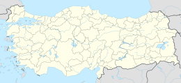
The uninhabited island is situated in the westernmost end of Gulf of Antalya about 7 kilometres (4.3 mi) to the Cape Gelidonya. Administratively, it is a part of Kumluca ilçe (district) of Antalya Province at 36°14′19″N30°28′18″E / 36.23861°N 30.47167°E / 36.23861; 30.47167 [2] The island is long and narrow where the 1,200 metres (3,900 ft)-long dimension points to northwest.

Daily excursions to Suluada from Antalya coast are being organized everyday between March and November. Island is also known as Turkish Maldives. [3]
Related Research Articles

<span class="mw-page-title-main">Antalya Province</span> Province of Turkey

Antalya Province is a province and metropolitan municipality of Turkey. It is located on the Mediterranean coast of south-west Turkey, between the Taurus Mountains and the Mediterranean Sea. Its area is 20,177 km2, and its population is 2,688,004 (2022).

<span class="mw-page-title-main">Gulf of Antalya</span>

The Gulf of Antalya is a large bay of the northern Levantine Sea, in the eastern Mediterranean Sea south of Antalya Province, Turkey. It includes some of the main seaside resorts of Turkey, also known as the "Turkish Riviera".

<span class="mw-page-title-main">Turkish Riviera</span> Region of Turkiye

The Turkish Riviera, also known popularly as the Turquoise Coast, is an area of southwest Turkey encompassing the provinces of Antalya and Muğla, and to a lesser extent Aydın, southern İzmir and western Mersin. The combination of a favorable climate, warm sea, mountainous scenery, fine beaches along more than a 1,000 km (620 mi) of shoreline along the Mediterranean and Aegean waters, and abundant natural and archaeological points of interest makes this stretch of Turkey's coastline a popular national and international tourist destination.

<span class="mw-page-title-main">Antalya Atatürk Stadium</span> Multi-purpose stadium in Antalya, Turkey

Antalya Atatürk Stadium was a multi-purpose stadium in Antalya, Turkey. It was used mostly for football matches and hosted the home games of Antalyaspor. The stadium held 12,453.

<span class="mw-page-title-main">Tekeli Mehmet Pasha Mosque</span> Ottoman mosque in Antalya, Turkey

The Tekeli Mehmet Paşa Mosque is a mosque in the city of Antalya, Turkey. The mosque takes its name from Lala Mehmed Pasa.

<span class="mw-page-title-main">Karaalioğlu Park</span>

Karaalioğlu Park is a large park in Antalya, Turkey. It is just south of Kaleiçi in the city center, easily reached on foot or by tram. The mayor's office, Municipal city theater, and an ancient fortress called Hıdırlık Tower overlooking the Roman harbor, view of the cliffs and the broad blue expanse of the Gulf of Antalya are major attractions of the park.

<span class="mw-page-title-main">Düden Waterfalls</span> Group of waterfalls in Antalya, Turkey

Düden Waterfalls are a group of waterfalls in the province of Antalya, Turkey. The waterfalls, formed by the recycle station water, are located 12 kilometres (7.5 mi) northeast of Antalya. They end where the waters of the Lower Düden Falls drop off a rocky cliff directly into the Mediterranean Sea.

<span class="mw-page-title-main">Iç Ada, Antalya</span> Turkish islet near Kaş

İç Ada is a Turkish islet near Kaş, in the homonymous district of Antalya province. It lies in the eastern Mediterranean Sea, about five nautical miles west-southwest of the island of Kekova, and about halfway between Kekova and the Greek islet of Stroggyli. The island has the shape of a right triangle elongated along a northeast-southwest axis, whose legs are 2.5 kilometres and 1.2 kilometres long. It is separated from the mainland by a 150 metres wide strait. Iç Ada is uninhabited and is covered with macchia.

<span class="mw-page-title-main">Mardan Sports Complex</span> Football stadium in Antalya, Turkey

Mardan Sports Complex is a multi-purpose stadium in Aksu, Antalya, Turkey. It is currently used mostly for football matches, and it hosted matches during the 2008 UEFA European Under-17 Championship, including the final. The stadium has a seating capacity of 7,428.

Alakır Dam is a dam in Antalya Province, Turkey, built between 1967 and 1971. The dam creates a lake that is 4 km2 (1.5 sq mi) and irrigates 3,262 hectares.

Gagae or Gagai was a town on the southeast coast of ancient Lycia, in what is now the province of Antalya, from which the Gagates lapis derived its name. The ruins are located in Kumluca district, Antalya Province, Turkey. Excavations in 2007 revealed an upper and lower acropolis and evidence of Rhodian colonization.

<span class="mw-page-title-main">Beşadalar</span> Group of islands in Turkey

Beşadalar or Beş Adalar is a group of islands off Cape Gelidonya on the south coast of Anatolia, Turkey. The largest island is named Devecitaşı Ada.

Çukurbağ Peninsula is a small Mediterranean peninsula in Turkey.

Kaledran Creek is a short creek in Anamur ilçe (district) of Mersin Province, south Turkey.

Yılan Island is a Mediterranean island in Turkey. It is administratively a part of Kaş ilçe (district) of Antalya Province at 36°12′53″N29°21′17″E.

Sıçan Island is a Mediterranean island in Turkey. It is administratively a part of Konyaaltı ilçe (district) of Antalya Province at 36°48′09″N30°55′22″E.

Sıçan Island is an islet in the Gulf of Antalya. In the history the islet had a number of names. According to Prof. Mustafa Adak, the oldest name of the islet was Lyrnateia. During the Roman Empire era it was called Attelebussa (grasshopper). Italian seamen of the Medieval Ages used the name Renathia. Evliya Çelebi the famous Ottoman Empire traveler of the 17th century called the island Güvercin (dove) and Kuş (bird). In the 19th century its name was Rasat (observation)

Üçadalar are three Mediterranean islets of Turkey. Üçadalar is a composite word meaning "three islands". The islands are part of the Kemer district of Antalya Province. They are situated to the west of the Gulf of Antalya. The two larger islands, each about 5 hectares in area, are on the southeast side of the group, and the smallest one is on the northwest. The coordinates of the southwestern island are 36°27′18″N30°32′51″E. The nearest town on the mainland is Tekirova about 5 kilometres (3 mi) to northwest.

<span class="mw-page-title-main">Isinda (Lycia)</span> Ancient Lycian town

Isinda was a town of ancient Lycia. Isinda was part of a sympoliteia with Aperlae, Apollonia and Simena.

<span class="mw-page-title-main">Teke Peninsula</span> Geographical region of Turkey

Teke Peninsula, also known as Teke Region, is a peninsula located in southwestern Turkey between the gulfs of Antalya and Fethiye extending into the Mediterranean Sea. It is bordered to the Turkish Lakes Region in the north.

References

  1. Fulantalya page (in Turkish)
  2. Map page
  3. "Antalya Suluada Tour". Book From Locals. 4 January 2022. Retrieved 8 December 2022.