
Otterberg is a town in the district of Kaiserslautern in the German state of Rhineland-Palatinate with about 7,350 inhabitants. It is situated approximately 7 kilometres (4 mi) north of Kaiserslautern.

Rockenhausen is a town in the Donnersbergkreis, in Rhineland-Palatinate, Germany. It is situated on the river Alsenz, approx. 30 km (19 mi) north of Kaiserslautern.
Enkenbach-Alsenborn is a municipality in the district of Kaiserslautern, in Rhineland-Palatinate, Germany. It is situated on the northern edge of the Palatinate forest, approx. 10 km north-east of Kaiserslautern. Enkenbach-Alsenborn is also the seat of the Verbandsgemeinde, also named Enkenbach-Alsenborn.

Hochspeyer is a municipality in the district of Kaiserslautern, in Rhineland-Palatinate, Germany. It is situated in the Palatinate forest, approx. 10 km east of Kaiserslautern.
Otterbach is a municipality in the district of Kaiserslautern, in Rhineland-Palatinate, Germany.
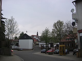
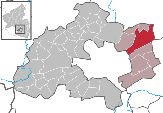
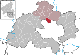
Sembach is a municipality in the district of Kaiserslautern in the state of Rhineland-Palatinate, Germany. It forms part of the Verbandsgemeinde of Enkenbach-Alsenborn. The town is nestled in the Palatinate Forest Nature Park between Kaiserslautern and Donnersbergkreis. Sembach was first mentioned in the 13th century, in a document about a donation to the monastery of Enkenbach.

Schallodenbach is municipality in the district Kaiserslautern of Rhineland-Palatinate, Germany.

Berglicht is an Ortsgemeinde – a municipality belonging to a Verbandsgemeinde, a kind of collective municipality – in the Bernkastel-Wittlich district in Rhineland-Palatinate, Germany.

Deuselbach is an Ortsgemeinde – a municipality belonging to a Verbandsgemeinde, a kind of collective municipality – in the Bernkastel-Wittlich district in Rhineland-Palatinate, Germany.

Etgert is an Ortsgemeinde – a municipality belonging to a Verbandsgemeinde, a kind of collective municipality – in the Bernkastel-Wittlich district in Rhineland-Palatinate, Germany.

Gielert is an Ortsgemeinde – a municipality belonging to a Verbandsgemeinde, a kind of collective municipality – in the Bernkastel-Wittlich district in Rhineland-Palatinate, Germany.

Gundersweiler is a village and a municipality in the Verbandsgemeinde Nordpfälzer Land and the Donnersbergkreis district, in Rhineland-Palatinate, Germany. It is located in the valley of Moschelbach in the North Palatine Uplands, southwest of Donnersberg and between Kaiserslautern and Bad Kreuznach.

Schneckenhausen is a municipality in the district of Kaiserslautern, in Rhineland-Palatinate, western Germany.

Queidersbach is a municipality in the district of Kaiserslautern, in Rhineland-Palatinate, western Germany.

Schopp is a municipality in the district of Kaiserslautern, in Rhineland-Palatinate, western Germany. Schopp station lies on the Biebermühl Railway.
Otterbach is a former Verbandsgemeinde in the district of Kaiserslautern, Rhineland-Palatinate, Germany. The seat of the Verbandsgemeinde was in Otterbach. On 1 July 2014 it merged into the new Verbandsgemeinde Otterbach-Otterberg.
Otterberg is a former Verbandsgemeinde in the district of Kaiserslautern, Rhineland-Palatinate, Germany. The seat of the Verbandsgemeinde was in Otterberg. On 1 July 2014 it merged into the new Verbandsgemeinde Otterbach-Otterberg.

Heinzenhausen on the Lauter is an Ortsgemeinde – a municipality belonging to a Verbandsgemeinde, a kind of collective municipality – in the Kusel district in Rhineland-Palatinate, Germany. It belongs to the Verbandsgemeinde of Lauterecken-Wolfstein.
Otterbach-Otterberg is a Verbandsgemeinde in the district Kaiserslautern, in Rhineland-Palatinate, Germany. The seat of the Verbandsgemeinde is in Otterberg. It was formed on 1 July 2014 by the merger of the former Verbandsgemeinden Otterbach and Otterberg.
The Odenbach is a 22.7-kilometre-long (14.1 mi) orographically right bank tributary of the Glan in the counties of Kaiserslautern and Kusel in the German state of Rhineland-Palatinate.


