Ramstein-Miesenbach

Last updated

Ramstein-Miesenbach
Kath. Kirche St. Nikolaus in Ramstein-Miesenbach.jpg
Church of Saint Nicholas
Wappen von Ramstein-Miesenbach.png
Location of Ramstein-Miesenbach within Kaiserslautern district
Ramstein-Miesenbach in KL.svgFischbachFrankensteinBannLindenHirschhornRodenbach
Germany adm location map.svg
Red pog.svg
Ramstein-Miesenbach
Rhineland-Palatinate location map.svg
Red pog.svg
Ramstein-Miesenbach
Coordinates: 49°26′46″N7°33′17″E / 49.44611°N 7.55472°E / 49.44611; 7.55472 Coordinates: 49°26′46″N7°33′17″E / 49.44611°N 7.55472°E / 49.44611; 7.55472
Country Germany
State Rhineland-Palatinate
District Kaiserslautern
Municipal assoc. Ramstein-Miesenbach
Government
   Mayor (201924) Ralf Hechler [1] (CDU)
Area
  Total43.03 km2 (16.61 sq mi)
Elevation
238 m (781 ft)
Population
 (2021-12-31) [2]
  Total8,057
  Density190/km2 (480/sq mi)
Time zone UTC+01:00 (CET)
  Summer (DST) UTC+02:00 (CEST)
Postal codes
66877
Dialling codes 06371
Vehicle registration KL
Website www.ramstein-miesenbach.de

Ramstein-Miesenbach is a town in the district of Kaiserslautern in Rhineland-Palatinate in Germany, adjacent to the U.S. Ramstein Air Base.

Contents

History

As a result of the State of Rheinland-Pfalz administrative reform, Ramstein-Miesenbach, which has a population of approx. 9,200, was created on 7 June 1969 from the independent villages of Ramstein and Miesenbach. City designation was awarded in 1991. [3] Ramstein-Miesenbach is the administrative center of the Verbandsgemeinde ("collective municipality") of Ramstein-Miesenbach which, with its approx. 19,100 inhabitants, is the largest Verbandsgemeinde in Kaiserslautern district.

Ramstein

During Roman times there was a village on the old east-west road north of the Western Palatinate swamps. Ceramic shards, coins and the remains of a Roman villa were found near "Unterschernauer" Mill, thus demonstrating that people have lived in this area since Roman times.

Ramstein is first mentioned in a document dated 2 June 1215. With this document Emperor Frederic II, the grandson of Emperor Frederic Barbarossa, gave to his knight Reinhard von Lautern the protector's rights of the Ramstein church along with its two subsidiary churches in Weilerbach and Spesbach. This knight's successor, Siegfried von Hohenecken, transferred the protectorate to the "Deutschorden" (Knights Order) in Einsiedeln, Switzerland.

In 1366 the knight Johannes von Ramstein lived in Ramstein. He served the counts of Veldenz and had his own court. In the 14th century Ramstein became part of the area under the Palatinate Elector.

In a document dated 18 October 1387 Ramstein was the center of the Ramstein court and administrative area. The village and the court belonged to the Lautern district. Court seals were found dated 1674 and 1774. After the invasion of the French in 1793 the court was dissolved. The Napoleonic Administrative Reform made Ramstein and Landstuhl into one mayoral district. Ramstein became its own mayoral entity in 1818.

Ramstein was almost completely depopulated in the Thirty Years War of the 17th century. Nine families settled in the area again in 1684. In 1802 there were 368 people in Ramstein. Economic hardship in the 1850s and 1860s forced many people to emigrate; however, by 1900 the population had grown again to 2000.

In addition to farming, peat harvesting became an important industry in the 18th and 19th century. After the railroad was built in 1868 many Ramstein men started working in the coal mines of the Saarland. The textile industry arrived in Ramstein in the 19th century. The former farming and artisan village slowly developed into an industrial community.

A significant economic and social event occurred in 1951 when the French built the Ramstein Air Base which today is the home of the Headquarters of the US Air Force Europe (USAFE) and the Component Command Air Headquarters Ramstein (CC-Air Ramstein). The City provided the base approximately one third of its 43 square kilometres of land. With about 1600 civilian employees the U.S. air base is the City's most important employer. There are some 8,200 military personnel stationed at Ramstein along with approx. 15,000 family members.

The beginning of Ramstein's modern industrial and business expansion began in the 1970s. The community had started developing a commercial area of about 0.66 km² south-west of Ramstein where several businesses settled. The immediate vicinity has now developed into an industry and commerce park with a size of 0.93 km², the "Industriezentrum Westrich". North of the city center, along the rail line, a service center with artisan and trade businesses, the "Stutzenwald" business district, has emerged. The city is currently developing a new business district (In den Seufzen) on the road to Spesbach.

Miesenbach

Miesenbach's early history is similar to that of Ramstein. It was first mentioned in 1255 in a document which states that King William leased the "Villa de Mensinbach" to Count Conrad for 300 Cologne denares. Another document from 1274 mentions a "Machtolf de Mensenbach". Otto von Huneberg was given feudal tenure of a mansion in Miesenbach by the Counts of Bolanden. Miesenbach later belonged to the Palatinate Electorate and the court district of Steinwenden. It is assumed that the feudal lords in charge of Kaiserslautern Castle temporarily lived in the "House in Miesenbach", which is why a part of Miesenbach is still named "leisure park" (Lustgarten). Animal husbandry had a long tradition in Miesenbach where animal fairs were held regularly. Miesenbach was also the home of several well-known musicians. Today Miesenbach is mainly a bedroom community. Its residents work in Ramstein or for companies in Landstuhl, Kaiserslautern, the Air Base, the neighboring state of Saarland or other parts of Rheinland-Pfalz.

Local council

The local council in Ramstein-Miesenbach has 24 members. The elections in May 2014 showed the following results: [4]

ElectionSPDCDUFWGTotal
2014513624 Seats
2009514524 Seats
2004515424 Seats

Ramstein-Miesenbach today

The city has all levels of schools as well as a number of private clubs, organizations and Volkshochschule which offers opportunities for educational and recreational activities in multiple languages.

The "Haus des Bürgers", Ramstein's cultural and conference center, is host to numerous national and international stars every year. The facility, which was completed in 1986, is also available for conferences and meetings and houses the city library.

The city museum, which is located in the old 1750 city hall which hosts a permanent collection of cultural items and regularly features special exhibits.

The AZUR Water World swimmingpool is one of the most popular attractions in the region and provides year-round indoor/outdoor water recreation for all ages.

The "Kurpfalz" Scout Center is a regular host to boy scouts and girl scouts from all over Germany. The "Seewoog" lakeside recreational area provides rest and relaxation for everyone.

Climate

Climate in this area has mild differences between highs and lows, and there is adequate rainfall year-round. The Köppen Climate Classification subtype for this climate is "Cfb" (Marine West Coast Climate/Oceanic climate). [5]

Climate data for Ramstein-Miesenbach
MonthJanFebMarAprMayJunJulAugSepOctNovDecYear
Average high °C (°F)2
(35)
4
(39)
9
(48)
14
(57)
18
(64)
21
(69)
23
(73)
22
(71)
19
(66)
14
(57)
7
(44)
3
(37)
13
(55)
Average low °C (°F)−3
(26)
−2
(28)
0
(32)
2
(35)
5
(41)
9
(48)
11
(51)
10
(50)
7
(44)
4
(39)
1
(33)
−1
(30)
3
(37)
Average precipitation mm (inches)53
(2.1)
46
(1.8)
41
(1.6)
41
(1.6)
48
(1.9)
66
(2.6)
58
(2.3)
74
(2.9)
58
(2.3)
46
(1.8)
51
(2)
64
(2.5)
640
(25.3)
Source: Weatherbase [6]

See also

Related Research Articles

<span class="mw-page-title-main">Kaiserslautern</span> Town in Rhineland-Palatinate, Germany

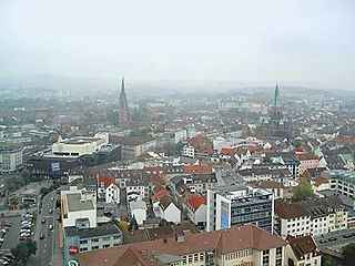
Kaiserslautern is a city in southwest Germany, located in the state of Rhineland-Palatinate at the edge of the Palatinate Forest. The historic centre dates to the 9th century. It is 459 kilometres from Paris, 117 km from Frankfurt am Main, 666 kilometers from Berlin, and 159 km from Luxembourg.

<span class="mw-page-title-main">Weilerbach</span> Municipality in Rhineland-Palatinate, Germany

Weilerbach is a municipality in the district of Kaiserslautern, in Rhineland-Palatinate, Germany. It is situated approximately 11 km north-west of Kaiserslautern.

<span class="mw-page-title-main">Landstuhl</span> Town in Germany

Landstuhl, officially the Sickingen Town of Landstuhl, is a town in the Kaiserslautern district of Rhineland-Palatinate in Germany. It is the seat of Verbandsgemeinde Landstuhl, a kind of municipal association. Landstuhl is situated on the north-west edge of the Palatinate Forest, 11 miles (18 km) west of Kaiserslautern.

<span class="mw-page-title-main">Bruchmühlbach-Miesau</span> Municipality in Rhineland-Palatinate, Germany

Bruchmühlbach-Miesau is a municipality in the district of Kaiserslautern in Rhineland-Palatinate, Germany. It is situated on the small river Glan, approx. 10 km north-east of Homburg, and 25 km west of Kaiserslautern. It has many festivals and is the home of two storks which are the pride of the village. Nearby is the Miesau Army Depot, a United States Army installation. Also nearby is Ohmbachsee, a small lake that is a popular location for concerts, festivals and the weekend.

<span class="mw-page-title-main">Hochspeyer</span> Municipality in Rhineland-Palatinate, Germany

Hochspeyer is a municipality in the district of Kaiserslautern, in Rhineland-Palatinate, Germany. It is situated in the Palatinate forest, approx. 10 km east of Kaiserslautern.

<span class="mw-page-title-main">Otterbach</span> Municipality in Rhineland-Palatinate, Germany

Otterbach is a municipality in the district of Kaiserslautern, in Rhineland-Palatinate, Germany.

<span class="mw-page-title-main">Sembach</span> Municipality in Rhineland-Palatinate, Germany

Sembach is a municipality in the district of Kaiserslautern in the state of Rhineland-Palatinate, Germany. It forms part of the Verbandsgemeinde of Enkenbach-Alsenborn. The town is nestled in the Palatinate Forest Nature Park between Kaiserslautern and Donnersbergkreis. Sembach was first mentioned in the 13th century, in a document about a donation to the monastery of Enkenbach.

<span class="mw-page-title-main">Schallodenbach</span> Municipality in Rhineland-Palatinate, Germany

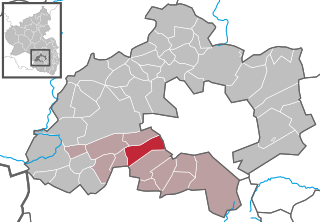
Schallodenbach is municipality in the district Kaiserslautern of Rhineland-Palatinate, Germany.

<span class="mw-page-title-main">Ellweiler</span> Municipality in Rhineland-Palatinate, Germany

Ellweiler is an Ortsgemeinde – a municipality belonging to a Verbandsgemeinde, a kind of collective municipality – in the Birkenfeld district in Rhineland-Palatinate, Germany. It belongs to the Verbandsgemeinde of Birkenfeld, whose seat is in the like-named town.

<span class="mw-page-title-main">Gundersweiler</span> Municipality in Rhineland-Palatinate, Germany

Gundersweiler is a village and a municipality in the Verbandsgemeinde Nordpfälzer Land and the Donnersbergkreis district, in Rhineland-Palatinate, Germany. It is located in the valley of Moschelbach in the North Palatine Uplands, southwest of Donnersberg and between Kaiserslautern and Bad Kreuznach.

<span class="mw-page-title-main">Katzweiler</span> Municipality in Rhineland-Palatinate, Germany

Katzweiler is a municipality in the district of Kaiserslautern, in Rhineland-Palatinate, western Germany.

<span class="mw-page-title-main">Schneckenhausen</span> Municipality in Rhineland-Palatinate, Germany

Schneckenhausen is a municipality in the district of Kaiserslautern, in Rhineland-Palatinate, western Germany.

<span class="mw-page-title-main">Queidersbach</span> Municipality in Rhineland-Palatinate, Germany

Queidersbach is a municipality in the district of Kaiserslautern, in Rhineland-Palatinate, western Germany.

<span class="mw-page-title-main">Schopp</span> Municipality in Rhineland-Palatinate, Germany

Schopp is a municipality in the district of Kaiserslautern, in Rhineland-Palatinate, western Germany. Schopp station lies on the Biebermühl Railway.

<span class="mw-page-title-main">Bann, Germany</span> Municipality in Rhineland-Palatinate, Germany

Bann is a municipality in the district of Kaiserslautern, in Rhineland-Palatinate, western Germany. Located in the Steinalb valley with the Palatinate Forest bordering it to the east.

<span class="mw-page-title-main">Linden, Kaiserslautern</span> Municipality in Rhineland-Palatinate, Germany

Linden is a municipality in the district of Kaiserslautern, in Rhineland-Palatinate, western Germany.

<span class="mw-page-title-main">Rodenbach, Rhineland-Palatinate</span> Municipality in Rhineland-Palatinate, Germany

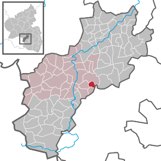
Rodenbach is a municipality in the district of Kaiserslautern, in Rhineland-Palatinate, Germany. It belongs to the Verbandsgemeinde Weilerbach.

<span class="mw-page-title-main">Börsborn</span> Municipality in Rhineland-Palatinate, Germany

Börsborn is an Ortsgemeinde – a municipality belonging to a Verbandsgemeinde, a kind of collective municipality – in the Kusel district in Rhineland-Palatinate, Germany. It belongs to the Verbandsgemeinde of Oberes Glantal.

<span class="mw-page-title-main">Niederstaufenbach</span> Municipality in Rhineland-Palatinate, Germany

Niederstaufenbach is an Ortsgemeinde – a municipality belonging to a Verbandsgemeinde, a kind of collective municipality – in the Kusel district in Rhineland-Palatinate, Germany. It belongs to the Verbandsgemeinde of Kusel-Altenglan, whose seat is in Kusel.

The Landstuhl Marsh or Landstuhl Bog is a region in West Palatinate in the German state of Rhineland-Palatinate.

References

  1. Direktwahlen 2019, Landkreis Kaiserslautern, Landeswahlleiter Rheinland-Pfalz, accessed 9 August 2021.
  2. "Bevölkerungsstand 2021, Kreise, Gemeinden, Verbandsgemeinden" (in German). Statistisches Landesamt Rheinland-Pfalz. 2022.
  3. www.ramstein-miesenbach.de Archived 2001-05-11 at archive.today
  4. Landeswahlleiter Rheinland-Pfalz: Kommunalwahl 2014, Stadt- und Gemeinderatswahlen.
  5. Climate Summary for Ramstein
  6. "Weatherbase.com". Weatherbase. 2013. Retrieved on July 6, 2013.