Queidersbach

Last updated
Queidersbach
Queidersbach-08-St Antonius-Pfarrhaus-gje.jpg
Church of Saint Anthony with the rectory
Wappen queidersbach.jpg
Location of Queidersbach within Kaiserslautern district
Queidersbach in KL.svgFischbachFrankensteinBannLindenHirschhornRodenbach
Germany adm location map.svg
Red pog.svg
Queidersbach
Rhineland-Palatinate location map.svg
Red pog.svg
Queidersbach
Coordinates: 49°22′28″N7°38′07″E / 49.37444°N 7.63528°E / 49.37444; 7.63528 Coordinates: 49°22′28″N7°38′07″E / 49.37444°N 7.63528°E / 49.37444; 7.63528
Country Germany
State Rhineland-Palatinate
District Kaiserslautern
Municipal assoc. Landstuhl
Government
   Mayor (201924) Ralph Simbgen [1] (CDU)
Area
  Total14.78 km2 (5.71 sq mi)
Elevation
321 m (1,053 ft)
Population
 (2021-12-31) [2]
  Total2,809
  Density190/km2 (490/sq mi)
Time zone UTC+01:00 (CET)
  Summer (DST) UTC+02:00 (CEST)
Postal codes
66851
Dialling codes 06371
Vehicle registration KL
Website www.queidersbach-pfalz.de

Queidersbach is a municipality in the district of Kaiserslautern, in Rhineland-Palatinate, western Germany.

Contents

Geography

The municipality is located 10 km southwest of Kaiserslautern in a natural meadow valley on the western edge of the Palatinate Forest, which merges in this area into the Sickingen Heights. Almost two-thirds of the 1500 hectare district is covered with forest. Queidersbach includes the areas Forsthaus Stempelberg, Schweinstal and Zuckerhof. [3] [4]

Through Queidersbach flows the eponymous creek, which is popularly referred to as Steinalb. The neighbouring communities are Bann, Kaiserslautern, Krickenbach, Linden, Weselberg and Obernheim-Kirchenarnbach.

History

The community was first documented in 976 when Emperor Otto II gave his vassal Biso, the Bishop of Paderborn, land on the Queidersbach.

The village Queidersbach, until the end of the 18th century, belonged to the Grand Court of the Rule Landstuhl, which was ruled by the barons of Sickingen-Hohenburg. In 1794, the left bank of the Rhine was occupied in the First Coalition War.

From 1798 to 1814, when the Palatinate was part of the French Republic and then part of the Napoleonic Empire, Queidersbach was incorporated into the canton of Landstuhl in the department of Donnersberg. At the time, it was the seat of a Mairie which also included Linden. Due to the agreements made at the Congress of Vienna, the area first came to Austria in June 1815 and was ceded to the Kingdom of Bavaria in 1816 on the basis of the Treaty of Munich. Under Bavarian administration, Queidersbach belonged to the Landeskommissariat Homburg in the Rhine district. This was converted into a district office in 1862.

From 1929 to 1939, Queidersbach belonged to the district office of Kaiserslautern. Since 1939, the community has been a part of the district of Kaiserslautern. After the Second World War, Trippstadt was within the French occupation zone of the then newly formed state of Rhineland-Palatinate and the administrative district of Pfalz. In 1972 Queidersbach was incorporated into the newly created collective municipality of Kaiserslautern-Süd during the first Rhineland-Palatinate administrative reform. This municipality subsequently merged with Landstuhl in July 2019.

Related Research Articles

Kaiserslautern is a district (Kreis) in the south of Rhineland-Palatinate, Germany. Neighboring districts are Kusel, Saarpfalz-Kreis, Donnersbergkreis, Bad Dürkheim and Südwestpfalz. The city of Kaiserslautern is almost fully enclosed by, but not belonging to the district.

<span class="mw-page-title-main">Landstuhl</span> Town in Germany

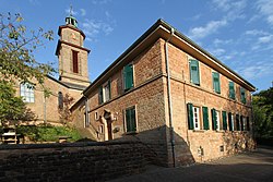
Landstuhl is a town in the Kaiserslautern district of Rhineland-Palatinate in Germany. It is the seat of Verbandsgemeinde Landstuhl, a kind of municipal association. Landstuhl is situated on the north-west edge of the Palatinate Forest, 11 miles (18 km) west of Kaiserslautern.

<span class="mw-page-title-main">Rockenhausen</span> Town in Rhineland-Palatinate, Germany

Rockenhausen is a town in the Donnersbergkreis, in Rhineland-Palatinate, Germany. It is situated on the river Alsenz, approx. 30 km (19 mi) north of Kaiserslautern.

<span class="mw-page-title-main">Hochspeyer</span> Municipality in Rhineland-Palatinate, Germany

Hochspeyer is a municipality in the district of Kaiserslautern, in Rhineland-Palatinate, Germany. It is situated in the Palatinate forest, approx. 10 km east of Kaiserslautern.

<span class="mw-page-title-main">Otterbach</span> Municipality in Rhineland-Palatinate, Germany

Otterbach is a municipality in the district of Kaiserslautern, in Rhineland-Palatinate, Germany.

<span class="mw-page-title-main">Berglangenbach</span> Municipality in Rhineland-Palatinate, Germany

Berglangenbach is an Ortsgemeinde – a municipality belonging to a Verbandsgemeinde, a kind of collective municipality – in the Birkenfeld district in Rhineland-Palatinate, Germany. It belongs to the Verbandsgemeinde of Baumholder, whose seat is in the like-named town.

<span class="mw-page-title-main">Schallodenbach</span> Municipality in Rhineland-Palatinate, Germany

Schallodenbach is municipality in the district Kaiserslautern of Rhineland-Palatinate, Germany.

<span class="mw-page-title-main">Schmittweiler</span> Municipality in Rhineland-Palatinate, Germany

Schmittweiler is an Ortsgemeinde – a municipality belonging to a Verbandsgemeinde, a kind of collective municipality – in the Bad Kreuznach district in Rhineland-Palatinate, Germany. It belongs to the Verbandsgemeinde of Meisenheim, whose seat is in the like-named town.

<span class="mw-page-title-main">Berschweiler bei Baumholder</span> Municipality in Rhineland-Palatinate, Germany

Berschweiler bei Baumholder is an Ortsgemeinde – a municipality belonging to a Verbandsgemeinde, a kind of collective municipality – in the Birkenfeld district in Rhineland-Palatinate, Germany. It belongs to the Verbandsgemeinde of Baumholder, whose seat is in the like-named town. Berschweiler bei Baumholder is one of two municipalities in the district with the name Berschweiler. The two are distinguished from each other by their geographical “tags”; the other one is called Berschweiler bei Kirn.

<span class="mw-page-title-main">Ruschberg</span> Municipality in Rhineland-Palatinate, Germany

Ruschberg is an Ortsgemeinde – a municipality belonging to a Verbandsgemeinde, a kind of collective municipality – in the Birkenfeld district in Rhineland-Palatinate, Germany. It belongs to the Verbandsgemeinde of Baumholder, whose seat is in the like-named town.

<span class="mw-page-title-main">Gerbach</span> Municipality in Rhineland-Palatinate, Germany

Gerbach is a municipality in the Donnersbergkreis district, in Rhineland-Palatinate, Germany.

<span class="mw-page-title-main">Gundersweiler</span> Municipality in Rhineland-Palatinate, Germany

Gundersweiler is a village and a municipality in the Verbandsgemeinde Nordpfälzer Land and the Donnersbergkreis district, in Rhineland-Palatinate, Germany. It is located in the valley of Moschelbach in the North Palatine Uplands, southwest of Donnersberg and between Kaiserslautern and Bad Kreuznach.

<span class="mw-page-title-main">Katzweiler</span> Municipality in Rhineland-Palatinate, Germany

Katzweiler is a municipality in the district of Kaiserslautern, in Rhineland-Palatinate, western Germany.

<span class="mw-page-title-main">Schneckenhausen</span> Municipality in Rhineland-Palatinate, Germany

Schneckenhausen is a municipality in the district of Kaiserslautern, in Rhineland-Palatinate, western Germany.

<span class="mw-page-title-main">Schopp</span> Municipality in Rhineland-Palatinate, Germany

Schopp is a municipality in the district of Kaiserslautern, in Rhineland-Palatinate, western Germany. Schopp station lies on the Biebermühl Railway.

<span class="mw-page-title-main">Bann, Germany</span> Municipality in Rhineland-Palatinate, Germany

Bann is a municipality in the district of Kaiserslautern, in Rhineland-Palatinate, western Germany. Located in the Steinalb valley with the Palatinate Forest bordering it to the east.

<span class="mw-page-title-main">Linden, Kaiserslautern</span> Municipality in Rhineland-Palatinate, Germany

Linden is a municipality in the district of Kaiserslautern, in Rhineland-Palatinate, western Germany.

<span class="mw-page-title-main">Rodenbach, Rhineland-Palatinate</span> Municipality in Rhineland-Palatinate, Germany

Rodenbach is a municipality in the district of Kaiserslautern, in Rhineland-Palatinate, Germany. It belongs to the Verbandsgemeinde Weilerbach.

<span class="mw-page-title-main">Merzalben</span> Municipality in Rhineland-Palatinate, Germany

Merzalben is a municipality in Südwestpfalz district, in Rhineland-Palatinate, western Germany, deriving its name from the Merzalbe, also known as the Merzalb, that flows through the village. Along with 5 other Ortsgemeinden Merzalben belongs to the Verbandsgemeinde Rodalben in Südwestpfalz, wherein it is the largest in terms of physical area, but the smallest in terms of population. The municipality contains several distinct natural and cultural landmarks, with the earliest known records dating back to 1237. It was also considered a state-approved tourist resort before the title was dropped in Rhineland Palatinate in 2016 and all communities awarded the designation were barred from its use in 2020.

<span class="mw-page-title-main">Sickingen Heights</span>

The Sickingen Heights form a landscape in the western part of the German state of Rhineland-Palatinate. The region was named after the family of imperial knight, Franz von Sickingen (1481–1523), because most of the area belonged to the territory of the House of Sickingen in the Middle Ages.

References

  1. Direktwahlen 2019, Landkreis Kaiserslautern, Landeswahlleiter Rheinland-Pfalz, accessed 9 August 2021.
  2. "Bevölkerungsstand 2021, Kreise, Gemeinden, Verbandsgemeinden" (in German). Statistisches Landesamt Rheinland-Pfalz. 2022.
  3. "Amtliches Verzeichnis der Gemeinden und Gemeindeteile" (PDF).
  4. Rheinland-Pfalz, Staatskanzlei. "Mein Dorf, meine Stadt (Template)". Statistisches Landesamt Rheinland-Pfalz (in German). Retrieved 2019-05-24.