
Rhineland-Palatinate is a western state of Germany. It covers 19,846 km2 (7,663 sq mi) and has about 4.05 million residents. It is the ninth largest and sixth most populous of the sixteen states. Mainz is the capital and largest city. Other cities are Ludwigshafen am Rhein, Koblenz, Trier, Kaiserslautern, Worms, and Neuwied. It is bordered by North Rhine-Westphalia, Saarland, Baden-Württemberg and Hesse and by France, Luxembourg and Belgium.

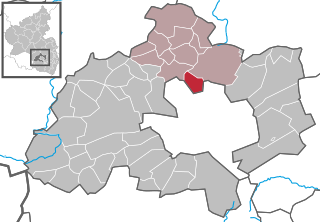
Weilerbach is a municipality in the district of Kaiserslautern, in Rhineland-Palatinate, Germany. It is situated approximately 11 km north-west of Kaiserslautern.

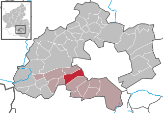
Landstuhl, officially the Sickingen Town of Landstuhl, is a town in the district of Kaiserslautern, in Rhineland-Palatinate, Germany. It is the seat of the Municipal Association of Landstuhl. Situated on the north-west edge of the Palatinate Forest, 11 miles (18 km) west of the city of Kaiserslautern, the town is located near Ramstein Air Base.

Rockenhausen is a town in the Donnersbergkreis, in Rhineland-Palatinate, Germany. It is situated on the river Alsenz, approx. 30 km (19 mi) north of Kaiserslautern.

Hochspeyer is a municipality in the district of Kaiserslautern, in Rhineland-Palatinate, Germany. It is situated in the Palatinate forest, approx. 10 km east of Kaiserslautern.
Otterbach is a municipality in the district of Kaiserslautern, in Rhineland-Palatinate, Germany.

Berglangenbach is an Ortsgemeinde – a municipality belonging to a Verbandsgemeinde, a kind of collective municipality – in the Birkenfeld district in Rhineland-Palatinate, Germany. It belongs to the Verbandsgemeinde of Baumholder, whose seat is in the like-named town.

Berschweiler bei Baumholder is an Ortsgemeinde – a municipality belonging to a Verbandsgemeinde, a kind of collective municipality – in the Birkenfeld district in Rhineland-Palatinate, Germany. It belongs to the Verbandsgemeinde of Baumholder, whose seat is in the like-named town. Berschweiler bei Baumholder is one of two municipalities in the district with the name Berschweiler. The two are distinguished from each other by their geographical “tags”; the other one is called Berschweiler bei Kirn.

Fohren-Linden is an Ortsgemeinde – a municipality belonging to a Verbandsgemeinde, a kind of collective municipality – in the Birkenfeld district in Rhineland-Palatinate, Germany. It belongs to the Verbandsgemeinde of Baumholder, whose seat is in the like-named town.

Sienhachenbach is an Ortsgemeinde – a municipality belonging to a Verbandsgemeinde, a kind of collective municipality – in the Birkenfeld district in Rhineland-Palatinate, Germany. It belongs to the Verbandsgemeinde Herrstein-Rhaunen, whose seat is in Herrstein.

Ruschberg is an Ortsgemeinde – a municipality belonging to a Verbandsgemeinde, a kind of collective municipality – in the Birkenfeld district in Rhineland-Palatinate, Germany. It belongs to the Verbandsgemeinde of Baumholder, whose seat is in the like-named town.

Gerbach is a municipality in the Donnersbergkreis district, in Rhineland-Palatinate, Germany.

Gundersweiler is a village and a municipality in the Verbandsgemeinde Nordpfälzer Land and the Donnersbergkreis district, in Rhineland-Palatinate, Germany. It is located in the valley of Moschelbach in the North Palatine Uplands, southwest of Donnersberg and between Kaiserslautern and Bad Kreuznach.
Katzweiler is a municipality in the district of Kaiserslautern, in Rhineland-Palatinate, western Germany.

Queidersbach is a municipality in the district of Kaiserslautern, in Rhineland-Palatinate, western Germany.

Schopp is a municipality in the district of Kaiserslautern, in Rhineland-Palatinate, western Germany. Schopp station lies on the Biebermühl Railway.
Bann is a municipality in the district of Kaiserslautern, in Rhineland-Palatinate, western Germany. Located in the Steinalb valley with the Palatinate Forest bordering it to the east.

Rodenbach is a municipality in the district of Kaiserslautern, in Rhineland-Palatinate, Germany. It belongs to the Verbandsgemeinde Weilerbach.
The Municipal Association of Landstuhl is a municipal association in the district of Kaiserslautern, in Rhineland-Palatinate, Germany. The seat of the municipal association is the Sickingen Town of Landstuhl.

Merzalben is a municipality in Südwestpfalz district, in Rhineland-Palatinate, western Germany, deriving its name from the Merzalbe, also known as the Merzalb, that flows through the village. Along with 5 other Ortsgemeinden Merzalben belongs to the Verbandsgemeinde Rodalben in Südwestpfalz, wherein it is the largest in terms of physical area, but the smallest in terms of population. The municipality contains several distinct natural and cultural landmarks, with the earliest known records dating back to 1237. It was also considered a state-approved tourist resort before the title was dropped in Rhineland Palatinate in 2016 and all communities awarded the designation were barred from its use in 2020.


