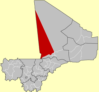
A Commune is the third level administrative unit in Mali. Mali is divided into eight regions and one capital district (Bamako). These subdivisions bear the name of their principal city. The regions are divided into 49 Cercles. The Cercles and the district are divided into 703 Communes, with 36 Urban Communes and 667 Rural Communes, while some larger Cercles still contain Arrondissements above the Commune level, these are organisational areas with no independent power or office. Rural Communes are subdivided in Villages, while Urban Communes are subdivided into Quartier. Communes usually bear the name of their principal town. The capital, Bamako, consists of six Urban Communes. There were initially 701 communes until the Law No. 01-043 of 7 June 2001 created two new Rural Communes in the desert region in the north east of the country: Alata, Ménaka Cercle in the Gao Region and Intadjedite, Tin-Essako Cercle in the Kidal Region.

Faraba is a village and rural commune in the Cercle of Kéniéba in the Kayes Region of south-western Mali. The commune includes 12 villages and in the 2009 census had a population of 8,563.

Kadiolo is a town, rural commune and seat of the Kadiolo Cercle in the Sikasso Region of southern Mali. The town lies 85 km south of Sikasso, 13 km north of the border with the Ivory Coast and 30 km west of the border with Burkino Faso. The commune of Kadiolo covers an area of 783 square kilometers and includes the town and 19 villages. In the 2009 census it had a population of 59,932.

Dioumaténé is a village and rural commune in the Cercle of Kadiolo in the Sikasso Region of southern Mali. The commune covers an area of 225 square kilometers and includes 5 villages. In the 2009 census it had a population of 4,274. The village of Dioumaténé, the administrative center (chef-lieu) of the commune, is 16 km west of Kadiolo.

Misséni is a village and rural commune in the Cercle of Kadiolo in the Sikasso Region of southern Mali. The commune covers an area of 915 square kilometers and includes 19 villages. In the 2009 census it had a population of 45,240. The village of Misséni, the administrative center (chef-lieu) of the commune, is 44 km southwest of Kadiolo.

Karagouana Mallé is a rural commune and village in the Cercle of Koutiala in the Sikasso Region of southern Mali. The commune covers an area of 182 square kilometers and includes 5 villages. In the 2009 census it had a population of 7,520. The village of Karagouana Mallé, the administrative centre (chef-lieu) of the commune, is 38 km northwest of Koutiala.

Kouniana is a village and commune in the Cercle of Koutiala in the Sikasso Region of southern Mali. The commune covers an area of 79 square kilometers and includes 2 settlements. In the 2009 census it had a population of 3,294. The village of Kouniana, the administrative centre (chef-lieu) of the commune, is 45 km northeast of Koutiala.

Tella is a village and rural commune in the Cercle of Sikasso in the Sikasso Region of southern Mali. The commune covers an area of 511 square kilometers and includes six villages. In the 2009 census it had a population of 4,372. The village of Tella, the administrative center (chef-lieu) of the commune, is 82 km northwest of Sikasso.

Koumankou is a village and rural commune in the Cercle of Sikasso in the Sikasso Region of southern Mali. The commune covers an area of 243 square kilometers and includes 4 villages. In the 2009 census it had a population of 4,227. The village of Koumankou, the chef-lieu of the commune, is 101 km northwest of Sikasso.

Dialakoro is a village and rural commune in the Cercle of Sikasso in the Sikasso Region of southern Mali. The commune covers an area of 83 square kilometers and includes four villages. In the 2009 census it had a population of 6,893. The village of Dialakoro, the chef-lieu of the commune, is 98 km northwest of Sikasso.

Danderesso is a small town and rural commune in the Cercle of Sikasso in the Sikasso Region of southern Mali. The commune covers an area of 1,645 square kilometers and includes the town and 30 villages. In the 2009 census it had a population of 41,723. The town of Danderesso, the chef-lieu of the commune, is 28 km northeast of Sikasso.

Dembela is a small town and rural commune in the Cercle of Sikasso in the Sikasso Region of southern Mali. The commune covers an area of 426 square kilometers and includes 11 villages. In the 2009 census it had a population of 13,061. The village of Dembela, the chef-lieu of the commune, is 88 km northwest of Sikasso.

Kiffosso I is a village and rural commune in the Cercle of Yorosso in the Sikasso Region of southern Mali. The commune covers an area of 446 square kilometers and includes 10 villages. In the 2009 census it had a population of 15,502. The village of Kiffosso I, the administrative center (chef-lieu) of the commune, is 21 km northeast of Yorosso.

Ménamba I is a village and rural commune in the Cercle of Yorosso in the Sikasso Region of southern Mali. The commune covers an area of 328 square kilometers and includes 8 villages. In the 2009 census it had a population of 10,449. The village of Ménamba I, the administrative center (chef-lieu) of the commune, is 12 km east-northeast of Yorosso.

Fakolo is a commune in the Cercle of Koutiala in the Sikasso Region of southern Mali. The commune covers an area of 201 square kilometers and includes 6 villages. In the 2009 census it had a population of 13,130. The village of Zansoni, the administrative centre (chef-lieu) of the commune, is 35 km northwest of Koutiala.

Diouradougou Kafo is a commune in the Cercle of Koutiala in the Sikasso Region of southern Mali. The commune covers an area of 402 square kilometers and includes 10 villages. In the 2009 census it had a population of 6,876. The village of Tièrè, the administrative centre (chef-lieu) of the commune, is 80 km south of Koutiala.

Djallon-Foula is a rural commune in the Cercle of Yanfolila in the Sikasso Region of southern Mali. The commune covers an area of 471 square kilometers and includes eight villages. In the 2009 census it had a population of 10,678. The village of Guélélinkoro, the administrative center (chef-lieu) of the commune, is 40 km west of Yanfolila and 4 km east of the Sankarani River that marks the border of Mali with Guinea.

Bolo-Fouta is a rural commune in the Cercle of Yanfolila in the Sikasso Region of southern Mali. The commune covers an area of 171 square kilometers and includes 4 villages. In the 2009 census it had a population of 4,413. The village of Doussoudiana, the administrative center (chef-lieu) of the commune, is 38 km east of Yanfolila.

Tagandougou is a rural commune in the Cercle of Yanfolila in the Sikasso Region of southern Mali. The commune covers an area of 614 square kilometers and includes 7 villages. In the 2009 census it had a population of 5,775. The village of Binko, the administrative center (chef-lieu) of the commune, is 52 km north of Yanfolila on the western side of the Sélingué Dam.

Gouanan is a rural commune in the Cercle of Yanfolila in the Sikasso Region of southern Mali. The commune covers an area of 1747 square kilometers and includes 35 villages. In the 2009 census it had a population of 24,704. The village of Yorobougoula, the administrative center (chef-lieu) of the commune, is 34 km southeast of Yanfolila.


