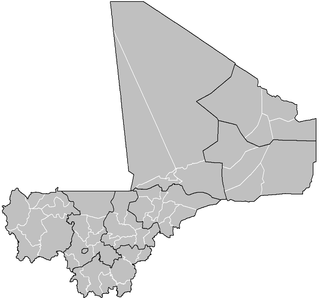
Gossi is a town and rural commune in the Cercle of Gourma-Rharous of the Tombouctou Region of Mali, lying northeast of Hombori and southwest of Gao. The town is just to the west of the main RN15 highway that links Mopti with Gao. It is on a seasonal lake, Mare de Gossi, and is surrounded by nature reserves in which a large herd of elephants live. The town is the site of a large cattle market. The commune contains around 31 villages and in the 2009 census, it had a population of 24,521. Most of the population are nomadic pastoralists but there are permanent settlements around Lake Gossi, Lake Ebanguemalène and Lake Agoufou.

Hombori is a small town and rural commune in the Cercle of Douentza in the Mopti Region of Mali. The commune contains 25 villages and in the 2009 census had a population of 23,099. The town lies just to the north of the Hombori Tondo mesa on the R15 highway linking Mopti and Gao.

A cercle is the second level administrative unit in Mali. Mali is divided into eight régions and one capital district (Bamako); the régions are subdivided into 49 cercles. These subdivisions bear the name of their principal city.

Douentza Cercle is an administrative subdivision of the Mopti Region of Mali. The administrative center (chef-lieu) is the town of Douentza.

Sama Foulala is a village and rural commune in the Cercle of Ségou in the Ségou Region of southern-central Mali. The commune contains 7 villages in an area of approximately 154 square kilometers. In the 2009 census it had a population of 6,180. The village of Sama Foulala, is on the left (north) bank of the River Niger.

Souba is a village and rural commune in the Cercle of Ségou in the Ségou Region of southern-central Mali. The commune contains 24 villages in an area of approximately 1,104 square kilometers. In the 2009 census it had a population of 17,961. The village of Souba, the chef-lieu of the commune, sits on the left (north) bank of the Niger River.

Togou is a village and rural commune in the Cercle of Ségou in the Ségou Region of southern-central Mali. The commune contains 10 villages in an area of approximate 147 square kilometers. In the 2009 census it had a population of 8,987. The village of Togou, the chef-lieu of the commune, is 35 km northeast of Ségou.

Sirifila-Boundy is a rural commune in the Cercle of Niono in the Ségou Region of Mali. It covers an area of approximately 159 square kilometers and includes 16 villages. In the 2009 census it had a population of 35,290. The seat of local government is the village of N'Debougou.

Bambara Maoudé or Bambara Maoundé is a village and rural commune of the Cercle of Gourma-Rharous in the Tombouctou Region of Mali. The commune contains 44 villages and had a population of 16,874 in the 2009 census.

Banikane is a village and commune of the Cercle of Gourma-Rharous in the Tombouctou Region of Mali. The village lies on the right bank of the River Niger, 25 km downstream of Rharous. The commune extends on both banks of the river and includes 15 villages. In the 2009 census the population of the commune was 9,433.

Inadiatafane is a village and commune of the Cercle of Gourma-Rharous in the Tombouctou Region of Mali. The commune contains 25 villages and in the 2009 census had a population of 3,557.

Daka Fifo is a village and seat of the commune of Haribomo in the Cercle of Gourma-Rharous in the Tombouctou Region of Mali.

Adiora is a small village and seat of the commune of Ouinerden in the Cercle of Gourma-Rharous in the Tombouctou Region of Mali.

Madiakoye is a village and seat of the commune of Séréré in the Cercle of Gourma-Rharous in the Tombouctou Region of Mali. The village lies on the right bank of the River Niger, upstream of Gourma-Rharous.

Haribomo is a rural commune of the Cercle of Gourma-Rharous in the Tombouctou Region of Mali. The commune contains 29 villages and in the 2009 census had a population of 7,389. The principal village (chef-lieu) is Daka Fifo.

Ouinderden is a rural commune of the Cercle of Gourma-Rharous in the Tombouctou Region of Mali. The seat lies at Adiora. The commune contains 28 small villages and in the 2009 census had a population of 6,105, nearly all of whom are nomadic pastoralists.

Séréré is a rural commune of the Cercle of Gourma-Rharous in the Tombouctou Region of Mali. The administrative center (chef-lieu) is the village of Madiakoye.


