Kaneye | |
|---|---|
Commune and village | |
| Country | |
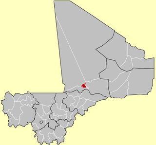
| Region | Tombouctou Region |
| Cercle | Goundam Cercle |
| Population (1998) | |
| • Total | 2,418 |
| Time zone | UTC+0 (GMT) |
Kaneye is a village and commune of the Cercle of Goudam in the Tombouctou Region of Mali. As of 1998 the commune had a population of 2,418. [1]

A Commune is the third level administrative unit in Mali. Mali is divided into eight regions and one capital district (Bamako). These subdivisions bear the name of their principal city. The regions are divided into 49 Cercles. The Cercles and the district are divided into 703 Communes, with 36 Urban Communes and 667 Rural Communes, while some larger Cercles still contain Arrondissements above the Commune level, these are organisational areas with no independent power or office. Rural Communes are subdivided in Villages, while Urban Communes are subdivided into Quartier. Communes usually bear the name of their principal town. The capital, Bamako, consists of six Urban Communes. There were initially 701 communes until the Law No. 01-043 of 7 June 2001 created two new Rural Communes in the desert region in the north east of the country: Alata, Ménaka Cercle in the Gao Region and Intadjedite, Tin-Essako Cercle in the Kidal Region.
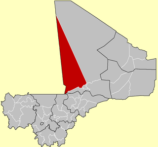
Goundam Circle is a second-level administrative subdivision of the Tombouctou Region in northern Mali. Its administrative center is the town of Goundam, although the most populous commune is that of Tonka. In the 2009 census, the circle had a population of 150,150.

Tombouctou Region is one of the administrative regions of Mali. It is the largest of Mali's eight regions and includes a large section of the Sahara Desert. For administrative purposes, the region is subdivided into five cercles.