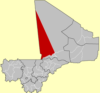
A Commune is the third level administrative unit in Mali. Mali is divided into eight regions and one capital district (Bamako). These subdivisions bear the name of their principal city. The regions are divided into 49 Cercles. The Cercles and the district are divided into 703 Communes, with 36 Urban Communes and 667 Rural Communes, while some larger Cercles still contain Arrondissements above the Commune level, these are organisational areas with no independent power or office. Rural Communes are subdivided in Villages, while Urban Communes are subdivided into Quartier. Communes usually bear the name of their principal town. The capital, Bamako, consists of six Urban Communes. There were initially 701 communes until the Law No. 01-043 of 7 June 2001 created two new Rural Communes in the desert region in the north east of the country: Alata, Ménaka Cercle in the Gao Region and Intadjedite, Tin-Essako Cercle in the Kidal Region.

Dioumaténé is a village and rural commune in the Cercle of Kadiolo in the Sikasso Region of southern Mali. The commune covers an area of 225 square kilometers and includes 5 villages. In the 2009 census it had a population of 4,274. The village of Dioumaténé, the administrative center (chef-lieu) of the commune, is 16 km west of Kadiolo.

Kaï is a village and rural commune in the Cercle of Kadiolo in the Sikasso Region of southern Mali. The commune covers an area of 183 square kilometers and includes 8 villages. In the 2009 census it had a population of 8,827. The village of Kaï, the administrative center (chef-lieu) of the commune, is 47 km north of Kadiolo.

Kapala is a village and commune in the Cercle of Koutiala in the Sikasso Region of southern Mali. The commune covers an area of 199 square kilometers and includes 4 villages. In the 2009 census the commune had a population of 4,064. The village of Kapala, the administrative centre (chef-lieu) of the commune, is about 20 km south of Koutiala.

Konina is a small town and commune in the Cercle of Koutiala in the Sikasso Region of southern Mali. The commune covers an area of 733 square kilometers and includes 7 villages. In the 2009 census it had a population of 14,786. The village of Konina, the administrative centre (chef-lieu) of the commune, is 78 km east of Koutiala.

Kourouma is a village and rural commune in the Cercle of Sikasso in the Sikasso Region of southern Mali. The commune covers an area of 293 square kilometers and includes 10 villages. In the 2009 census it had a population of 11,234. The village of Kourouma, the chef-lieu of the commune, is 81 km northwest of Sikasso.

Dialakoro is a village and rural commune in the Cercle of Sikasso in the Sikasso Region of southern Mali. The commune covers an area of 83 square kilometers and includes four villages. In the 2009 census it had a population of 6,893. The village of Dialakoro, the chef-lieu of the commune, is 98 km northwest of Sikasso.

Nongo-Souala is a village rural commune in the Cercle of Sikasso in the Sikasso Region of southern Mali. The commune covers an area of 264 square kilometers and includes four villages. In the 2009 census it had a population of 4,578. The village of Nongo-Souala, the administrative center (chef-lieu) of the commune, is 50 km north of Sikasso.

Dembela is a small town and rural commune in the Cercle of Sikasso in the Sikasso Region of southern Mali. The commune covers an area of 426 square kilometers and includes 11 villages. In the 2009 census it had a population of 13,061. The village of Dembela, the chef-lieu of the commune, is 88 km northwest of Sikasso.

Sokourani-Missirikoro is a village and rural commune in the Cercle of Sikasso in the Sikasso Region of southern Mali. The commune covers an area of 88 square kilometers and includes five villages. In the 2009 census it had a population of 4,478. The village of Sokourani-Missirikoro, the administrative center (chef-lieu) of the commune, is 13 km southwest of Sikasso. The main language spoken in the commune is Senufo.

Koury is a small town and rural commune in the Cercle of Yorosso in the Sikasso Region of southern Mali. The commune covers an area of 712 square kilometers and includes the town and 16 villages. In the 2009 census it had a population of 54,435. The town, the administrative center (chef-lieu) of the commune, is 19 km south of Yorosso on the main road linking Koutiala in Mali with the town of Bobo-Dioulasso in Burkina Faso.

Fakolo is a commune in the Cercle of Koutiala in the Sikasso Region of southern Mali. The commune covers an area of 201 square kilometers and includes 6 villages. In the 2009 census it had a population of 13,130. The village of Zansoni, the administrative centre (chef-lieu) of the commune, is 35 km northwest of Koutiala.

Koningué is a commune in the Cercle of Koutiala in the Sikasso Region of southern Mali. The commune covers an area of 255 square kilometers and includes 4 settlements. In the 2009 census it had a population of 15,943. The small town of Sougoumba, the administrative centre (chef-lieu) of the commune, is about 40 km southeast of Koutiala.

Goudie Sougouna is a commune in the Cercle of Koutiala in the Sikasso Region of southern Mali. The commune covers an area of 267 square kilometers and includes 6 villages. In the 2009 census it had a population of 8,303. The village of Sanguela, the administrative centre (chef-lieu) of the commune, is 57 km southeast of Koutiala.

Fagui is a commune in the Cercle of Koutiala in the Sikasso Region of southern Mali. The commune covers an area of 504 square kilometers and includes 9 villages. In the 2009 census it had a population of 11,800. The village of Ziéna, the administrative centre (chef-lieu) of the commune, is 45 km southwest of Koutiala.

Kofan is a rural commune in the Cercle of Sikasso in the Sikasso Region of southern Mali. The commune covers an area of 283 square kilometers and includes a small town and 7 villages. In the 2009 census it had a population of 10,236. The administrative center of the commune, the chef-lieu, is the small town of Kafana. The town is 68 km northwest of Sikasso.

Djallon-Foula is a rural commune in the Cercle of Yanfolila in the Sikasso Region of southern Mali. The commune covers an area of 471 square kilometers and includes eight villages. In the 2009 census it had a population of 10,678. The village of Guélélinkoro, the administrative center (chef-lieu) of the commune, is 40 km west of Yanfolila and 4 km east of the Sankarani River that marks the border of Mali with Guinea.

Séré Moussa Ani Samou is a rural commune in the Cercle of Yanfolila in the Sikasso Region of southern Mali. The commune covers an area of 552 square kilometers and includes 15 villages. In the 2009 census it had a population of 18,088. The village of Siékorolé, the administrative center (chef-lieu) of the commune, is 20 km northwest of Yanfolila.

Sankarani is a rural commune in the Cercle of Yanfolila in the Sikasso Region of southern Mali. The commune covers an area of 229 square kilometers and includes 8 villages. In the 2009 census it had a population of 7,876. The village of Bambala, the administrative center (chef-lieu) of the commune, is 30 km northwest of Yanfolila on the western shore of Lake Sélingué.

Baya is a rural commune in the Cercle of Yanfolila in the Sikasso Region of southern Mali. The commune covers an area of 128 square kilometers and includes the small towns of Kangaré and Dalabala, three villages and part of Lake Sélingué. In the 2009 census the commune had a population of 33,519. The town of Kangaré, the administrative center (chef-lieu) of the commune, lies to the east of the Sélingué Dam, 52 km north of Yanfolila.


