Nioro Cercle is an administrative subdivision of the Kayes Region of Mali. Its administrative center (chef-lieu) is the town of Nioro du Sahel. The commune is on the Mauritanian border and has long been a major stop on the trans-Saharan trade.

Yorosso Cercle is an administrative subdivision of the Sikasso Region of southern Mali. The main town (chef-lieu) is Yorosso.

San Cercle is an administrative subdivision of the Ségou Region of Mali. The administrative center (chef-lieu) is the town of San.

Tominian Cercle is an administrative subdivision of the Ségou Region of Mali. The administrative center of the local government is in the town of Tominian. The Cercle is divided into Communes, and below this, quarters/villages. In the 2009 census the cercle had a population of 219,853 people.

Koro Cercle is an administrative subdivision of the Mopti Region of Mali. The administrative center is the town of Koro.

Mopti Cercle is an administrative subdivision of the Mopti Region of Mali. The administrative center (chef-lieu) is the town of Mopti.

Youwarou Cercle is an administrative subdivision of the Mopti Region of Mali. The administrative center (chef-lieu) is the town of Youwarou.

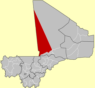
Gourma-Rharous Cercle is an administrative subdivision of the Tombouctou Region of Mali. The administrative center is the town of Gourma-Rharous.
Wola is a small town and commune in the Cercle of Bougouni in the Sikasso Region of south-western Mali. In 1998 the commune had a population of 10,158.
Kokele is a small town and commune in the Cercle of Bougouni in the Sikasso Region of southern Mali. In 1998 the commune had a population of 5,753.
Danou is a commune in the Cercle of Bougouni in the Sikasso Region of southern Mali. The principal town lies at Torakoro. In 1998 the commune had a population of 8,869.
N'Golodiana is a commune in the Cercle of Kolondieba in the Sikasso Region of southern Mali. The principal town lies at Toutiala. In 1998 the commune had a population of 4435.

Dogofry is a village and a rural commune in the Cercle of Niona in the Ségou Region of southern-central Mali. The commune covers an area of approximately 3,820 square kilometers and is bordered to the north by the Republic of Mauritania, to the east by the commune of Nampalari, to the southeast by the commune of Diabaly, to the southwest by the commune of Sokolo and to the west by the commune of Guiré in the Cercle of Nara. It includes 19 villages, and had a population of 34,057 in the 2009 census. The south of the commune includes a region irrigated as part of the Office du Niger scheme. The village of Dogofry lies in this irrigated area, about 60 km north of Niono, to the west of the Fala de Molodo and the Distributeur de Kogoni.
Pogo is a village and rural commune in the Cercle of Niono in the Ségou Region of Mali. The commune has an area of approximately 550 square kilometers and includes 18 villages. In the 2009 census it had a population of 16,308.
Sy is a small town and commune in the Cercle of San in the Ségou Region of Mali. In 1998 the commune had a population of 8,888.
Kassorola is a commune in the Cercle of San in the Ségou Region of Mali. The administrative center is the town of Nianasso. In a 2009 census, this regions total population was 16,275.
Kirchamba is a village and commune of the Cercle of Diré in the Tombouctou Region of Mali. As of 1998 the commune had a population of 2,305.
M'Bouna is a village and commune of the Cercle of Goudam in the Tombouctou Region of Mali. As of 1998, the commune had a population of 6,070.
Alzounoub is a commune of the Cercle of Goundam in the Tombouctou Region of Mali. The seat lies at Sonima. As of 1998 the commune had a population of 2,923.It covers an area of 7853 km².
Sahel is a small town and rural commune in Larache Province of the Tanger-Tetouan-Al Hoceima region of Morocco. At the time of the 2004 census, the commune had a total population of 15785 people living in 2949 households.