Essakane is a rural commune and village of the Cercle of Goundam in the Tombouctou Region of Mali. The commune includes around 16 small settlements. The small village of Essakane is around 70 kilometers west of the town of Timbuktu. The commune includes Lake Faguibine and two depression, Lake Kamango and Lake Gouber, which fill with water in years when the annual flood of the Niger River is particularly extensive.
Bara is a rural commune and village in the Cercle of Ansongo in the Gao Region of south-eastern Mali.
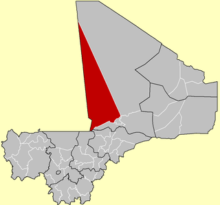
Arham is a village and commune of the Cercle of Diré in the Tombouctou Region of Mali.
Bourem Sidi Amar is a village and commune of the Cercle of Diré in the Tombouctou Region of Mali.
Dangha is a village and commune of the Cercle of Diré in the Tombouctou Region of Mali.
Haibongo is a village and rural commune of the Cercle of Diré in the Tombouctou Region of Mali.
Sareyamou is a village and commune of the Cercle of Diré in the Tombouctou Region of Mali. The commune contains 11 settlements.
Tienkour is a village and rural commune of the Cercle of Diré in the Tombouctou Region of Mali.
Bintagoungou is a rural commune and village of the Cercle of Goudam in the Tombouctou Region of Mali. The village lies at the south east corner of Lake Faguibine near the channel that connects Lake Faguibine to Lake Takara. The commune includes all of Lake Takara and a small section at the eastern end of Lake Faguibine.
Doukouria is a village and rural commune of the Cercle of Goudam in the Tombouctou Region of Mali.
N'Gorkou is a village and rural commune of the Cercle of Niafunké in the Tombouctou Region of Mali. The commune includes around 54 small settlements.
Soumpi is a village and commune of the Cercle of Niafunké in the Tombouctou Region of Mali. Lac Soumpi is a lake of note here, as is the archaeological site of Tissalaten.
Soboundou is a commune of the Cercle of Niafunké in the Tombouctou Region of Mali. The administrative center (chef-lieu) is the town of Niafunké.
Banikane Narhawa is a village and commune of the Cercle of Niafunké in the Tombouctou Region of Mali.
Gari is a village and seat of the commune of Tinguereguif in the Cercle of Diré in the Tombouctou Region of Mali.
Ber is a village and commune of the Cercle of Timbuktu in the Tombouctou Region of Mali. The village lies 8 km north of the Niger River and 53 km east of Timbuktu. In the 2009 census the commune had a population of 9,128. The commune is mainly sand dunes and extends for 35,280 km2.
Tinguereguif is a rural commune of the Cercle of Diré in the Tombouctou Region of Mali. The administrative center (chef-lieu) is the village of Gari.
Télé is a rural commune of the Cercle of Goundam in the Tombouctou Region of Mali. The administrative center (chef-lieu) is the village of Hangabéra. The village lies to the east of Lake Télé and 20 km north of the small town of Goundam. Lake Télé is connected to the Niger River by a system of channels. When the river floods in September water flows into the southern end of the lake. Lake Télé is connected at its northern end to Lake Takara. The river water flows out of Lake Takara, across a rocky sill at Kamaïna and eventually reaches Lake Faguibine.
Séréré is a rural commune of the Cercle of Gourma-Rharous in the Tombouctou Region of Mali. The administrative center (chef-lieu) is the village of Madiakoye.
Lafia is a commune of the Cercle of Timbuktu in the Tombouctou Region of Mali. The administrative center (chef-lieu) is the village of Aglal.