Kemptville Creek

Last updated
Kemptville Creek
South Branch of the Rideau River
Kemptville ON 1.JPG
Kemptville Creek in the town of Kemptville
Canada Southern Ontario relief location map.jpg
Red pog.svg
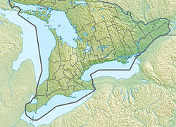
Location of the mouth of Kemptville Creek in southern Ontario
Location
Country Canada
Province Ontario
Region Eastern Ontario
County United Counties of Leeds and Grenville
Municipalities
Physical characteristics
Sourceunnamed marsh
  location North Augusta, Augusta
  coordinates 44°45′57″N75°45′00″W / 44.76583°N 75.75000°W / 44.76583; -75.75000
  elevation112 m (367 ft)
Mouth Rideau River
  location
Kemptville, North Grenville
  coordinates
45°03′21″N75°39′15″W / 45.05583°N 75.65417°W / 45.05583; -75.65417
  elevation
85 m (279 ft)
Length69 km (43 mi)
Basin size456 km2 (176 sq mi)
Basin features
Progression Rideau RiverOttawa RiverSaint Lawrence RiverGulf of Saint Lawrence
River system Ottawa River drainage basin

Kemptville Creek is a stream in the municipalities of North Grenville and Augusta, in the United Counties of Leeds and Grenville, in Eastern Ontario, Canada. [1] It is in the Ottawa River drainage basin, is a right tributary of the Rideau River, and is under the auspices of the Rideau Valley Conservation Authority. [2]

Contents

Kemptville Creek is 69 kilometres (43 mi) long and has a drainage basin of 456 square kilometres (176 sq mi). [2] Portions of the drainage basin extend into other municipalities of Leeds and Grenville, such as Athens, Elizabethtown-Kitley and Merrickville–Wolford. The creek was historically referred to by the name South Branch of the Rideau River, until its name was changed to Kemptville Creek in 1908.[ citation needed ] However, the former name is still in use as of 2015. [3]

Course

The main branch, also called the South Branch, begins northwest of the community of North Augusta in the municipality of Augusta, where it immediately takes in the right tributary Mud Creek. It travels north, passing into North Grenville near the community of Bishop's Mills.

Kemptville Creek at Oxford Mills Top of the Creek - panoramio.jpg
Kemptville Creek at Oxford Mills

The North Branch begins at Cranberry Lake in Merrickville–Wolford, and flows northeast, passes into North Grenville as it flows through the community of Bishop's Mills, before joining the main branch northeast of the community.

Combined, the creek continues north through the community of Oxford Mills, where it goes over Oxford Mills Dam, flows under the Canadian Pacific Railway main line, heads through Kemptville, where it takes in the right tributary Barnes Creek, and reaches its mouth at the Rideau River. The Rideau River flows northward to the Ottawa River.

Recreation

The creek is navigable, for smaller watercraft, from the Rideau River to the town docks in Kemptville. In the summer it is also suitable for canoeing from Bishop's Mills to approximately 10 kilometres (6.2 mi) to the south of Oxford Mills (rough-launch near the railway bridge, or at the dam in town). In the spring, it should be possible to canoe from Oxford Station Road (or further) to the Rideau River with one portage.

Tributaries

Related Research Articles

<span class="mw-page-title-main">Rideau River</span> River in Ontario, Canada

The Rideau River is a river in Eastern Ontario, Canada. The river flows north from Upper Rideau Lake and empties into the Ottawa River at the Rideau Falls in Ottawa, Ontario. Its length is 146 kilometres (91 mi).

<span class="mw-page-title-main">Actons Corners, Ontario</span> Compact rural community in Ontario, Canada

Actons Corners is a community in the municipality of North Grenville, United Counties of Leeds and Grenville, in eastern Ontario, Canada. An unincorporated place and compact rural community, it is located on County Road 43 between Kemptville and Merrickville at the intersection with Actons Corners Road and County Road 25.

<span class="mw-page-title-main">United Counties of Leeds and Grenville</span> County in Ontario, Canada

The United Counties of Leeds and Grenville, commonly known as Leeds and Grenville, is a county in Ontario, Canada, in the Eastern Ontario subregion of Southern Ontario. It fronts on the Saint Lawrence River and the international boundary between Canada and the United States, opposite of the State of New York. The county seat is Brockville. The county was formed by the union of the historical counties of Leeds and Grenville in 1850.

<span class="mw-page-title-main">North Grenville</span> Municipality in Ontario, Canada

North Grenville is a township in eastern Ontario, Canada, in the United Counties of Leeds and Grenville on the Rideau River. It is located just south of Ottawa in Canada's National Capital Region.

<span class="mw-page-title-main">Bishop's Mills, Ontario</span> Compact rural community in Ontario, Canada

Bishop's Mills is a community in the municipality of North Grenville, United Counties of Leeds and Grenville, in eastern Ontario, Canada, approximately 80 kilometres (50 mi) south of Ottawa, south of Kemptville and east of Merrickville. An unincorporated place and Compact Rural Community, it has a population of about 135 and is the home of the Bishops Mills Natural History Centre.

<span class="mw-page-title-main">Seguin River</span> River in Ontario, Canada

The Seguin River is a river in Parry Sound District in central Ontario, Canada that empties into Parry Sound on Georgian Bay, Lake Huron at the town of Parry Sound. The river's name comes from the Ojibwe word ziigwan, meaning "spring".

<span class="mw-page-title-main">Gananoque River</span> River in Ontario, Canada

The Gananoque River is a river in Leeds and Grenville United Counties in Eastern Ontario, Canada. The river is in the Atlantic Ocean drainage basin and is a left tributary of the Saint Lawrence River.

<span class="mw-page-title-main">Grenville County, Ontario</span> Former county in Ontario, Canada

Grenville County is a former county in the Canadian province of Ontario. It fronted on the north shore of the Saint Lawrence River, between the towns of Kingston and Cornwall. The county was created in 1792, and named in honour of William Grenville, 1st Baron Grenville, who was the British Secretary of State responsible for the colonies in 1790. It consisted of five townships, which were settled primarily by United Empire Loyalists in the late 1700s after the Revolutionary War. Prior to being settled by Europeans, the area was home to many generations of native cultures. Grenville County merged with Leeds County in 1850 to create Leeds and Grenville County. The county covered an area of 272,261 acres (110,180 ha).

<span class="mw-page-title-main">Sauble River (Ontario)</span> River in Ontario, Canada

The Sauble River is a river in Bruce County and Grey County in southwestern Ontario, Canada that flows from its headwaters in the township of Chatsworth to Lake Huron north of the community of Sauble Beach.

<span class="mw-page-title-main">Crowe River</span> River in Ontario, Canada

The Crowe River is a river in the counties of Haliburton, Hastings, Northumberland and Peterborough in southern Ontario, Canada. It is in the Lake Ontario drainage basin and is a tributary of the Trent River.

<span class="mw-page-title-main">Kemptville</span> Unincorporated community in Ontario, Canada

Kemptville is a community located in the Municipality of North Grenville in Eastern Ontario, Canada in the northernmost part of the United Counties of Leeds and Grenville. It is located approximately 56 km (35 mi) south of the downtown core of Ottawa and 2.5 to 3 km south of the Rideau River.

<span class="mw-page-title-main">Jock River</span> River in Ontario, Canada

The Jock River, known locally as the Mighty Jock, is a river in Ottawa and Lanark County in Eastern Ontario, Canada. It is in the Saint Lawrence River drainage basin and is a left tributary of the Rideau River. The river is named after Jacques, a French man who drowned in it in the early 19th century, and it was once known as the Goodwood River. The River is supported by a community-volunteer organization known as the Friends of the Jock River.

<span class="mw-page-title-main">Tay River</span> River in Canada

The Tay River is a river in Lanark County in Eastern Ontario, Canada. It is in the Saint Lawrence River drainage basin and is a left tributary of the Rideau River.

<span class="mw-page-title-main">Big Rideau Lake</span>

Big Rideau Lake is a lake in the municipalities of Tay Valley and Drummond/North Elmsley, Lanark County and Rideau Lakes, United Counties of Leeds and Grenville in Eastern Ontario, Canada. The lake is on the border between the two counties, 72 kilometres (45 mi) to the southwest of Ottawa. It is 32 kilometres (20 mi) long and is 6 kilometres (3.7 mi) wide, is much narrower at its northeastern end than at its southwestern end, and is part of the Saint Lawrence River drainage basin. It is the largest lake on the Rideau Canal, which was designated a UNESCO world heritage site in 2007.

<span class="mw-page-title-main">Merrickville–Wolford</span> Village in Ontario, Canada

Merrickville–Wolford is a village-status municipality in Eastern Ontario, Canada, located in the United Counties of Leeds and Grenville. It spans both shores of the Rideau River.

<span class="mw-page-title-main">Geography of Ottawa</span>

This is the outline of the geography of the city of Ottawa, the capital of Canada. Ottawa's current borders were formed in 2001, when the former city of Ottawa amalgamated with the ten other municipalities within the former Regional Municipality of Ottawa–Carleton. Ottawa is now a single-tiered census division, home to 1,017,449 people.

The Indian River is a river in Peterborough County in Central Ontario, Canada. It is in the Great Lakes Basin, and is a tributary of Rice Lake.

<span class="mw-page-title-main">Beaver River (Grey County)</span> River in Ontario, Canada

The Beaver River is a river in Grey County and Simcoe County in Southern Ontario, Canada. It is part of the Great Lakes Basin, and is a tributary of Lake Huron. The river's drainage basin is under the auspices of Grey Sauble Conservation.

<span class="mw-page-title-main">Black River (York Region)</span> River in Ontario, Canada

The Black River is a river in the Regional Municipality of York and the Regional Municipality of Durham in Central Ontario, Canada. It is part of the Great Lakes Basin, and is a tributary of Lake Simcoe; the entire watershed is under the auspices of the Lake Simcoe Region Conservation Authority.

Black Creek is a stream in the municipalities of Tay Valley, Lanark County and Rideau Lakes, United Counties of Leeds and Grenville in Eastern Ontario, Canada. It flows from an unnamed lake in Rideau Lakes to the west shore of Big Rideau Lake in Tay Valley. Big Rideau Lake, on the Rideau Canal, flows via the Rideau River and Ottawa River to the Saint Lawrence River. The stream has a drainage basin of 94 square kilometres (36 sq mi).

References

  1. "Kemptville Creek". Geographical Names Data Base . Natural Resources Canada . Retrieved 2015-07-14.
  2. 1 2 "Subwatershed Reporting — Kemptville Creek". Rideau Valley Conservation Authority. Archived from the original on 2015-09-24. Retrieved 2015-07-14.
  3. "Environmental Assessment - Proposed Waterfront Trails and Pedestrian Bridge On the South Branch of the Rideau River" (PDF). Municipality of North Grenville. 2015-03-14. Retrieved 2015-08-10.

Sources