Likely named for early nearby settler George Wilkins Kendall, the community was surveyed in 1883, although a post office was not established until 1895. The local economy has long been dependent primarily on ranching, although many residents today work in cities such as Blanco or San Antonio.[6]
The Holy Archangels Greek Orthodox Monastery was founded by Elder Ephraim of Arizona in 1996 in the vicinity of Kendalia.[7]
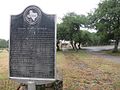
Kendalia sign on Ranch to Market Road 473 looking south
This page is based on this Wikipedia article Text is available under the CC BY-SA 4.0 license; additional terms may apply. Images, videos and audio are available under their respective licenses.