The High Tauern are a mountain range on the main chain of the Central Eastern Alps, comprising the highest peaks east of the Brenner Pass. The crest forms the southern border of the Austrian states of Salzburg, Carinthia and East Tyrol, with a small part in the southwest belongs to the Italian province of South Tyrol. The range includes Austria's highest mountain, the Grossglockner at 3,798 metres (12,461 ft) above the Adriatic.

The Zillertal Alps are a mountain range of the Central Eastern Alps on the border of Austria and Italy.

The Tux Alps or Tux Prealps are a sub-group of the Austrian Central Alps, which in turn form part of the Eastern Alps within Central Europe. They are located entirely within the Austrian federal state of Tyrol. The Tux Alps are one of three mountain ranges that form an Alpine backdrop to the city of Innsbruck. Their highest peak is the Lizumer Reckner, 2,886 m (AA), which rises between the glen of Wattentaler Lizum and the valley of the Navisbach. Their name is derived from the village of Tux which is tucked away in a side valley of the Zillertal.
The Bezirk Schwaz is an administrative district (Bezirk) in Tyrol, Austria. It borders Bavaria (Germany) in the north, the districts of Kufstein, Kitzbühel and Pinzgau (Salzburg) in the east, South Tyrol (Italy) in the south, and the Innsbruck-Land district in the west.

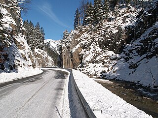
Seeberg Saddle, also just Seeberg (Jezersko) is a high mountain pass connecting Bad Eisenkappel in the Austrian state of Carinthia with Jezersko in the Slovenian region of Carinthia. It is located in the Southern Limestone Alps, between the Karavanke range in the west and the Kamnik–Savinja Alps in the east.
The Ammer Saddle is a high mountain pass in the Alps on the border between Tyrol, Austria and Bavaria, Germany.

Gerlos Pass is a mountain pass in the Austrian Alps between the Oberpinzgau region in the state of Salzburg and the Zillertal valley in Tyrol. The old road leads from Wald im Pinzgau to Gerlos in the Zillertal valley. It is closed to trucking and not always open in winter. A new toll road that is open all year was built in the 1960s from Krimml to Gerlos.
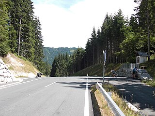
Kreuzberg Saddle is a high mountain pass across the Gailtal Alps in the Austrian state of Carinthia.

Kühtai Saddle is a mountain pass in the Austrian Alps in the Bundesland of Tyrol.
The Lahn Saddle is a high mountain pass in the Austrian Alps between the Bundesländer of Lower Austria and Styria.
The Rohr Saddle is a high mountain pass in the Austrian Alps, located in the Bundesland of Lower Austria.
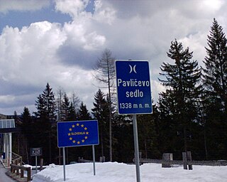
The Pavlič Pass, Paulitsch Pass or Paulitsch Saddle or just Pavlič is a mountain pass that connects the Slovenian municipality of Solčava in the historical region of Lower Styria with the Austrian state of Carinthia.

Greifenburg is a market town in the district of Spittal an der Drau in the Austrian state of Carinthia.

The Sonnenjoch is a mountain in the Kitzbühel Alps in Tyrol. The summit has a height of 2,287 m (AA)

The Alpbachtal is a valley in Tyrol, Austria. It is a side valley of the Inn valley.

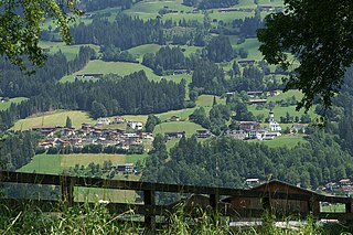
Hinterwaldberg is a dispersed settlement in the Oberpinzgau, the upper Salzach valley and the district of Zell am See/Pinzgau, and is a village and Katastralgemeinde in the municipality of Wald im Pinzgau, on the southern edge of the Kitzbühel Alps in Austria.

The Tuxer Joch is a mountain pass in the Zillertal Alps at a height of 2,338 m (AA) that links the lower Zillertal valley with the Brenner route just north of the Brenner Pass. To the northeast just below the summit lies the Tuxer Joch-Haus.
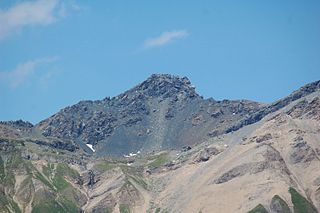
The Lizumer Reckner is, at 2,886 m above sea level (AA), the highest mountain in the Tux Alps in the Austrian state of Tyrol.

The word Tauern is German and originally meant "high mountain pass" in the Austrian Central Alps, referring to the many bridleways and passes of the parallel side valleys of the River Salzach that cut into the mountain ranges. From the Middle Ages, when mining reached its heyday, the word "Tauern" was also used to name the corresponding ranges. The name has survived in many local placenames today.
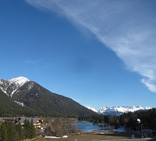
The Seefeld Saddle is a saddle and mountain pass, 1,185 m (AA), in the Northern Limestone Alps in the Austrian federal state of Tyrol. Two major transport routes run over it: the Seefelder Straße (B 177) and the Mittenwald Railway. On the Seefeld Plateau north of the saddle lies the village and ski resort of Seefeld in Tirol.