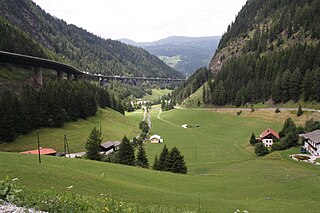
The Brenner Pass is a mountain pass over the Alps which forms the border between Italy and Austria. It is one of the principal passes of the Eastern Alpine range and has the lowest altitude among Alpine passes of the area.

Semmering is a mountain pass in the Eastern Northern Limestone Alps connecting Lower Austria and Styria, between which it forms a natural border.
Rohr im Gebirge is a village in the Wiener Neustadt-Land district of Lower Austria in Austria.

Seeberg Saddle, also just Seeberg (Jezersko) is a high mountain pass connecting Bad Eisenkappel in the Austrian state of Carinthia with Jezersko in the Slovenian region of Carinthia. It is located in the Southern Limestone Alps, between the Karawanks range in the west and the Kamnik–Savinja Alps in the east.

The Loibl Pass or Ljubelj Pass is a high mountain pass in the Karawanks chain of the Southern Limestone Alps, linking Austria with Slovenia. The Loibl Pass road is the shortest connection between the Carinthian town of Ferlach and Tržič in Upper Carniola and part of the European route E652 from Klagenfurt to Naklo.

Reichenau an der Rax is a market town in the Austrian state of Lower Austria, situated at the foot of the Rax mountain range on the Schwarza river, a headstream of the Leitha.
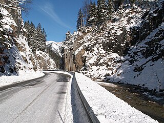
The Ammer Saddle is a high mountain pass in the Alps on the border between Tyrol, Austria and Bavaria, Germany.
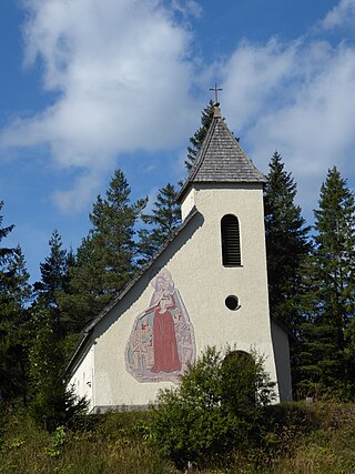
The Kernhofer Gscheid Pass is a high mountain pass in the Austrian Alps in the Bundesland of Lower Austria.

Gschütt Pass is a high mountain pass in the Austrian Alps between the Bundesländer of Salzburg and Upper Austria.
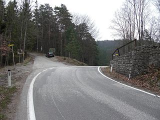
Hals Pass is a low mountain pass in the Austrian Alps in the Bundesland of Lower Austria.
Pyhrn Pass is a mountain pass in the Austrian Alps between the Austrian states of Upper Austria and Styria.
Ochsattel is a mountain pass in the foothills of the Austrian Alps in the Bundesland of Lower Austria.

Staller Saddle, at 2,052 m (6,732 ft), is a high mountain pass in the High Tauern range of the Central Eastern Alps, connecting the Defereggen Valley in East Tyrol with the Antholz Valley in South Tyrol. The pass forms the border between Austria and Italy, it separates the Villgraten Mountains in the southeast from the Rieserferner Group in the northwest.
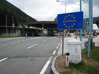
The Wurzen Pass is a mountain pass in a col of the Karawanks mountain range in the Southern Limestone Alps, on the border between Radendorf in the Austrian state of Carinthia and Kranjska Gora in Slovenia. It is named after the nearby village of Podkoren (Wurzen).
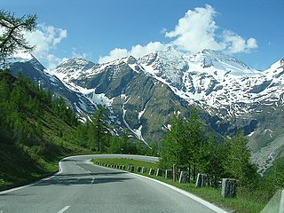
The Grossglockner High Alpine Road is the highest surfaced mountain pass road in Austria. It connects Bruck in the state of Salzburg with Heiligenblut in Carinthia via Fuscher Törl at 2,428 m (7,966 ft) and Hochtor Pass at 2,504 m (8,215 ft). The road is named after the Grossglockner, Austria's highest mountain. Built as a scenic route, a toll is charged.

The Schober group is a sub-range of the Hohe Tauern mountains in the Central Eastern Alps, on the border between the Austrian states of Tyrol and Carinthia. Most of the range is located inside Hohe Tauern national park. It is named after Mt. Hochschober, 3,242 metres (10,636 ft), though its highest peak is Mt. Petzeck at 3,283 metres (10,771 ft).

The Höllental in Lower Austria is a narrow valley between the steep limestone massifs of the Schneeberg and Rax through which the River Schwarza flows.
This page is based on this
Wikipedia article Text is available under the
CC BY-SA 4.0 license; additional terms may apply.
Images, videos and audio are available under their respective licenses.


