Brenner Pass

Last updated • 7 min readFrom Wikipedia, The Free Encyclopedia

Brenner Pass
Brennerpass nordrampe.jpg
View between the top of the pass and the village of Gries am Brenner
Elevation 1,370 m (4,495 ft)
Traversed by E45 motorway
Location AustriaItaly border
Range Alps
Coordinates 47°0′12″N11°30′27″E / 47.00333°N 11.50750°E / 47.00333; 11.50750
Alps location map.png
Red pog.svg
Brenner Pass
Brenner Pass lies along the border of Austria and Italy
The Brenner Pass carries a four-lane motorway, one of the most important transit routes between Northern and Southern Europe Brenner LKW Stau.jpg
The Brenner Pass carries a four-lane motorway, one of the most important transit routes between Northern and Southern Europe

The Brenner Pass (German: Brennerpass [ˈbʁɛnɐpas] , shortly Brenner; Italian : Passo del Brennero [ˈpassodelˈbrɛnnero] ) is a mountain pass over the Alps which forms the border between Italy and Austria. It is one of the major passes of the Eastern Alpine range and has the lowest altitude among Alpine passes of the area.

Contents

Dairy cattle graze in alpine pastures throughout the summer in valleys beneath the pass and on the mountain slopes. At lower altitudes, farmers log pine trees, plant crops and harvest hay for winter fodder. Many of the high pastures are at an altitude of over 1,500 metres (4,900 feet); a small number stand high in the mountains at around 2,000 metres (6,600 feet).

The central section of the Brenner Pass covers a four-lane motorway and railway tracks connecting Bozen/Bolzano in the south and Innsbruck to the north. The village of Brenner consists of an outlet shopping centre (supermarkets and stores), fruit stores, restaurants, cafés, hotels and a gas station. It has a population of 400 to 600 (as of 2011).

Etymology

Older, obsolete theories suggested a connection of the name Brenner with the ancient tribe of the Breuni or the Gaulish chieftain Brennus, but since the pass name appears for the first time only in the 14th century, a more recent etymology is far more likely. [1] Prenner was originally the name of a nearby farm, which itself was named after its former owner. The farm of a certain Prennerius is mentioned in documents in 1288, a certain Chunradus Prenner de Mittenwalde is mentioned in 1299. The German word Prenner probably refers to somebody who uses slash-and-burn techniques for land clearing. A name for the pass itself appears for the first time in 1328 as ob dem Prenner (German for above the Prenner). [2]

History

Roman Empire

Brenner and the surrounding Roman road network shown in the Tabula Peutingeriana. Brenner is between Matreio and Vepiteno. Part of Tabula Peutingeriana around Brenner Pass.png
Brenner and the surrounding Roman road network shown in the Tabula Peutingeriana . Brenner is between Matreio and Vepiteno.

The Romans regularised the mountain pass at Brenner, which had already been under frequent use during the prehistoric eras since the most recent Ice Age. [3] The Brenner Pass, however, was not the first trans-Alpine Roman road to become regularised under the Roman Empire.

The first Roman road to cross the Alpine range, Via Claudia Augusta, connected Verona in northern Italy with Augusta Vindelicorum (modern-day Augsburg) in the Roman province of Raetia. Via Augusta was completed in 46–47 AD; the route took its course along the Adige valley to the neighbouring Reschen Pass (west of the Brenner Pass), then descended into the Inn valley before rising to Fern Pass towards Augsburg.

The Roman road that physically crossed over the Brenner Pass did not exist until the 2nd century AD. It took the "eastern" route through the Puster Valley and descended into Veldidena (modern-day Wilten), where it crossed the Inn and into Zirl and arrived at Augsburg via Füssen.

The Alamanni (Germanic tribe) crossed the Brenner Pass southward into modern-day Italy in 268 AD, but they were stopped in November of that year at the Battle of Lake Benacus. The Romans kept control over the mountain pass until the end of their empire in the 5th century. [4]

Holy Roman Empire

During the High Middle Ages, Brenner Pass was a part of the important Via Imperii , an imperial road linking the Kingdom of Germany north of the Alps with the Italian March of Verona. In the Carolingian Divisio Regnorum of 806, the Brenner region was called per alpes Noricas, the transit through the Noric Alps. [5] From the 12th century, the Brenner Pass was controlled by the Counts of Tyrol within the Holy Roman Empire. Emperor Frederick Barbarossa made frequent uses of the Brenner Pass to cross the Alps during his imperial expeditions into Italy. [6] The 12th-century Brenner Pass accommodated mule trains and carts.

Modernisation of the Brenner Pass started in 1777, when a carriage road was laid out at the behest of Empress Maria Theresa.

Austrian Empire

Modernisation further took place under the Austrian Empire and the Brenner Railway, which was completed in stages from 1853 to 1867. It became the first trans-Alpine railway without a major tunnel and at high altitude (crossing the Brenner Pass at 1,371 m). Completion of the railway enabled the Austrians to move their troops more efficiently; the Austrians had hoped to secure their territories of Venetia and Lombardy (south of the Alps), but lost them to Italy following the Second Italian War of Independence in 1859 and Austro-Prussian War in 1866.[ citation needed ]

Recent history

At the end of World War I in 1918, the control of the Brenner Pass became shared between Italy and Austria under the Treaty of Saint-Germain-en-Laye (1919). The Treaty of London (1915) secretly awarded Italy the territories south of the Brenner Pass for supporting the Entente Powers. Welschtirol/Trentino, along with the southern part of the County of Tyrol (now South Tyrol), was transferred to Italy, and Italian troops occupied Tyrol and arrived at the Brenner Pass in 1919 to 20.

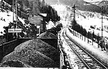
German coal entering Italy through the Brenner Pass in the 1930s Carbone tedesco per il Brennero.jpg
German coal entering Italy through the Brenner Pass in the 1930s

During World War II, Adolf Hitler and Benito Mussolini met at the Brenner Pass to celebrate their Pact of Steel on 18 March 1940. Later, in 1943, following the Italian armistice with the Allies, the Brenner Pass was annexed by Nazi Germany, shifting the border with the Italian Social Republic, the Nazi puppet state headed by Mussolini, much further south. In 1945, the area was occupied by the US Army and returned to Italy after the end of the war. The Brenner Pass was part of the ratlines that were used by senior Nazis fleeing the allies after the German surrender in 1945.

Following World War II, the pass once again formed the border between Italy and the newly independent Republic of Austria, and maintained its importance as a key trade route. On January 1, 1995, the Schengen Agreement entered into force in Austria, a treaty Italy ratified on October 26. As a consequence, border checks were abolished in the Brenner Pass for goods and people between the two countries. On November 19, 1995, the border barrier between Italy and Austria at Brenner was officially abolished, with a commemoration attended by Austrian Minister of the Interior Karl Schlögl, Italian Minister of the Interior Giorgio Napolitano, and the governors of Innsbruck and Bolzano. [7]

Brenner Pass
Climate chart (explanation)
J
F
M
A
M
J
J
A
S
O
N
D
 
 
37
 
 
0
−7
 
 
31
 
 
1
−6
 
 
47
 
 
4
−4
 
 
69
 
 
7
−1
 
 
98
 
 
13
4
 
 
138
 
 
16
6
 
 
137
 
 
19
9
 
 
124
 
 
19
9
 
 
102
 
 
15
6
 
 
81
 
 
10
2
 
 
67
 
 
3
−3
 
 
47
 
 
0
−6
Average max. and min. temperatures in °C
Precipitation totals in mm
Source: ZAMG
Imperial conversion
JFMAMJJASOND
 
 
1.5
 
 
32
19
 
 
1.2
 
 
34
21
 
 
1.9
 
 
39
25
 
 
2.7
 
 
45
30
 
 
3.9
 
 
55
39
 
 
5.4
 
 
61
43
 
 
5.4
 
 
66
48
 
 
4.9
 
 
66
48
 
 
4
 
 
59
43
 
 
3.2
 
 
50
36
 
 
2.6
 
 
37
27
 
 
1.9
 
 
32
21
Average max. and min. temperatures in °F
Precipitation totals in inches

Motorway

The motorway E45 (European designation; in Italy A22, in Austria the A13), Brenner Autobahn/Autostrada del Brennero, begins in Innsbruck, runs through the Brenner Pass, Bozen/Bolzano, Verona and finishes outside Modena. It is one of the most important routes of north–south connections in Europe.

After the signing of the Schengen Agreement in 1992 and Austria's subsequent entry into the European Union in 1995, customs and immigration posts at the Brenner Pass were removed in 1997. However, Austria reinstituted border checks in 2015 as a response to the European migrant crisis. In April 2016, Austria announced it would build a 370-meter long fence at the Pass but clarify that "it would be used only to "channel" people and was not a barrier. [8] "

The Europabrücke (Europe Bridge), located roughly halfway between Innsbruck and the Brenner Pass, is a large concrete bridge carrying the six-lane Brenner Autobahn over the valley of Sill River (Wipptal). At a height of 180 metres (590 feet) and span of 820 metres (2,690 feet), the bridge was celebrated as a masterpiece of engineering upon its completion in 1963. It is a site where bungee-jumping from the bridge has become a popular tourist attraction.

The ever-increasing freight and leisure traffic, however, has been causing long traffic jams at busy times even without border enforcements. The Brenner Pass is the only major mountain pass within the area; other nearby alternatives are footpaths across higher mountains at an altitude of above 2,000 metres (6,600 feet). As a result, air and noise pollution have generated heavy debate in regional and European politics. As of 2004, about 1.8 million trucks crossed the Europa Bridge per year. [9]

Railway

In order to ease the road traffic, there are plans to upgrade the Brenner Railway from Verona to Innsbruck with a series of tunnels, including the Brenner Base Tunnel underneath Brenner. [10] While the official groundbreaking of the tunnel had taken place in 2006 (with survey tunnels drilled in the same year), substantial work did not begin until 2011. Funding issues have delayed the tunnel's scheduled date of completion from 2022 to no earlier than 2032. [11]

See also

Related Research Articles

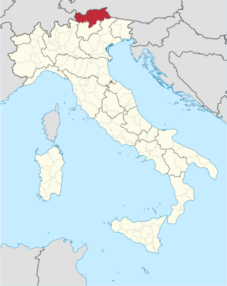
<span class="mw-page-title-main">South Tyrol</span> Autonomous province of Italy

South Tyrol is an autonomous province in northern Italy. An English translation of the official German and Italian names could be the Autonomous Province of Bolzano – South Tyrol, reflecting the multilingualism and different naming conventions in the area. Together with Trentino, South Tyrol forms the autonomous region of Trentino-Alto Adige/Südtirol. The province is the northernmost of Italy, the second largest with an area of 7,400 square kilometres (2,857 sq mi), and has a total population of about 534,000 inhabitants as of 2021. Its capital and largest city is Bolzano.
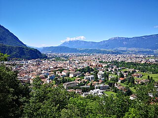
<span class="mw-page-title-main">Bolzano</span> Capital city of the province of South Tyrol, Northern Italy

Bolzano is the capital city of South Tyrol, Northern Italy. With a population of 108,245, Bolzano is also by far the largest city in South Tyrol and the third largest in historical Tyrol. The greater metro area has about 250000 inhabitants and is one of the urban centres within the Alps.

<span class="mw-page-title-main">Trentino-Alto Adige/Südtirol</span> Region of Italy

Trentino-Alto Adige/Südtirol is an autonomous region of Italy, located in the northern part of the country. The region has a population of 1.1 million, of whom 62% speak Italian as their mother tongue, 30% speak South Tyrolean German and several foreign languages are spoken by immigrant communities. Since the 1970s, most legislative and administrative powers have been transferred to the two self-governing provinces that make up the region: the province of Trento, commonly known as Trentino, and the province of Bolzano, commonly known as South Tyrol. In South Tyrol, German remains the sizeable majority language.

<span class="mw-page-title-main">Adige</span> Major river in Southern Europe

The Adige is the second-longest river in Italy, after the Po. It rises near the Reschen Pass in the Vinschgau in the province of South Tyrol, near the Italian border with Austria and Switzerland, and flows 410 kilometres (250 mi) through most of northeastern Italy to the Adriatic Sea.
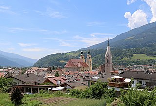
<span class="mw-page-title-main">Brixen</span> Comune in Trentino-Alto Adige/Südtirol, Italy

Brixen is a town and commune in South Tyrol, northern Italy, located about 40 kilometres (25 mi) north of Bolzano.
<span class="mw-page-title-main">Wipptal</span> Valley in Austria and Italy

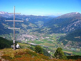
The Wipp Valley is an Alpine valley in Tyrol, Austria and in South Tyrol, Italy, running between Innsbruck and Franzensfeste. The Brenner Pass at the Austro-Italian border divides it into the northern, Austrian Lower Wipp Valley and the southern, Italian Upper Wipp Valley. The Lower Wipp Valley extends along the Sill River southward from Innsbruck, where the Sill meets the larger Inn River, up to the Brenner Pass. South of the border, the Upper Wipp Valley stretches along the Eisack River by way of Sterzing to Franzensfeste. It forms the Wipptal District of the province of South Tyrol.

<span class="mw-page-title-main">Brenner Base Tunnel</span> Railway under construction through the Alps

The Brenner Base Tunnel is a 55-kilometre-long (34 mi) railway tunnel under construction through the base of the Eastern Alps beneath the Brenner Pass. Once completed, the Brenner Base Tunnel will rank as either the second or third longest railway tunnel in the world, depending on the definition employed. It will be surpassed in length only by the Gotthard Base Tunnel in Switzerland and, depending on the relative completion dates of these projects, the Mont d'Ambin Base Tunnel between France and Italy. When combined with the Inntal Tunnel, which forms part of the existing Innsbruck bypass, the Brenner Base Tunnel will reach a length of 64 kilometres (40 mi), making it the longest underground railway connection in the world.

<span class="mw-page-title-main">Brenner, South Tyrol</span> Comune in Trentino-Alto Adige/Südtirol, Italy

Brenner is a comune and a village in South Tyrol in northern Italy, located about 60 km (37 mi) north of Bolzano on the border with Tyrol, Austria.

<span class="mw-page-title-main">Brenner Autobahn</span> Road in Austria

The Brenner Autobahn refers to a major European truck route that connects Innsbruck in Austria to Verona in northern Italy.

<span class="mw-page-title-main">Innsbruck Hauptbahnhof</span> Railway station in Tyrol, Austria

Innsbruck Hauptbahnhof is the main railway station in Innsbruck, the capital city of the Austrian federal state of Tyrol. Opened in 1853, the station is a major hub for western and central Austria. In 2019, it was the 8th-busiest station in the country, and the 2nd-busiest outside of Vienna after only Linz Hauptbahnhof, with 315 train movements and 38,500 passengers daily.

<span class="mw-page-title-main">Verona Porta Nuova railway station</span> Railway station in Verona, Italy

Verona Porta Nuova is the main railway station of Verona, Italy. It is one of the two stations serving central Verona; the other station, Verona Porta Vescovo, is located at the east of the city.

<span class="mw-page-title-main">Brenner Railway</span> Major Austro-Italian transport link

The Brenner Railway is a major line connecting the Austrian and Italian railways from Innsbruck to Verona, climbing up the Wipptal, passing over the Brenner Pass, descending down the Eisacktal to Bolzano/Bozen, then further down the Adige Valley to Rovereto/Rofreit, and along the section of the Adige Valley, called in Italian the "Vallagarina", to Verona. This railway line is part of the Line 1 of Trans-European Transport Networks (TEN-T). It is considered a "fundamental" line by the state railways Ferrovie dello Stato (FS).

<span class="mw-page-title-main">Berlin–Palermo railway axis</span> Key high-speed rail link in Central Europe

The Berlin–Palermo railway axis is project No. 1 of the Trans-European high-speed rail network (TEN-R), which involves the creation of a 2,200-kilometre-long (1,400 mi) high-speed rail line between Berlin and Palermo. It is designated as one of the main transport links connecting Central and Southern Europe, tracking through Germany, Austria and Italy.

<span class="mw-page-title-main">Bolzano/Bozen railway station</span> Railway station in Italy

Bolzano/Bozen railway station is the main station of Bolzano, capital of the autonomous province of South Tyrol, in northeastern Italy.

<span class="mw-page-title-main">Trento railway station</span> Railway station in Italy

Trento railway station is the main station of Trento, capital of the autonomous province of Trentino, in northeastern Italy.

<span class="mw-page-title-main">Rovereto railway station</span> Railway station in Rovereto, Italy

Rovereto railway station serves the Comune of Rovereto in the autonomous province of Trentino, northeastern Italy.

<span class="mw-page-title-main">Brenner railway station</span> Railway station in Italy

Brenner railway station is the border station of Italy and Austria. It serves the town and comune of Brenner in the autonomous province of South Tyrol, northeastern Italy.
<span class="mw-page-title-main">Tyrol</span> Region across the Alps

Tyrol is a historical region in the Alps of Northern Italy and western Austria. The area was historically the core of the County of Tyrol, part of the Holy Roman Empire, Austrian Empire and Austria-Hungary, from its formation in the 12th century until 1919. In 1919, following World War I and the dissolution of Austria-Hungary, it was divided into two modern administrative parts through the Treaty of Saint-Germain-en-Laye:

The South Tyrolean Unterland or Bozen Unterland is a section of the Etschtal valley stretching from the regional capital Bolzano (Bozen) down the Adige (Etsch) river to Tramin and Salorno (Salurn). The area is known for its history, particularly regarding Rhaetic, Roman, and Germanic archaeological sites; its bilingualism, and its viticulture; the Gewürztraminer grape originated here.

<span class="mw-page-title-main">Autostrada A22 (Italy)</span> Controlled-access highway in Italy

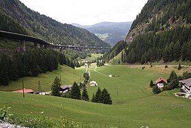
The Autostrada A22 or Autobrennero or Autostrada del Brennero is one of the most important autostrada in Italy, as it connects Po Valley, the city of Modena and the Autostrada A1 to Austria through the Brenner Pass, located in the municipality of Brenner. The Autostrada A22 is 315 kilometres (196 mi) long. It is a part of the E45 European route. The operator of the road is Autostrada del Brennero S.p.A.. The Autostrada A22 is located in the regions of Emilia-Romagna, Lombardy, Veneto and Trentino-Alto Adige/Südtirol.
References

  1. Alois Trenkwalder: Brenner. Bergdorf und Alpenpaß – Brennero. Storia di un paesino e di un valico internazionale. Brenner 1999, p. 72 (online Archived 23 August 2019 at the Wayback Machine )
  2. Egon Kühebacher (1991). Die Ortsnamen Südtirols und ihre Geschichte, Bozen: Athesia, p. 59
  3. Walter Woodburn Hyde (1935). Roman Alpine Routes (Philadelphia: University of Pennsylvania Press), p. 194: "the use of the major pass-routes has been continuous from prehistoric times down to the present".
  4. "Geschichte Schwabens bis zum Ausgang des 18. Jahrhunderts" by Max Spindler, Christoph Bauer, Andreas Kraus, 3rd edition; publisher: C.H. Beck Verlag 2001, page 80 ISBN   3-406-39452-3, ISBN   978-3-406-39452-2
  5. Martin Bitschnau; Hannes Obermair (2009). Tiroler Urkundenbuch, II. Abteilung: Die Urkunden zur Geschichte des Inn-, Eisack- und Pustertals. Vol. 1: Bis zum Jahr 1140 (in German). Innsbruck: Universitätsverlag Wagner. pp. 51–52 no. 73. ISBN   978-3-7030-0469-8.
  6. Santosuosso, Antonio (2004). Barbarians, Marauders, and Infidels: The Ways of Medieval Warfare . New York: MJF Books. p.  190. ISBN   978-1-56731-891-3.
  7. Michael Gehler, Der Brenner: Vom Ort negativer Erfahrung zum historischen Gedächtnisort oder zur Entstehung und Überwindung einer Grenze in der Mitte Europas (1918-1998), in Idem, Andreas Pudlat (a cura di), Grenzen in Europa, Hildesheim-Zurigo-New York, 2009, pp. 145-182.
  8. Scherer, Steve; Pullella, Philip; Jones, Gavin; Roche, Andrew (28 April 2016). "Italy, Austria seek to calm tensions over Brenner border controls". Reuters. Reuters. Archived from the original on 26 November 2018. Retrieved 2 May 2016. On Wednesday, Austria outlined plans to erect a 370 meter-long fence at the Brenner Pass, which is the busiest route through the Alps for heavy goods vehicles, but Sobotka said on Thursday it would be used only to "channel" people and was not a barrier.
  9. [ dead link ]
  10. Galleria di Base del Brennero – Brenner Basistunnel BBT SE – Offline Archived 22 December 2005 at the Wayback Machine
  11. "Governors protest latest delay to Brenner Base Tunnel construction". railjournal.com. 27 May 2021. Archived from the original on 1 February 2022. Retrieved 12 January 2022.