Noric Alps

Last updated
Noric Alps
Nationalpark Nockberge Landschaft 26082007 01.jpg
Nock Mountains
Highest point
Peak Eisenhut
Elevation 2,441 m (8,009 ft)
Coordinates 46°57′11″N13°55′45″E / 46.95306°N 13.92917°E / 46.95306; 13.92917
Geography
CountriesAustria and Slovenia
States Carinthia, Styria and Lower Styria
Parent range Central Eastern Alps

The Noric Alps (German : Norische Alpen) is a collective term denoting various mountain ranges of the Eastern Alps. The name derives from the ancient Noricum province of the Roman Empire on the territory of present-day Austria and the adjacent Bavarian and Slovenian area.

Contents

Concept history

Referring to extinct Noricum, the designation originally comprised the Alpine mountain ranges in the medieval Bavarian stem duchy of East Francia, including the later Tyrol, Salzburg and Upper Austrian regions. [1]

In the 19th century, the German term Norische Alpen covered the whole group of ranges of the Central Eastern and Northern Limestone Alps east of the Dreiherrnspitze peak. [1] The Noric Alps were considered the major northern range of the Eastern Alps, alongside the Carnic Alps (i.e. the Carnic Alps proper, Gailtal Alps, Karawanks, Kamnik–Savinja Alps, and Pohorje) in the south and the Julian Alps in the southeast. Later the meaning was confined to the ranges south of the Alpine divide between the Mur and Drava rivers

Geography

Mt. Eisenhut and Wintertalernock Nockberge - Eisenhut und Wintertalernock.JPG
Mt. Eisenhut and Wintertalernock

In the traditional context, the Noric Alps are located mostly in Austria — 98% of the region is Austrian, mainly in the southern states of Carinthia and Styria—, with a small area in the adjacent Lower Styria region of Slovenia.

The area covers 9,811 km2 (3,788 sq mi) and stretches 97 km (60 mi) from the upper Mur River in the North to the Drava in the South and 176 km (109 mi) from the Katschberg Pass in the West to the Mur River in the East. The Noric Alps are surrounded by the Hohe Tauern range in the West and the Low Tauern in the North, in the South they border on the Gailtal Alps, the Karavanke and Pohorje ranges of the Southern Limestone Alps.

The highest point is Mt. Eisenhut in Styria, which, at 2,441 m (8,009 ft), is only modest in the context of the Eastern Alps, where many mountains rise above 3,000 m (10,000 ft). Other notable peaks in the range are Rosennock (2,440 m (8,010 ft)), Zirbitzkogel (2,396 m (7,861 ft)) and Großer Speikkogel (2,140 m (7,020 ft)).

In the south the Noric Alps comprise the Klagenfurt Basin with the historic centres of Zollfeld and Magdalensberg. The mountainside is characterised by transhumance (Alm) agriculture and was also a mining area, still for magnesite in the area of Radenthein. Today the region largely depends on tourism, in winter around the ski aras of Bad Kleinkirchheim, Krems, at Katschberg, Turracher Höhe and Klippitztörl, in summer around several picturesque Carinthian lakes like Wörthersee, Lake Millstatt or Lake Ossiach. The Nock Mountain National Park, accessible via the Nockalmstraße scenic road, is a protected landscape according to IUCN V category.

The Norian Age in the Triassic Period of geological time is named for the Noric Alps

Classification

Rosennock summit Nockberge-rosennock.jpg
Rosennock summit

The Italian Partizione delle Alpi classification of 1926 referred to the Alpi Noriche as the mountain chain from the Mur in the East up to the Brenner Pass in the West, including High and Low Tauern as well as Tux and Zillertal Alps.

According to the Alpine Club classification, the Noric Alps are divided into

separated by the Neumarkt Pass.

The Noric Alps roughly correspond to the Carinthian-Styrian Alps according to the recent unofficial SOIUSA classification.

Related Research Articles

<span class="mw-page-title-main">Carinthia</span> State of Austria

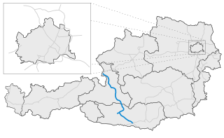
Carinthia is the southernmost and least densely populated Austrian state, in the Eastern Alps, and is noted for its mountains and lakes. The main language is German. Its regional dialects belong to the Southern Bavarian group. Carinthian Slovene dialects, forms of a South Slavic language that predominated in the southeastern part of the region up to the first half of the 20th century, are now spoken by a small minority in the area.

<span class="mw-page-title-main">Kreuzeck group</span> Mountain range

The Kreuzeck Group is a mountain range of the Central Eastern Alps. It may be considered either a separate range or part of the larger High Tauern chain. Administratively, the range belongs to the Austrian states of Carinthia and, in the westernmost part, Tyrol.

<span class="mw-page-title-main">High Tauern</span> Mountain range of the eastern Alps

The High Tauern are a mountain range on the main chain of the Central Eastern Alps, comprising the highest peaks east of the Brenner Pass. The crest forms the southern border of the Austrian states of Salzburg, Carinthia and East Tyrol, with a small part in the southwest belongs to the Italian province of South Tyrol. The range includes Austria's highest mountain, the Grossglockner at 3,798 metres (12,461 ft) above the Adriatic.

Bezirk Tamsweg is an administrative district (Bezirk) in the federal state of Salzburg, Austria. It is congruent with the Lungau region. The administrative centre of the district is Tamsweg.

<span class="mw-page-title-main">Eastern Alps</span> Eastern part of the Alps mountain range

The Eastern Alps are usually defined as the area east of a line from Lake Constance and the Alpine Rhine valley, up to the Splügen Pass at the Alpine divide, and down the Liro River to Lake Como in the south. The peaks and mountain passes are lower than the Western Alps, while the range itself is broader and less arched.

<span class="mw-page-title-main">Lower Tauern</span> Mountain range in Austria

The Lower Tauern or Niedere Tauern are a mountain range of the Central Eastern Alps, in the Austrian states of Salzburg and Styria.

<span class="mw-page-title-main">Mauterndorf</span> Place in Salzburg, Austria

Mauterndorf is a market town of the Tamsweg District in the Austrian state of Salzburg. The municipality also comprises the Katastralgemeinden Faningberg, Neuseß and Steindorf.

<span class="mw-page-title-main">Katschberg Pass</span> Mountain pass in Austria at the border Carinthia / Salzburg

Katschberg Pass is a high mountain pass in the Central Eastern Alps in Austria between Rennweg am Katschberg in the state of Carinthia and Sankt Michael im Lungau in Salzburg.

<span class="mw-page-title-main">Rennweg am Katschberg</span> Place in Carinthia, Austria

Rennweg am Katschberg is a market town in the district of Spittal an der Drau in Carinthia, Austria.

<span class="mw-page-title-main">Tauern Autobahn</span> Autobahn in Austria

The Tauern Autobahn is an autobahn (motorway) in Austria. It starts at the Salzburg junction with the West Autobahn (A1), runs southwards, crosses the Tauern mountain range on the main chain of the Alps and leads to the Süd Autobahn (A2) and Karawanken Autobahn (A11) at Villach in Carinthia.

<span class="mw-page-title-main">Schober group</span>

The Schober group is a sub-range of the Hohe Tauern mountains in the Central Eastern Alps, on the border between the Austrian states of Tyrol and Carinthia. Most of the range is located inside Hohe Tauern national park. It is named after Mt. Hochschober, 3,242 metres (10,636 ft), though its highest peak is Mt. Petzeck at 3,283 metres (10,771 ft).

<span class="mw-page-title-main">SOIUSA</span>

SOIUSA is a proposal for a new classification system of the Alps from the geographic and toponomastic point of view. It was designed by Sergio Marazzi, Italian researcher and author of the Orographic Atlas of the Alps SOIUSA. His book was presented with the patronage of the Italian Alpine Club on 23 Jan 2006, but has yet to receive any formal acceptance.

<span class="mw-page-title-main">Ankogel Group</span>

The Ankogel Group is a sub-group of the Central Eastern Alps. Together with the Goldberg Group, the Glockner Group, the Schober Group, the Kreuzeck Group, the Granatspitze Group, the Venediger Group, the Villgraten Mountains and the Rieserferner Group it forms the mountain range of the Hohe Tauern.

<span class="mw-page-title-main">Western Tauern Alps</span>

The Western Tauern Alps are a mountain range of the Central Eastern Alps.

<span class="mw-page-title-main">Carnic and Gailtal Alps</span> Grouping of mountain ranges in Austria and Italy

The Carnic and Gailtal Alps is a geographic grouping of mountain ranges belonging to the Southern Limestone Alps. They are located in Austria and Italy.

<span class="mw-page-title-main">Gurktal Alps</span> Mountain range in the Central Eastern Alps in Austria

The Gurktal Alps is a mountain range in the Central Eastern Alps in Austria which is named after the valley of the Gurk river. The range stretches west to Lake Millstatt and east to Neumarkter Sattel. The highest peak is Eisenhut at 2,441m .

<span class="mw-page-title-main">Lavanttal Alps</span> Austrian section of the Alps

The Lavanttal Alps are part of the Central Eastern Alps in Austria and Slovenia, between the river Mur in the north and the Drava in the south.

<span class="mw-page-title-main">Gailtal Alps</span>

The Gailtal Alps, is a mountain range of the Southern Limestone Alps in Austria. It rises between the River Drava (Drau) and the Gail valley and through the southern part of East Tyrol. Its western group called "Lienz Dolomites", is sometimes counted as part of this range and sometimes seen as separate.

<span class="mw-page-title-main">Nock Mountains</span> Mountain range of the Gurktal Alps in Austria

The Nock Mountains are the westernmost and highest mountain range of the Gurktal Alps in Austria, spread over parts of the federal states of Carinthia, Salzburg and Styria. Their appearance is characterised by numerous dome-like and grass-covered summits (Nocken). Their highest peak is the Eisenhut in Styria which reaches an elevation of 2,441 m (8,009 ft) AA.

<span class="mw-page-title-main">Großer Hafner</span>

Großer Hafner is a 3,076 m (10,092 ft) high partly-glaciated mountain of the Ankogel Group in the High Tauern range, located at the border between the Austrian states of Carinthia and Salzburg. It is the easternmost three-thousander peak of the range, and also in the entire Alps.

References

  1. 1 2 Alpen. In: Heinrich August Pierer, Julius Löbe (Hrsg.): Universal-Lexikon der Gegenwart und Vergangenheit. 4. Auflage. Band 1. Altenburg 1857, S. 349–351 (zeno.org).