It connects Warscheneck and Bosruck and is at an elevation of 954m (3,130ft). The pass road (B 138) has a maximum grade of 10 percent.
Since the middle of the 1980s, traffic on the pass has been reduced by the opening of the Bosruck Tunnel for the A9 Pyhrn Autobahn. There has also been a railway tunnel since the nineteenth century. Since the road tunnel was built, the road has not been cleared regularly in winter, and there is a weight limit for trucking.
The Brenner Pass is a mountain pass through the Alps which forms the border between Italy and Austria. It is one of the principal passes of the Eastern Alpine range and has the lowest altitude among Alpine passes of the area.
The Engadin or Engadine is a long high Alpine valley region in the eastern Swiss Alps in the canton of Graubünden in southeasternmost Switzerland with about 25,000 inhabitants. It follows the route of the Inn from its headwaters at Maloja Pass in the southwest running roughly northeast until the Inn flows into Austria, one hundred kilometers downstream. The En/Inn subsequently flows at Passau into the Danube, making it the only Swiss river to drain into the Black Sea. The Engadine is protected by high mountain ranges on all sides and is famous for its sunny climate, beautiful landscapes and outdoor activities.
Arlberg is a massif between Vorarlberg and Tyrol in Austria. The highest peak is the Valluga at 2,811 metres (9,222 ft). The name Arlberg derives from the tradition of the "Arlenburg", who are said to have once established themselves on the Tyrolean side of the Arlberg passes. Another story derives the name from the "Arlenbushes" that are very numerous there. Ski resorts at the Arlberg include Lech, Zürs, Stuben, St. Christoph, St. Anton, Oberlech, Stubenbach, Zug, Warth
Semmering is a mountain pass in the Eastern Northern Limestone Alps connecting Lower Austria and Styria, between which it forms a natural border.
Thurn Pass is a high mountain pass in Austria, in the Kitzbühel Alps. It connects Kitzbühel in Tyrol with Mittersill in Salzburg.
The Radstadt Tauern are a subrange of the Central Eastern Alps in Austria. Together with the Schladming Tauern, the Rottenmann and Wölz Tauern and the Seckau Tauern the Radstadt Tauern form the major range of mountains known as the Low Tauern. The mountains are found in the southeast of the Austrian state of Salzburg, between the upper reaches of the Enns and Mur rivers.
The Ennstal Alps, the Alps of the Enns valley, are a mountain range of the Northern Limestone Alps System. They are located primarily in the Austrian state of Styria, and also into the state of Upper Austria.
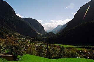
The Loibl Pass or Ljubelj Pass is a high mountain pass in the Karawanks chain of the Southern Limestone Alps, linking Austria with Slovenia. The Loibl Pass road is the shortest connection between the Carinthian town of Ferlach and Tržič in Upper Carniola and part of the European route E652 from Klagenfurt to Naklo.
The Austrian autobahns are controlled-access highways in Austria. They are officially called Bundesstraßen A (Bundesautobahnen) under the authority of the Federal Government according to the Austrian Federal Road Act (Bundesstraßengesetz), not to be confused with the former Bundesstraßen highways maintained by the Austrian states since 2002.
The Ötztal is an alpine valley located in Tyrol, Austria. The Ötztaler Ache river flows through the valley in a northern direction. The Ötztal separates the Stubai Alps in the east from the Ötztal Alps in the west. The valley is 65 km (40 mi) long. The northern end of the valley is at the confluence of the Ötztaler Ache and Inn rivers, 8 km east of Imst and 50 km west of Innsbruck. The only railway station of the valley, Ötztal railway station, is located here and connects the Ötztal with the Arlberg railway (Innsbruck-Bludenz) and also a motorway interchange to the A12 (E60).
The Pyhrn Autobahn (A9) is an Autobahn (motorway), in Austria. It runs through the Alps by two two-lane tunnels, the 5,400-metre-long (17,700 ft) Bosrucktunnel and the 8,320-metre-long (27,300 ft) Gleinalmtunnel. The longest tunnel on the motorway is the 10-kilometre-long (6.2 mi) Plabutschtunnel under Graz and its outskirts. The last section of the highway was completed in 2004.
Flexen Pass is a high mountain pass in the Austrian Alps in the Bundesland of Vorarlberg. It is at an elevation of 1,773 metres (5,817 ft).
Katschberg Pass is a high mountain pass in the Central Eastern Alps in Austria between Rennweg am Katschberg in the state of Carinthia and Sankt Michael im Lungau in Salzburg.
The Bielerhöhe connects the Montafon valley in Vorarlberg with the Paznaun valley in Tirol. At 2,037 m above sea level, the Bielerhöhe lies in the Vorarlberg region, due north of the Silvretta Reservoir.
Video tolling is a form of electronic toll collection, which uses video or still images of a vehicle's license plate to identify a vehicle liable to pay a road toll. The system dispenses with collection of road tolls using road-side cash or payment card methods, and may be used in conjunction with "all electronic" open road tolling, to permit drivers without an RFID device to use the toll road.
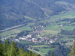
Rennweg am Katschberg is a market town in the district of Spittal an der Drau in Carinthia, Austria.
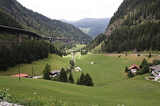
Spital am Pyhrn is a municipality in the district of Kirchdorf an der Krems in the Austrian state of Upper Austria.
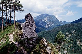
Kalkalpen National Park is a national park within the Northern Limestone Alps mountain range, located in the state of Upper Austria, Austria. The park was established in 1997.
This page is based on this Wikipedia article Text is available under the CC BY-SA 4.0 license; additional terms may apply. Images, videos and audio are available under their respective licenses.