Kicukiro District

Last updated
Kicukiro District
KicukiroDist.png
Shown within Kigali Province and Rwanda
Country Rwanda
Province Kigali
Capital Kagarama
Area
  Total167 km2 (64 sq mi)
Population
 (2022 census)
  Total491,731
  Density2,900/km2 (7,600/sq mi)
Mass Grave and Flame Monument at Nyanza Genocide Memorial Site Mass Grave and Flame Monument - Nyanza Genocide Memorial Site - Kicukiro District - Kigali - Rwanda.jpg
Mass Grave and Flame Monument at Nyanza Genocide Memorial Site

Kicukiro District is one of the three Districts which constitute the City of Kigali and is situated in the South-East of the City of Kigali. Is a district (akarere) located in Kigali Province, Rwanda. Kicukiro is home to a thriving market, a number of NGOs(Non-Government Organizations) and the Bralirwa Brewery. In addition, it is the headquarters for the Friends Church in Rwanda. Kicukiro District is also home to two major memorial sites associated with the Rwandan genocide. These are the Rebero Genocide Memorial Site where 14,400 victims are buried, and the Nyanza Genocide Memorial Site where 5,000 victims were killed after Belgian soldiers who were serving in the United Nations peacekeeping forces abandoned them.[ citation needed ]

Contents

Geography

Map of the Kicukiro District by Sectors. Map of the Kicukiro District by Sectors.svg
Map of the Kicukiro District by Sectors.

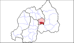
This district is located in the south-east city of Kigali, the capital of Rwanda. It is made up to ten (10) administrative sectors (Imirenge), Kagarama, Niboye, Gatenga, Gikondo, Gahanga, Kanombe, Nyarugunga, Kigarama, Masaka, 41cells (Utugali) and 333 Administrative villages (imidugudu). The district covers a total area of 166.7 km2 with about 319,661 inhabitants. It was established by Organic Law n°29/2005 organizing the administrative entities of the Republic of Rwanda, at the start of the second phase of decentralization in January 2006.

Population

Historical Population
of the Kicukiro District
YearPopulation
Kicukiro
Census of Population
and Housing
[1] [2]
2002Steady2.svg 207,819 2002 Rwandan Census
2012Increase2.svg 318,564 2012 Rwandan Census
2022Increase2.svg 491,731 2022 Rwandan Census

The 4th Rwanda Population and Housing Census (PHC) has enumerated 318,564 residents in Kicukiro district, which represents 28.4% of the total population of Kigali City (1,132,686 residents). The population of Kicukiro district is predominantly male: 163,445 are men corresponding to 51.3% of the total population. Females are predominant in Masaka (50.6%) and Gahanga (50.2%) sectors. Gatenga, Kanombe, Kigarama, Nyarugunga and Masaka are the most populated sectors with more than 39 thousands residents each. Kagarama and Gikondo are the last populated sectors in Kicukiro district (14,385 and 17,146 inhabitants respectively). Each of them represents 4.5% of the total resident population of Kicukiro district. [3]

Sectors of the Kicukiro District by
population according to the 2022 census
Sectors of
Kicukiro District
Census
(2022)
[2]
Gahanga79,082
Masaka78,788
Kanombe72,346
Gatenga67,084
Kigarama63,153
Nyarugunga49,247
Niboye26,912
Kagarama21,277
Gikondo19,803
10°Kicukiro14,039
TotalKicukiro District491,731

Topography and climate

The hydrographs of the District are largely constituted by streams and rivers which form a part of the basin of the Akagera River. The main rivers are the Akagera and the Nyabarongo, which flows through the city of Kigali from Lake Muhazi. The District has four seasons. Two rainy seasons and two dry seasons, alternating in the following manner: Small dry season: December, January and February Big rainy season March, April and May Big Dry season June, July, August and September Small rainy season October and November. These seasons are often irregular due to world climate changes. Lower or higher limits of each Season cannot be determined accurately. The rainy season may drag on into the dry season and vice versa. Average temperature is 22 °C for a rainfall varying between 900 and 1150 mm of annual rain. [4]

Integrated Polytechnic Regional Centre (IPRC)

The 4th Rwanda Population and Housing Census (PHC) has enumerated 318,564 residents in Kicukiro district, which represents 28.4% of the total population of Kigali City (1,132,686 residents). The population of Kicukiro district is predominantly male: 163,445 are men corresponding to 51.3% of the total population. Females are predominant in Masaka (50.6%) and Gahanga (50.2%) sectors. Gatenga, Kanombe, Kigarama, Nyarugunga and Masaka are the most populated sectors with more than 39 thousands residents each. Kagarama and Gikondo are the last populated sectors in Kicukiro district (14,385 and 17,146 inhabitants respectively). Each of them represents 4.5% of the total resident population of Kicukiro district. [3]

Education (some universities)

Kicukiro College of Technology

Kicukiro College of Technology is one of only two colleges of technology in Rwanda. The college opened in October 2008. [5]

Integrated Polytechnic Regional Centre (IPRC)

IPRC was initially established by the Government of Rwanda in 2008 as "Kicukiro College of Technology (KCT)". Its core mission of the college was to develop and provide professional technical education at the level of diploma (A1). The college inherited the existing physical infrastructure from the ETO Kicukiro which seized to operate as a Technical Secondary School in 1994 when almost all of its equipment was vandalized during the genocide. After the genocide two secondary schools used the infrastructure consecutively up to January 2008.

In July 2008, the Government of Rwanda (GoR) decided to integrate Technical education, Vocational Education and Training into an integrated (TVET) system. Currently the college is among the two existing and operational Integrated Polytechnic Regional Centre (IPRC) in the country with its Mission and Vision changed to reflect its IPRC. [6]

Related Research Articles

<span class="mw-page-title-main">Rwanda</span> Country in Central Africa

Rwanda, officially the Republic of Rwanda, is a landlocked country in the Great Rift Valley of Central Africa, where the African Great Lakes region and Southeast Africa converge. Located a few degrees south of the Equator, Rwanda is bordered by Uganda, Tanzania, Burundi, and the Democratic Republic of the Congo. It is highly elevated, giving it the soubriquet "land of a thousand hills", with its geography dominated by mountains in the west and savanna to the southeast, with numerous lakes throughout the country. The climate is temperate to subtropical, with two rainy seasons and two dry seasons each year. It is the most densely populated mainland African country; among countries larger than 10,000 km2, it is the fifth most densely populated country in the world. Its capital and largest city is Kigali.

<span class="mw-page-title-main">Kigali</span> Capital and the largest city of Rwanda

Kigali is the capital and largest city of Rwanda. It is near the nation's geographic centre in a region of rolling hills, with a series of valleys and ridges joined by steep slopes. As a primate city, Kigali is a relatively new city. It has been Rwanda's economic, cultural, and transport hub since it was founded as an administrative outpost in 1907, and became the capital of the country at independence in 1962, shifting focus away from Huye.

<span class="mw-page-title-main">Education in Rwanda</span> Overview of education in Rwanda

Education in Rwanda has undergone considerable changes throughout Rwanda's recent history, and has faced major disruptions due to periods of conflict. Education was divided by gender whereby women and men had a different education relevant to their responsibilities in day-to-day life. Women were mostly taught housekeeping while men were mainly taught how to hunt, raise animals, and fish. This is because Rwanda was a community-based society where every member had a specific contribution to the overall development of the community. Older family members like grandparents usually took on the role of educators.

<span class="mw-page-title-main">Kigali International Airport</span> International airport in Rwanda

Kigali International Airport, formerly known as Kanombe International Airport, is the primary international airport serving Kigali, the capital of Rwanda. Currently, there is an ongoing project to build another mega-airport in Bugesera District, Eastern Province, which will be the biggest and the main air gateway for all destinations in the country, in addition to serving as a transit airport for Goma and Bukavu in the eastern Democratic Republic of the Congo. There are 4 airlines based in Kigali: RwandAir, the flag carrier airline of Rwanda; Akagera Aviation, a Rwandan heli-company; Tempus Jet, an American airline providing charter flights; and Nexus Aero, a Saudi VIP airline.

<span class="mw-page-title-main">Districts of Rwanda</span>

The five provinces of Rwanda are divided into 30 districts. Each district is in turn divided into sectors, which are in turn divided into cells, which are in turn divided into villages.

Tourism in Rwanda is the largest source of foreign exchange earnings in Rwanda and was projected to grow at a rate of 25% every year from 2013-2018. The sector is the biggest contributor to the national export strategy. Total revenues generated from the sector in 2014 alone were USD 305 million. The sector has also attracted direct foreign investments with major international hotel brands setting up shop in the country including Marriot Hotels & Resorts, Radisson Blu, Park Inn by Radisson, Sheraton Hotels and Resorts, Protea Hotels by Marriott, Golden Tulip Hotels, and Zinc. With its new world-class convention center, Rwanda is set to become a regional and international conference hub owing to ever-improving conference facilities, an excellent and expanding transportation network, and straightforward immigration procedures such as the ability for online visa applications, visa-free for all Africans, and a one-tourist visa policy for the EAC.

<span class="mw-page-title-main">Nyagatare District</span> District in Eastern Province, Rwanda

Nyagatare is the largest and second most populous district (akarere) in Rwanda. Located in Eastern Province, Rwanda, it occupies the northeastern extremity of Rwanda. Its capital is Nyagatare City, the former capital of the now defunct Umutara province. Nyagatare District borders Uganda in the North, Tanzania in the East, Gatsibo District of the in the South, and Gicumbi District of the Northern Province in the West. Nyagatare has an area of 1741 km2, what makes it the largest district in Rwanda. With a population of 466,944 in 2012, and 653,861 in 2023, Nyagatare is the second most populated district of Rwanda only after Gasabo District of Kigali City with 879,505 inhabitants. This is a 156% increase from 2002 when the population was only 255,104. This sharp rise in the population is mainly due to the major movement of the population from other parts of the country in search of land.

<span class="mw-page-title-main">Muhanga District</span> District in Rwanda

Muhanga is a district (akarere) in Rwanda. It is found in southern province and its administrative centre is located in the city of Muhanga.

<span class="mw-page-title-main">Gasabo District</span> District in Rwanda

Gasabo is a district (akarere) in Kigali city, the capital of Rwanda. The headquarter of Gasabo is located in Remera Sector. The district also includes large areas of the city itself, including Kacyiru, Kimironko, Remera, Nyarutarama and Kimihurura.

<span class="mw-page-title-main">Rubavu District</span> District in Rwanda

Rubavu District is one of the seven districts (akarere) in Western Province, Rwanda, with a total surface area of 388.4 km2. Its capital is Gisenyi, a large beach resort and border city. The Rubavu Urban area, which includes Gisenyi, Rugerero and other nearby localities, had a 2012 population of 149,209, the second most populous urban area in Rwanda.

<span class="mw-page-title-main">Rwanda Cricket Association</span>

Rwanda Cricket Association is the official governing body of cricket sports in Rwanda. Its current headquarters is located in kicukiro district in Kigali city.

<span class="mw-page-title-main">Gatsibo District</span> District in Rwanda

Gatsibo is a district (akarere) in Eastern Province, Rwanda. Its capital is Kabarore. It lies in the sectors of Gatsibo and Kageyo. It’s at about 1 hour and 50 minutes drive from Kigali city.

<span class="mw-page-title-main">Lake Muhazi</span>

Lake Muhazi is a long thin shallow lake in the east of Rwanda. The bulk of the lake lies in the Eastern Province, with the western end forming the border between the Northern and Kigali Provinces. It is a flooded valley lake, lying predominantly in an east to west direction, but with numerous offshoots in a north to south direction, formerly the location of tributaries. The lake has a concrete dam at the western end, constructed in 1999 to replace an earth dam which had existed since time immemorial. The lake empties into the Nyabugogo River, which flows southwards to Kigali where it meets the Nyabarongo River, part of the upper Nile.

<span class="mw-page-title-main">Culture of Rwanda</span>

The culture of Rwanda is varied. Unlike many other countries in Africa, Rwanda has been a unified state since precolonial times, populated by the Banyarwanda people who share a single language and cultural heritage. Eleven regular national holidays are observed throughout the year, with others occasionally inserted by the government.

<span class="mw-page-title-main">Nyamata</span> Rwanda Popular Place

Nyamata is a town in the Bugesera District, southeastern Rwanda. Nyamata literally means 'place of milk' from the two Kinyarwanda words nya- 'of' and amata 'milk'. It is the location of the Nyamata Genocide Memorial, commemorating the Rwandan genocide of 1994.

The following is a timeline of the history of the city of Kigali, Rwanda.

Masaka is a populated neighborhood within the city of Kigali, the capital and largest city of Rwanda.

Masaka Hospital, Rwanda, commonly known as Masaka Hospital, is a hospital in Rwanda. It is an urban, general hospital built between 2008 and 2011, with funding from the Government of China, as a gift to the Government of Rwanda.

The University Teaching Hospital of Kigali (CHUK) is a 519 beds teaching hospital located in Kigali City, Rwanda. Founded in 1918 by Belgian colonialists, CHUK is the first and the biggest healthcare institution in Rwanda. CHUK has played a role in rebuilding Rwanda's healthcare after the genocide against Tutsi of 1994.

Kagarama is a sector (umurenge) in the Kigali Province, Kicukiro District, Rwanda. It is located in the south part of the city of Kigali.

References

  1. "Population of Rwanda according to the population and housing censuses". citypopulation.de. 2022-08-01. Retrieved 2023-03-05.
  2. 1 2 National Institute of Statistics of Rwanda (2023-02-28). "5th Population and Housing Census : Main Indicators Report". statistics.gov.rw. Retrieved 2023-03-05.
  3. 1 2 Ugochukwu, Onuike Godwin; Niyibizi, Jean Baptiste (2019-11-13). "Comparing Milk Microbial Quality and Hygiene between Milk Processed at Home and Milk Processed by Industries in Kicukiro District, Kigali City-Rwanda". doi: 10.20944/preprints201911.0063.v2 .{{cite journal}}: Cite journal requires |journal= (help)
  4. "Kigali City".
  5. "Kicukiro College of Technology". RWANDA EDUTORY. Retrieved 2020-10-10.
  6. "iprckigali".

2°00′S30°09′E / 2.000°S 30.150°E / -2.000; 30.150