Kings Creek, South Carolina

Last updated

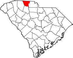
Kings Creek (or King's Creek) is an unincorporated community in Cherokee County, South Carolina, United States. [1] It is located in the vicinity of South Carolina Highways 5 and 97. Situated nearby is the NRHP-designated King's Creek Furnace Site. [2] The name of the community comes from a local settler named King who lived close to the locale on the namesake Kings Creek. [3]

An abandoned trestle over Kings Creek Abandoned SB line trestle in Kings Creek, SC.png
An abandoned trestle over Kings Creek

The settlement has a history of mining operations and represents the former Kings Creek Mining District, which held deposits of iron and copper sulfides. [4] South of Kings Creek sits a historic gold mine bearing the locality's name. [5] Railways have also seen historic prominence in the area, and the hamlet exists as the western terminus of the Triple C Rail Trail. [6] Near Kings Creek remains a railroad line formerly operated by the Carolina Coastal Railway. [7]

Related Research Articles

<span class="mw-page-title-main">Cherokee County, South Carolina</span> County in South Carolina, United States

Cherokee County is a county in the U.S. state of South Carolina. As of the 2020 census, the population was 56,216. The county seat is Gaffney. The county was formed in 1897 from parts of York, Union, and Spartanburg counties. It was named for the Cherokee people who historically occupied this area prior to European encounter.

<span class="mw-page-title-main">Jackson County, North Carolina</span> County in North Carolina, United States

Jackson County is a county located in the western part of the U.S. state of North Carolina. As of the 2020 census, the population was 43,109. Since 1913, its county seat has been Sylva, which replaced Webster.

<span class="mw-page-title-main">Gaston County, North Carolina</span> County in North Carolina, United States

Gaston County is a county in the U.S. state of North Carolina. As of the 2020 census, the population was 227,943. The county seat is Gastonia. Dallas served as the original county seat from 1846 until 1911.

<span class="mw-page-title-main">Blacksburg, South Carolina</span> Town in South Carolina, United States

Blacksburg is a small town in Cherokee County, South Carolina, United States. The population was 1,848 at the 2010 census. The communities of Cherokee Falls, Kings Creek, Cashion Crossroads, Buffalo, and Mount Paran are located near the town.

<span class="mw-page-title-main">Gaffney, South Carolina</span> City in South Carolina, United States

Gaffney is a city in and the seat of Cherokee County, South Carolina, United States, in the Upstate region of South Carolina. Gaffney is known as the "Peach Capital of South Carolina". The population was 12,539 at the 2010 census, with an estimated population of 12,609 in 2019. It is the principal city of the Gaffney, South Carolina, Micropolitan Statistical Area, which includes all of Cherokee County and which is further included in the greater Greenville-Spartanburg-Anderson, South Carolina Combined Statistical Area.

<span class="mw-page-title-main">Ninety Six, South Carolina</span> Town in South Carolina, United States

Ninety Six is a town in Greenwood County, South Carolina, United States. The population was 1,998 at the 2010 census.

<span class="mw-page-title-main">Sevierville, Tennessee</span> City in Tennessee, United States

Sevierville is a city in and the county seat of Sevier County, Tennessee, United States, located in eastern Tennessee. The population was 17,889 at the 2020 United States Census.

<span class="mw-page-title-main">Crowders Mountain State Park</span> State park in North Carolina, United States

Crowders Mountain State Park is a 5,217-acre (21.11 km2) North Carolina state park in Gaston County, North Carolina in the United States. It is near Kings Mountain, North Carolina and on the outskirts of Gastonia, North Carolina, it includes the peaks of Crowder's Mountain and The Pinnacle. Crowders Mountain is named for Crowders Creek which originates near its base. The cliffs are a popular destination for rock climbers.

The Cherokee Path was the primary route of English and Scots traders from Charleston to Columbia, South Carolina in Colonial America. It was the way they reached Cherokee towns and territories along the upper Keowee River and its tributaries. In its lower section it was known as the Savannah River. They referred to these towns along the Keowee and Tugaloo rivers as the Lower Towns, in contrast to the Middle Towns in Western North Carolina and the Overhill Towns in present-day southeastern Tennessee west of the Appalachian Mountains.

<span class="mw-page-title-main">Overmountain Men</span> American frontiersmen from west of the Appalachian Mountains

The Overmountain Men were American frontiersmen from west of the Blue Ridge Mountains which are the leading edge of the Appalachian Mountains, who took part in the American Revolutionary War. While they were present at multiple engagements in the war's southern campaign, they are best known for their role in the American victory at the Battle of Kings Mountain in 1780. The term "overmountain" arose because their settlements were west of, or "over", the Blue Ridge, which was the primary geographical boundary dividing several of the 13 American states from the Native American lands to the west. The Overmountain Men hailed from parts of Virginia, North Carolina, and what is now Tennessee and Kentucky.

Fort Cass was a fort located on the Hiwassee River in present-day Charleston, Tennessee, that served as the military operational headquarters for the entire Cherokee removal, an forced migration of the Cherokee known as the Trail of Tears from their ancestral homelands in the Southeast to Indian Territory in present-day Oklahoma. Fort Cass housed a garrison of United States troops who watched over the largest concentration of internment camps where Cherokee were kept during the summer of 1838 before starting the main trek west to Indian Territory, and served as one of three emigration deports where the Cherokee began their journey west, the others of which were located at Ross's Landing in Chattanooga and Gunter's Landing near Guntersville, Alabama.

<span class="mw-page-title-main">Pine Grove Furnace State Park</span> State park in Cumberland County, Pennsylvania

Pine Grove Furnace State Park is a protected Pennsylvania area that includes Laurel and Fuller Lakes in Cooke Township of Cumberland County. The Park accommodates various outdoor recreation activities, protects the remains of the Pine Grove Iron Works (1764), and was the site of Laurel Forge (1830), Pine Grove Park (1880s), and a brick plant (1892). The Park is 8 miles (13 km) from exit 37 of Interstate 81 on Pennsylvania Route 233.

The Battle of Taliwa was fought in Ball Ground, Georgia, in 1755. The battle was part of a larger campaign of the Cherokee against the Muscogee Creek people, where a contingent of 500 Cherokee warriors led by war chief Oconostota defeated the Muscogee Creek people and pushed them south from their northern Georgia homelands, allowing the Cherokee to begin settling in the region.

<span class="mw-page-title-main">Table Rock State Park (South Carolina)</span> United States historic place

Table Rock State Park is a 3,083-acre (12.48 km2) park at the edge of the Blue Ridge Mountains in northern Pickens County, South Carolina. The park includes Pinnacle Mountain, the tallest mountain totally within the state.

<span class="mw-page-title-main">Overhill Cherokee</span> 18th century Cherokee people who lived on the west side of the Appalachian Mountains

Overhill Cherokee was the term for the Cherokee people located in their historic settlements in what is now the U.S. state of Tennessee in the Southeastern United States, on the western side of the Appalachian Mountains. This name was used by 18th-century European traders and explorers from British colonies along the Atlantic coast, as they had to cross the mountains to reach these settlements.

<span class="mw-page-title-main">Cowpens Furnace Site (38CK73)</span> Archaeological site in South Carolina, United States

Cowpens Furnace Site (38CK73) is the remains of an early 19th-century iron-making furnace in Cherokee County, South Carolina. The site shows early American iron-making technology. The site was listed on the National Register of Historic Places in 1987.

The Ghost Town Trail is a rail trail in Western Pennsylvania that runs 36 miles (58 km) between Black Lick, Indiana County, and Ebensburg, Cambria County. Established in 1991 on the right-of-way of the former Ebensburg and Black Lick Railroad, the trail follows the Blacklick Creek and passes through many ghost towns that were abandoned in the early 1900s with the decline of the local coal mining industry. Open year-round to cycling, hiking, and cross-country skiing, the trail is designated a National Recreation Trail by the United States Department of the Interior.

King's Creek Furnace Site (38CK71) is a historic archaeological site located near Kings Creek, Cherokee County, South Carolina, United States. The site contains a partially collapsed but well-preserved iron furnace built about 1838, retaining walls, sluiceway, stone dam abutments, stone building foundations, large piles of slag, and a large slag levee along the creek bank. It also includes the remains of the site's log framed dam. King's Creek Furnace Site is one of two remaining sites that can be associated with the King's Mountain Iron Company, a major iron manufacturing company that operated in present-day Cherokee County from about 1815 to about 1860. The other site is Jackson's Furnace Site in York County.

<span class="mw-page-title-main">Triple C Rail Trail</span>

The Charleston, Cincinnati and Chicago or Triple C Rail Trail is a rail trail in the Piedmont region of north-central South Carolina.

Jackson's Furnace Site, also known as Stroup's Furnace, is a historic archaeological site located near Smyrna, York County, South Carolina. The site includes an earthen sluiceway, stone dam abutments, the stone foundation of an iron furnace and slag heaps. It is one of only two sites that can be associated with the King's Mountain Iron Company, which operated in present-day Cherokee County from about 1815 to about 1860. The other site is King's Creek Furnace Site in Cherokee County.

References

  1. "Kings Creek". Geographic Names Information System . United States Geological Survey, United States Department of the Interior . Retrieved October 25, 2022.
  2. "NPGallery Asset Detail: King's Creek Furnace Site". NPGallery Digital Asset Management System. Retrieved October 6, 2022.
  3. Writers' Program of the Work Projects Administration in the State of South Carolina (1941). Palmetto place names. Columbia, S. C.: The Sloane printing co. p. #68 (62).
  4. "Kings Creek Mining District, Cherokee County, South Carolina, USA". www.mindat.org. Retrieved October 6, 2022.
  5. "Map of Historic Sites and Places in Cherokee County, South Carolina" (PDF). Fort Lauderdale, Florida: Dolph Map Company. 2003. Retrieved October 6, 2022 via the Nuclear Regulatory Commission.
  6. "Triple C Rail Trail | About Us - History". triplecrailtrail. Retrieved October 6, 2022.
  7. "Node: Kings Creek (154150171)". OpenStreetMap. Retrieved October 6, 2022.

35°04′26″N81°26′12″W / 35.07389°N 81.43667°W / 35.07389; -81.43667