Kirillapone කිරිල්ලපනේ கிருலப்பனை | |
|---|---|
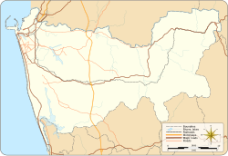 Kirillapone Location in Colombo District | |
| Coordinates: 6°52′31″N79°52′31″E / 6.87528°N 79.87528°E | |
| Country | Sri Lanka |
| Province | Western Province |
| District | Colombo District |
| Time zone | UTC+5:30 (Sri Lanka Standard Time Zone) |
Kirulapone (Kirulapana) is a suburb in Colombo, Sri Lanka which is also known as Colombo 5.
Contents
The A4 (High Level Road) runs through Kirulapone while Elvitigala Mawatha (Narahenpita Road), which leads to the Katunayake Airport (CMB) begins from here.
