Wellawatte

Last updated

Wellawatta
වැල්ලවත්ත
வெள்ளவத்தை
Wellawatte.jpg
Wellawatte junction that connects to the railway station
Colombo district location map.svg
Red pog.svg
Wellawatta
Location in Colombo District
Sri Lanka adm-2 location map.svg
Red pog.svg
Wellawatta
Wellawatta (Sri Lanka)
Coordinates: 6°52′29″N79°51′38″E / 6.874657°N 79.860483°E / 6.874657; 79.860483
Country Sri Lanka
Province Western Province
District Colombo District
Time zone UTC+5:30 (Sri Lanka Standard Time Zone)
Postal Code
00600

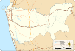
Wellawatta is a neighbourhood of Colombo, Sri Lanka. It lies immediately south of Bambalapitiya and is classified as zone 6 within the Colombo Municipal region. [1] The town begins at the old Dutch canal just before the Savoy Cinema and extends south to the same canal that reaches the sea just before the junction at Hospital Road where Dehiwela begins. It is bounded on the west by the waters of the Indian Ocean and extends to Pamankada where Havelock Road forks and meets the Sri Saranankara Road bridge, which stretches over the Dutch canal, extending towards Kohuwala-Hospital Road junction on Dutugemunu Street.

Contents

The name Wellawatta means 'Sandy Garden' in Sinhalese and 'White Garden' in Tamil.

During the colonial period, much of present day Wellawatta was made of coconut estates owned by European families, particularly that of Charlemont Jonathan Gauder. Many of the roads and place names bear the names of the Gauder family including Charlemont, Frederica, Collingwood, Alexandra and Frances. The landmark Savoy cinema was built by CV De Silva in the 1940s. In the 1980s, the area drew many Tamils fleeing the civil war from the north of the country. Today, Wellawatta is a built up commercial and residential area with a small amount of light industry. Posh new apartment complexes coexist with slums particularly along the canal areas.
Schools

Art and religious centres

Related Research Articles

<span class="mw-page-title-main">Sri Jayawardenepura Kotte</span> Legislative capital of Sri Lanka

Sri Jayewardenepura Kotte, commonly known as Kotte, is the legislative capital of Sri Lanka. Sri Jayawardenepura Kotte is located adjacent to the urban area of Sri Lanka's de facto economic, executive, and judicial capital, Colombo.

<span class="mw-page-title-main">Dehiwala-Mount Lavinia</span> Suburb in Colombo District, Western Province, Sri Lanka

Dehiwala-Mount Lavinia, population 245,974 (2012), is a large municipality in Sri Lanka, covering 2,109 ha. It lies south of the Colombo Municipal Council area and is separated from it by the Dehiwala canal which forms the northern boundary of DMMC. Its southern limits lie in Borupana Road and the eastern boundary is Weras Ganga with its canal system and it includes some areas to its east. This town has experienced extensive population growth and rapid industrialisation and urbanisation in recent years. It is home to Sri Lanka's National Zoological Gardens, which remains one of Asia's largest. Colombo South Teaching Hospital, Kalubowila and Colombo Airport, Ratmalana are some important landmarks in this area. Dehiwela-Mount Lavinia and Sri Jayawardenapura Kotte being two large suburban centres of the city of Colombo function together as one large urban agglomeration in the Region. The overspill from the City in residential and commercial uses of land has rapidly urbanised these suburban centres. Dehiwela-Mount Lavinia and Sri Jayawardenpaura along with Colombo Municipal Council form the most urbanised part of the core area of the Colombo Metropolitan Region. Dehiwala and Mount Lavinia lie along the Galle Road artery, which runs along the coast to the south of the country.

<span class="mw-page-title-main">Negombo</span> City in Western Province, Sri Lanka

Negombo is a major city in Sri Lanka, situated on the west coast and at the mouth of the Negombo Lagoon, in the Western Province, 38 km (24 mi) from Colombo via the Colombo–Katunayake Expressway and the nearest major city from the Bandaranaike International Airport.

Arumbakkam is a residential locality in Chennai.

<span class="mw-page-title-main">Tirusulam</span> Census Town in Chengalpattu district

Tirusulam is a southern suburb of Chennai and a census town in Chengalpattu district falling within the Chennai metropolitan area, adjoining the Chennai International Airport, with the cargo terminal located at the adjacent Meenambakkam. The locality is served by Tirusulam railway station and Pallavaram Railway Station. Connectivity to Chennai Central Railway Station is provided by the Chennai Airport metro station of the Chennai Metro. Also there is a tower testing station here.

Anakaputhur is a neighborhood in the city of Tambaram, situated within the Chennai Metropolitan Area, Tamil Nadu, India.

Pozhichalur is a census town in Chennai metropolitan city in the Indian state of Tamil Nadu. It is a suburb of Chennai and is located close to the Chennai Airport at Tirusulam on its south west side. It lies on the south banks of the Adyar River. Agasteeswarar Temple, which is called North Thirunallaru, is situated there. The neighborhood is served by Pallavaram Railway Station of the Chennai Suburban Railway Network.

Villivakkam is a neighbourhood of Chennai, Tamil Nadu, India. It is served by the Villivakkam railway station on the Chennai Central–Arakkonam suburban section. Villivakkam is the largest state assembly constituency in Tamil Nadu in terms of number of voters.

Korattur is a neighbourhood situated in the western part of Chennai. It is a part of the Ambattur Zone of Chennai Corporation and located along the Chennai-Bangalore/Mumbai railroad about 12 km from the Chennai Central. It is developed with TNHB Layouts similar to Anna Nagar and the southern section of Korattur located near Padi is often considered to be an integral part of Anna Nagar.

Uduvil is an agricultural village of about 32.7 square kilometers situated along the KKS Road at about five miles to the North of Jaffna city, Sri Lanka. It is surrounded by the villages Chunnākam, Kandarōdai, Sanguvēli, Mānipāy, Suthumalai and Inuvil. KKS Road and Kaithady - Mānipāy Road intersect at Uduvil and the Junction is called 'Maruthanār Madam' Junction. The name 'Maruthanār Madam' came into use because of the public resting place (Madam) situated at the North - Western corner of the junction. The old building that still exists is not in use nowadays. Two main roads, the Kaithady - Mānipāy Road and the branching Dutch Road cut through the village. The fork point is called 'Uduvil Junction.' A cross road connects the Dutch Road and the Puttūr - Chankānai Road that passes through Chunnākam Junction. It is called Uduvil - Kandarōdai Road. The nearest town to Uduvil is Chunnākam.

Annanur is a western neighbourhood of Chennai, India. It is located near Ambattur and lies in Chennai District. It comes under the Avadi Municipal Corporation. It is located about 20 km from the city centre.

Tellippalai or Thellippalai also known as Tillypalli (தில்லைப்பள்ளி) is a small town in the northern Jaffna District of Sri Lanka. It is located about 15 kilometers north of Jaffna town along the Kankesanthurai road

Madhavaram Milk Colony is a neighbourhood in northern Chennai, a metropolitan city in Chennai district in the Indian state of Tamil Nadu.

<span class="mw-page-title-main">Kopay</span> Town in Sri Lanka

Kopay is a Sri Lankan town about 4 km from the city of Jaffna along Point Pedro road. An agricultural town consisting mainly of vegetable farms, paddy fields and coconut gardens. The suburb Kopay has several scholars because of very strong schooling system. Arumuka Navalar established the school managed by Suwaminathan is famous for this. Arrival of Church Missionary Society (CMS) strengthened the educational system. Kopay Christian College is one of the oldest schools in Jaffna with 150 years of service remain unbeaten in producing quality scholars.

Kattupakkam is a suburb of Chennai, in Tiruvallur district, Tamil Nadu, India. It is located in the western side of the city.

Aishwarya Lakshmi Amman Kovil is a Hindu Temple located in the Colombo District, Wellawatte, western province Sri Lanka.

Savoy Cinema, Colombo also known as Savoy 3D Cinema and Savoy 2 is a prominent cinema in Sri Lanka located on Galle Road in Wellawatte, Colombo, just near the old Dutch canal. The building is owned and run by EAP Films and Theatres Private Limited. The theatre generally have premiere releases in four languages including English, Sinhala, Tamil and Hindi languages.

<span class="mw-page-title-main">Wellawatta South Grama Niladhari Division</span> Grama Niladhari Division in Western Province, Sri Lanka

Wellawatta South Grama Niladhari Division is a Grama Niladhari Division of the Thimbirigasyaya Divisional Secretariat of Colombo District of Western Province, Sri Lanka.

Goripalayam is a locality situated in Madurai city of Madurai district in the state of Tamil Nadu in the peninsular India.

References

  1. "Wellawatte (Colombo-6)". colombofort.com. Retrieved 19 September 2022.