Bambalapitiya බම්බලපිටිය பம்பலப்பிட்டி | |
---|---|
Coordinates: 6°53′20″N79°51′24″E / 6.88889°N 79.85667°E | |
Country | Sri Lanka |
Province | Western Province |
District | Colombo District |
Time zone | UTC+5:30 (Sri Lanka Standard Time Zone) |
Postal Code | 00400 [1] |
Bambalapitiya is a southern coastal neighbourhood of Colombo, Sri Lanka. [2]
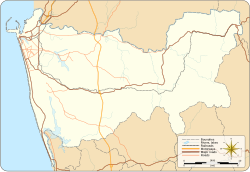
The area also known as Colombo 4, spans about 1.5 km2 (370 acres) along Galle Road. The western boundary of the suburb is the Indian Ocean and it is bordered to the east by Havelock Town, the north by Kollupitiya, and to the south by Wellawatte. It falls within the Kollupitiya (Colpetty) Ward of the Colombo Municipal Council.
Bambalapitiya is regarded as an educational hub. Many private sector schools and colleges such as IIT(Informatics Institute of Technology),ICBS, ICBT Campus, IDM Computer Studies, ESOFT Computer Studies, and PIBT [3] are in this area. It contains a number of notable schools, including Colombo Hindu College, Holy Family Convent, Muslim Ladies College, Ramanathan Hindu Ladies' College, St. Peter's College, Visakha Vidyalaya.
The A2 Highway (Galle Road) and Marine Drive, runs through the suburb, parallel to the coast.
The Bambalapitiya railway station services the area. It is the fourth station on the Coastal line.
Colombo is the executive and judicial capital and largest city of Sri Lanka by population. According to the Brookings Institution, the Colombo metropolitan area has a population of 5.6 million, and 752,993 in the Municipality. It is the financial centre of the island and a tourist destination. It is located on the west coast of the island and adjacent to the Greater Colombo area which includes Sri Jayawardenepura Kotte, the legislative capital of Sri Lanka, and Dehiwala-Mount Lavinia. Colombo is often referred to as the capital since Sri Jayawardenepura Kotte is itself within the urban/suburban area of Colombo. It is also the administrative capital of the Western Province and the district capital of Colombo District. Colombo is a busy and vibrant city with a mixture of modern life, colonial buildings and monuments.
Galle is a major city in Sri Lanka, situated on the southwestern tip, 119 km (74 mi) from Colombo. Galle is the provincial capital and largest city of Southern Province, Sri Lanka and is the capital of Galle District.
Dehiwala-Mount Lavinia, population 245,974 (2012), is a large municipality in Sri Lanka, covering 2,109 ha. It lies south of the Colombo Municipal Council area and is separated from it by the Dehiwala canal which forms the northern boundary of DMMC. Its southern limits lie in Borupana Road and the eastern boundary is Weras Ganga with its canal system and it includes some areas to its east. This town has experienced extensive population growth and rapid industrialisation and urbanisation in recent years. It is home to Sri Lanka's National Zoological Gardens, which remains one of Asia's largest. Colombo South Teaching Hospital, Kalubowila and Colombo Airport, Ratmalana are some important landmarks in this area. Dehiwela-Mount Lavinia and Sri Jayawardenapura Kotte being two large suburban centres of the city of Colombo function together as one large urban agglomeration in the Region. The overspill from the City in residential and commercial uses of land has rapidly urbanised these suburban centres. Dehiwela-Mount Lavinia and Sri Jayawardenpaura along with Colombo Municipal Council form the most urbanised part of the core area of the Colombo Metropolitan Region. Dehiwala and Mount Lavinia lie along the Galle Road artery, which runs along the coast to the south of the country.
Moratuwa is a large municipality in Sri Lanka, on the southwestern coast of Sri Lanka, near Dehiwala-Mount Lavinia. It is situated on the Galle–Colombo main highway, 18 km (11 mi) south of the centre of Colombo. Moratuwa is surrounded on three sides by water, except in the north of the city, by the Indian Ocean on the west, the Lake Bolgoda on the east and the Moratu river on the south. According to the 2012 census, the suburb had a population of 168,280.
Negombo is a major city in Sri Lanka, situated on the west coast and at the mouth of the Negombo Lagoon, in the Western Province, 38 km (24 mi) from Colombo via the Colombo–Katunayake Expressway and the nearest major city from the Bandaranaike International Airport.
Galle Face is a 5 ha ocean-side urban park, which stretches for 500 m (1,600 ft) along the coast, in the heart of Colombo, the financial and business capital of Sri Lanka. The promenade was initially laid out in 1859 by Governor Sir Henry George Ward, although the original Galle Face Green extended over a much larger area than is seen today. The Galle Face Green was initially used for horse racing and as a golf course, but was also used for cricket, polo, football, tennis, and rugby.
Maharagama is an outer suburb of Colombo, Sri Lanka on the High-Level (A4) Road about 10 km (6.2 mi) from the centre of the commercial capital. It developed rapidly in the 1980s as a dormitory suburb. Governed by the Maharagama Urban Council, the town possesses facilities like supermarkets, department stores, clothing, food and beverages shops to fulfill the needs of citizens.
The Roman Catholic Metropolitan Archdiocese of Colombo is a Latin metropolitan archdiocese of the Roman Catholic Church, whose ecclesiastical province covers all Sri Lanka plus the Maldives. It depends on the missionary Roman Congregation for the Evangelization of Peoples.
Elpitiya is a town in Galle District, Southern Province, Sri Lanka.
Aluthgama is a coastal town in Kalutara District in the Western Province of Sri Lanka. It is approximately 63.5 kilometres (39.5 mi) south of Colombo and 68 kilometres (42 mi) north of Galle. Aluthgama is situated on the northern bank of the Bentota Ganga (River) mouth.
Maradana is a suburb of Colombo, Sri Lanka. Maradana is the site of Maradana Railway Station, one of the primary railway hubs in the country, serving intercity rail and commuter rail. Maradana also has many railway yards and running sheds. A technical college, many national schools, the Lotus Tower, and business institutions are also located in the area.
Kollupitiya, also known as Colpetty is a major neighbourhood of Colombo, Sri Lanka. The name Kollupitiya comes from the name of a chief from Kandy who had unsuccessfully attempted to dethrone the last king of Kandy. During the period of British and Dutch administration, a brewery had commenced in Kollupitiya which converted coconut treacle into liquor. Nowadays, the suburb is a thriving commercial area containing fashionable high-end shopping malls. Some foreign embassies are located in Kollupitiya. The Prime Minister's House (Colombo) is located in Colombo 3 just two blocks south of Maha Nuge Gardens; a prominent private laneway in Kollupitiya.
Dematagoda is a suburb of Colombo, Sri Lanka. It is represented by divisional code 9. It is surrounded by the suburbs of Borella, Maradana and Kolonnawa. The Baseline Road passes through Dematagoda. It is the only location in Sri Lanka to have two railway stations and the first to have a flyover.
Havelock Town is a neighbourhood of Colombo, Sri Lanka, part of an area zoned as Colombo 5. It is located approximately 6 kilometres south of Fort, the central business district of Colombo. Havelock City, a mixed-used development in Havelock Town is to be the largest property development in Sri Lanka incorporating residential and commercial facilities.
Thimbirigasyaya Divisional Secretariat is a Divisional Secretariat of Colombo District, of Western Province, Sri Lanka.
Sri Lanka Railways Class S11 is a diesel multiple-unit (DMU) train, built for Sri Lanka Railways by Integral Coach Factory and imported through RITES Ltd, an Indian state infrastructure corporation on a line of credit extended by the Indian Government. They were built to replace locomotive-hauled passenger trains. Twenty S11 DMUs were ordered to strengthen long-distance travel on the Coastal Line from Colombo to Matara.
Ruhunu Kumari is a daytime passenger train that runs between Colombo and Matara in Sri Lanka.
The Western Region Megapolis is an urban planning, zoning, and development area stretching from Negombo in the north to Beruwala in the south. It is designed to create a megapolis in Sri Lanka's Western Province by 2030.
Kollupitiya Grama Niladhari Division is a Grama Niladhari Division of the Thimbirigasyaya Divisional Secretariat of Colombo District of Western Province, Sri Lanka.
Bambalapitiya Grama Niladhari Division is a Grama Niladhari Division of the Thimbirigasyaya Divisional Secretariat of Colombo District of Western Province, Sri Lanka.
6°53′20″N79°51′24″E / 6.88889°N 79.85667°E