Kohuwala

Last updated
Kohuwala
කොහුවල
கொஹுவளை
S De S. Jayasinghe Mawatha, Kohuwala.jpg
S De S. Jayasinghe Mawatha, Kohuwala
Colombo district location map.svg
Red pog.svg
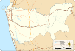
Kohuwala
Location in Colombo District
Coordinates: 6°52′31″N79°52′31″E / 6.87528°N 79.87528°E / 6.87528; 79.87528 Coordinates: 6°52′31″N79°52′31″E / 6.87528°N 79.87528°E / 6.87528; 79.87528
Country Sri Lanka
Province Western Province
District Colombo District
Time zone UTC+5:30 (Sri Lanka Standard Time Zone)
Postal Code
10250

Kohuwala is a suburb in Colombo, Sri Lanka and is situated where the Colombo Piliyandala Road crosses Nugegoda Dehiwala Road. Hence it is connected to Nugegoda, Dehiwala, Pamankada, Boralesgamuwa and Piliyandala. Kohuwala is inside the administration boundary of Dehiwala-Mount Lavinia Municipal Council.

Schools and universities

Related Research Articles

Sri Jayawardenepura Kotte Capital of Sri Lanka

Sri Jayawardenepura Kotte, commonly known as Kotte, is the official administrative capital of Sri Lanka. Sri Jayawardenepura Kotte is a satellite city and located within the urban area of Sri Lanka's de facto economic, executive, and judicial capital, Colombo.

Nugegoda Suburb in Western Province, Sri Lanka

Nugegoda is a large, densely populated suburb of Colombo, Sri Lanka. It is located in the border of Sri Jayawardenapura Municipal Council limits and Dehiwela Mt. Lavinia Municipal Council limits, just outside Colombo City limits.

Dehiwala-Mount Lavinia Suburb in Colombo District, Western Province, Sri Lanka

Dehiwala-Mount Lavinia, population 245,974 (2012) is the largest suburb of the City of Colombo, and covers an extent of 2109 hectares. It lies south of the Colombo Municipal Council area and separated from it by the Dehiwala canal which forms the northern boundary of DMMC. Its southern limits lie in Borupana Road and the eastern boundary is Weras Ganga with its canal system and including some areas to its east. This town has extensive population and rapid industrialisation and urbanization in recent years. It is home to Sri Lanka's National Zoological Gardens, which remains one of Asia's largest. Colombo South Teaching Hospital, Kalubowila and Colombo Airport, Ratmalana are some important landmark in this area. Dehiwela-Mount Lavinia and Sri Jayawardenapura Kotte being two large suburban centres of the city of Colombo function together as one large urban agglomeration in the Region. The overspill from the City in residential and commercial uses of land have rapidly urbanised these suburban centers. Dehiwela-Mount Lavinia and Sri Jayawardenpaura along with Colombo Municipal Council form the most urbanised part of the core area of the Colombo Metropolitan Region. Dehiwala and Mount Lavinia lie along the Galle Road artery, which runs along the coast to the south of the country.

Battaramulla Suburb in Western Province, Sri Lanka

Battaramulla is a suburb of Colombo, situated 8.4 km (5 mi) from the city centre at Colombo Fort, near the Parliament of Sri Lanka. It is one of the fastest developing administrative, commercial and residential areas in the Colombo District, being home to the country's elite. Battaramulla is an important town in Sri Lanka, because of the Sri Lankan government's decision to locate all the government department head offices in this town.

Homagama Suburb in Colombo District, Western Province, Sri Lanka

Homagama is a town in the Colombo District, Sri Lanka, about 24 kilometres (15 mi) south-east of Colombo. The Homagama Pradeshiya Sabha consists of the Homagama divisional secretariat and 10 GN division of Padukka DS division. The total Land area is about is 137 square kilometres (53 sq mi) of 90 GN division. The Pradeshiya Sabha was established under act No 15 of 1987, and has the highest population of any pradeshiya sabha area in Sri Lanka. It is home to notable places, such as the campus of the National School of Business Management, Sri Lanka Institute of Nanotechnology, the Panagoda Cantonment, Upali Newspapers, Mahinda Rajapaksha College Homagama, St. Michael's College, Homagama, Buddhist and Pali University of Sri Lanka, Ceylon Biscuits Limited and the Laxapana Battery Company.

Maharagama Suburb in Colombo District, Western Province, Sri Lanka

Maharagama is an outer suburb of Colombo, Sri Lanka on the High-Level (A4) Road about 10 km (6.2 mi) from the centre of the commercial capital. It developed rapidly in the 1980s as a dormitory suburb. Governed by the Maharagama Urban Council, the town possesses facilities like supermarkets, department stores, clothing, food and beverages shops to fulfill the needs of citizens.

The "'Madhya Maha Vidyalaya'(Central College)" concept is a type of state school in Sri Lanka. Originally mooted in the 1930s by C.W.W. Kannangara, 54 Central Colleges were founded between 1943 and 1947 as part of his initiative to establish free education in Sri Lanka. The first of these was C. W. W. Kannangara Central College in Matugama, followed by others in areas such as Horana, Weeraketiya, Kekirawa, Kattankudy, Mawathagama, Veyangoda, Piliyandala and Dickwella.

Pannipitiya Place

Pannipitiya is a suburb of Colombo city. It is an area in Colombo District, Sri Lanka and is located about 15 km from the commercial capital. Pannipitiya is subdivided into a number of smaller areas.

Kesbewa Place in Western Province, Sri Lanka

Kesbewa is a town in Sri Lanka, situated approximately 20 km (12 mi) south of Colombo. It is one of the relatively more populated suburbs located in the Colombo District of the Western Province and it is surrounded by the suburbs of Moratuwa, Maharagama, Pannipitiya, Bandaragama and Kahathuduwa. The Kesbewa Urban Council is located in Piliyandala City.

Piliyandala suburb in Colombo District, Western Province, Sri Lanka

Piliyandala is a suburb in Colombo, Sri Lanka. It is situated approximately 18 kilometres (11 mi) south of Colombo. It is one of the relatively more populated suburbs located in the Colombo District of the Western Province, Sri Lanka and it is surrounded by the suburbs of Moratuwa, Kesbawa, Maharagama, Pannipitiya, Bandaragama and Kahathuduwa. Piliyandala has a thriving market in the town centre and the Kesbewa Urban Council is also located in Piliyandala.

Kirulapana Suburb in Western Province, Sri Lanka

Kirulapone (Kirulapana) is a suburb in Colombo, Sri Lanka which is also known as Colombo 5.

The Lyceum International School, popularly known as LIS and its students as Lyceumers, is a school providing primary and secondary education in Sri Lanka. It is a network of schools in Sri Lanka.

Dehiwala-Mount Lavinia Municipal Council

Dehiwala-Mount Lavinia Municipal Council (DMMC) is the local authority for the city of Dehiwala-Mount Lavinia in Sri Lanka. The Council is responsible for providing a variety of local public services including roads, sanitation, drains, housing, libraries, public parks and recreational facilities. It has 48 members elected under the mixed electoral system where 60% of members will be elected using first-past-the-post voting and the remaining 40% through closed list proportional representation.

Nugegoda Grama Niladhari Division Grama Niladhari Division in Sri Lanka

Nugegoda Grama Niladhari Division is a Grama Niladhari Division of the Sri Jayawardanapura Kotte Divisional Secretariat of Colombo District of Western Province, Sri Lanka. It has Grama Niladhari Division Code 519.

Gangodavila North Grama Niladhari Division Grama Niladhari Division in Sri Lanka

Gangodavila North Grama Niladhari Division is a Grama Niladhari Division of the Sri Jayawardanapura Kotte Divisional Secretariat of Colombo District of Western Province, Sri Lanka. It has Grama Niladhari Division Code 526.

Kirulapone Grama Niladhari Division is a Grama Niladhari Division of the Thimbirigasyaya Divisional Secretariat of Colombo District of Western Province, Sri Lanka.

Nedimala Grama Niladhari Division is a Grama Niladhari Division of the Dehiwala Divisional Secretariat of Colombo District of Western Province, Sri Lanka. It has Grama Niladhari Division Code 536.

References