Nugegoda is a large, densely populated suburb of Colombo, Sri Lanka. It is located in the border of Sri Jayawardenapura Municipal Council limits and Dehiwela Mt. Lavinia Municipal Council limits, just outside Colombo city limits. It has a population of roughly over 250,000 people
Padukka is a town in the district of Colombo in the Western Province of Sri Lanka. It has a population of roughly 8,000. Elevation 44feet.

Battaramulla is situated 8.4 km (5 mi) from the Colombo Fort, near the Parliament of Sri Lanka. It is one of the fastest developing administrative, commercial and residential areas in the Colombo District, being home to the country's elite. Battaramulla is an important town in Sri Lanka, because of the Sri Lankan government's decision to locate all the government department head offices in this town.
Hanwella is a town in Sri Lanka, situated about 30 km (19 mi) from Colombo, the commercial capital of the country. Hanwella lies on the Colombo-Ratnapura main road, on the banks of the Kelani River.
Maharagama is an outer suburb of Colombo, Sri Lanka on the High-Level (A4) Road about 10 km (6.2 mi) from the centre of the commercial capital. It developed rapidly in the 1980s as a dormitory suburb. Governed by the Maharagama Urban Council, the town possesses facilities like supermarkets, department stores, clothing, food and beverages shops to fulfill the needs of citizens.
Pannipitiya is a suburb of Colombo. It is an area in Colombo District, Sri Lanka and is located about 15 km (9.3 mi) from the commercial capital. Pannipitiya is subdivided into a number of smaller areas.

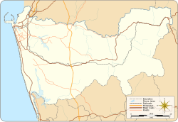
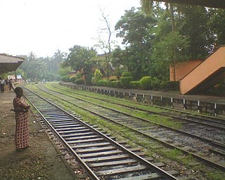
The Kelani Valley railway line in Sri Lanka, covering the breadth of Colombo District. The line is owned, maintained, and operated by Sri Lanka Railways.
Kottawa is one of the main suburbs in Colombo, Sri Lanka and is administered by the Maharagama Urban Council. It is located 21 km (13 mi) from the centre of Colombo. It is a five-way junction and lies as the epicenter for Maharagama road, Homagama road, Piliyandala road, Malabe road and Borella road.
Piliyandala is a suburb in Colombo, Sri Lanka. It is situated approximately 18 kilometres (11 mi) south of Colombo.
Kirulapone (Kirulapana) is a suburb in Colombo, Sri Lanka which is also known as Colombo 5.

The A4 Highway also known as the Colombo-Batticaloa highway, is the longest highway in Sri Lanka, at 430 kilometres (270 mi) in length. It connects Colombo with Batticaloa, through many important cities in Western, Sabaragamuwa, Uva and Eastern provinces.
Godagama is a town close to city of Colombo Sri Lanka. It is located in Colombo District within the Western Province, Sri Lanka.
Hokandara is a suburb of Colombo. It is located approximately 13 kilometres (8 mi) from the city centre of Colombo, adjacent to Thalawathugoda to the west, Pelawatte on the north-west, Malabe on the north, Aturugiriya on the east and Pannipitiya on the south.
Rukmale is a village situated in the Maharagama Electorate, Colombo District, in the Western Province, Sri Lanka. It is administered by the Maharagama Urban Council.
Henawatta Grama Niladhari Division is a Grama Niladhari Division of the Homagama Divisional Secretariat of Colombo District of Western Province, Sri Lanka. It has Grama Niladhari Division Code 482C.

Maharagama Urban Council is the local authority for Maharagama and surrounding suburbs in Sri Lanka. The Council is responsible for providing a variety of local public services including public health and sanitation, road maintenance, garbage disposal, libraries, public parks and recreational facilities. The stated goals of the council include providing infrastructure needs, and enhancing regional economic development in a sustainable manner.

Kesbewa Urban Council is the local authority for the city of Kesbewa and surrounding suburbs in Sri Lanka.