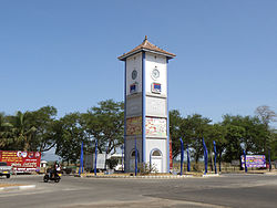
Ampara District is one of the 25 districts of Sri Lanka, the second-level administrative divisions of the country. The district is administered by a District Secretariat headed by a District Secretary appointed by the central government of Sri Lanka. The capital of the district is the town of Ampara. The district was carved out of the southern part of Batticaloa District in April 1961.
Sri Lankan state-sponsored colonization schemes is the government program of settling mostly Sinhalese farmers from the densely populated wet zone into the sparsely populated areas of the dry zone. This has taken place since the 1950s near tanks and reservoirs being built in major irrigation and hydro-power programs such as the Mahaweli project.

Ampara Airport, also known Gal-Oya Airport, is a domestic airport in Gal-Oya in southeastern Sri Lanka. It is also a military airbase known as Sri Lanka Air Force Ampara or SLAF Ampara.

Monaragala is a district in Uva Province of Sri Lanka. It is the second largest of the 25 districts in Sri Lanka, with an area of 5,636 km2 (2,176 sq mi).
Akkaraipattu is a large town in the Ampara District, Eastern Province, Sri Lanka. The town is strategically located with links via the Siyambalanduwa-Ampara Road (A25) and the Colombo-Batticaloa highway (A4). Akkaraipattu is situated 441 km (274 mi) from Colombo.
Petikirige Dayaratna is a Sri Lankan politician and a member of the Parliament of Sri Lanka. He was elected to Ampara electorate in 1977 as a Member of Parliament from the United National Party.
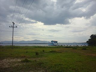
Senanayake Samudraya is the biggest reservoir and man-made lake in Sri Lanka. It is locally known as the sea. Senanayake Samudraya was opened on 28 August 1949 under the Gal Oya Multipurpose Scheme, which was completed in 1953 by D. S. Senanayake.

The Gal Oya Dam is an embankment dam in the Uva Province of Sri Lanka. The dam creates one of the largest reservoirs in the country, the Gal Oya Reservoir. Water from the reservoir is used primarily for irrigation in the Uva and Eastern provinces, in addition to powering a small hydroelectric power station. Construction of the dam and reservoir began in August 24, 1949, completing four years later in 1953.

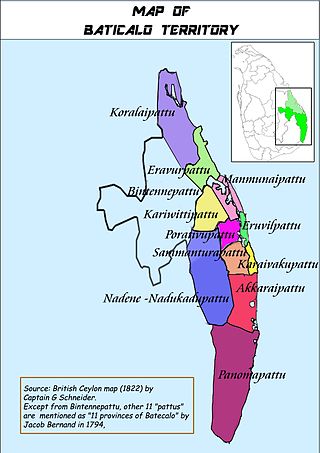
Batticaloa region in colonial records was the ancient region of Tamil settlements in Sri Lanka. The foremost record of this region can be seen in Portuguese and Dutch historical documents along with local inscriptions such as Sammanthurai Copper epigraphs written in 1683 CE which also mentions Mattakkalappu Desam. Although the region was bifuricated into districts of Batticaloa and Ampara Districts, the amended term "Batti-Ampara Districts" as well as “Keezhakarai” can still be seen in the Tamil print media of Sri Lanka.

The Gal Oya is a 108 km (67 mi) long river, in southeast Sri Lanka. It is the 16th longest river in Sri Lanka. It begins in the hills east of Badulla and flows northeast, emptying into the Indian Ocean south of Kalmunai.

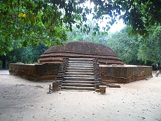
Ovagiriya is one of archaeological sites in Polwatta, Ampara District, Sri Lanka. It is situated on Ampara-Inginiyagala road, about 19 km (12 mi) away from Ampara town.

The Rambakan Oya Dam is an embankment dam in Maha Oya, Eastern Province, Sri Lanka. The reservoir was designed and constructed by the Sri Lanka Mahaveli Authority and currently functions under the direction of the Ministry of Irrigation and Water Resources Management. It has been created by building an Earthen dam which is about 1,225m in length across the Mundeni Aru river.

Konduwattuwana Wewa or Kondawattuwana Wewa is an ancient reservoir located in Ampara, Sri Lanka. The reservoir lies on the Ampara – Inginiyagala main road, approximately 4 km (2.5 mi) away from the town of Ampara. The site with ancient Buddhist ruins belonging to the Konduwattuwana reservoir area is formally recognised as an archaeological site in Sri Lanka.

Sri Dharmendrarama Purana Raja Maha Vihara is an ancient Buddhist temple in Mayadunna, Sri Lanka. The temple is located in the Gonagolla village on Ampara – Maha Oya road approximately 10 km (6.2 mi) distance from Uhana town. The temple has been formally recognised by the Government as an archaeological site in Sri Lanka. The designation was declared on 10 October 2014 under the government Gazette number 1884.

Galmaduwa Raja Maha Vihara is an ancient Buddhist temple in Galmaduwa, Sri Lanka. The temple is located on Hingurana – Ampara road approximately 6 km (3.7 mi) distance from Hingurana. It is believed that this temple complex was constructed during the reign of king Saddha Tissa. The temple has been formally recognised by the Government as an archaeological site in Sri Lanka. The designation was declared on 26 December 2014 under the government Gazette number 1895.

Gonagolla is a town in the Ampara District, Eastern Province of Sri Lanka.
Mahaoya is a town in the Ampara District, Eastern Province of Sri Lanka. It is located in 64 km (40 mi) north-west of Ampara, at the intersection of the Peradeniya-Badulla-Chenkalady Highway (A5) and the Manampitiya - Aralaganwila - Maduru Oya Road (B502).
Uhana is a town in the Ampara District, Eastern Province of Sri Lanka.
Senerath Somaratne was a Sri Lankan politician. He was the Deputy Minister of Irrigation, Power and Highways and a member of Parliament of Sri Lanka from Ampara representing the Sri Lanka Freedom Party.


