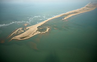
Dhanushkodi is an abandoned town at the south-eastern tip of Pamban Island of the state of Tamil Nadu in India. It is south-east of Pamban and is about 24 kilometres (15 mi) west of Talaimannar in Sri Lanka. The town was destroyed during the 1964 Rameswaram cyclone and remains uninhabited in the aftermath. Although devoid of inhabitants, Dhanushkodi remains a tourist attraction due to its historical and mythological relevance.

Rameswaram is a municipality in the Ramanathapuram district of the Indian state of Tamil Nadu. It is on Pamban Island separated from mainland India by the Pamban channel and is about 40 kilometres (25 mi) from Mannar Island, Sri Lanka. It is in the Gulf of Mannar, at the tip of the Indian peninsula. Pamban Island, also known as Rameswaram Island, is connected to mainland India by the Pamban Bridge. Rameswaram is the terminus of the railway line from Chennai and Madurai. Together with Varanasi, it is considered to be one of the holiest places in India to Hindus and is part of the Char Dham pilgrimage.
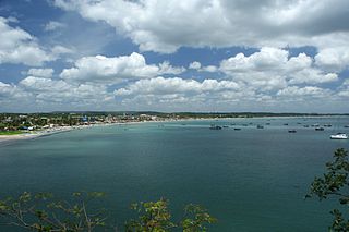
Trincomalee, historically known as Gokanna and Gokarna, is the administrative headquarters of the Trincomalee District and major resort port city of Eastern Province, Sri Lanka. Located on the east coast of the island overlooking the Trincomalee Harbour, Trincomalee has been one of the main centres of Sri Lankan Tamil speaking culture on the island for nearly a millennium. With a population of 99,135, the city is built on a peninsula of the same name, which divides its inner and outer harbours. It is home to the famous Koneswaram temple from where it developed and earned its historic Tamil name Thirukonamalai. The town is home to other historical monuments such as the Bhadrakali Amman Temple, Trincomalee, the Trincomalee Hindu Cultural Hall and, opened in 1897, the Trincomalee Hindu College. Trincomalee is also the site of the Trincomalee railway station and an ancient ferry service to Jaffna and the south side of the harbour at Muttur.
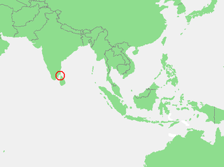
The Gulf of Mannar is a large shallow bay forming part of the Laccadive Sea in the Indian Ocean with an average depth of 5.8 m (19 ft). It lies between the southeastern tip of India and the west coast of Sri Lanka, in the Coromandel Coast region. The chain of low islands and reefs known as Adam’s Bridge or Rama Setu, which includes Mannar Island, separates the Gulf of Mannar from Palk Bay, which lies to the north between India and Sri Lanka. The estuaries of Thamirabarani River and Vaippar River of South India and the Malvathu Oya of Sri Lanka drain into the Gulf. The dugong is found here.

Batticaloa is a major city in the Eastern Province, Sri Lanka, and its former capital. It is the administrative capital of the Batticaloa District. The city is the seat of the Eastern University of Sri Lanka and is a major commercial centre. It is on the east coast, 111 kilometres (69 mi) south of Trincomalee, and is situated on an island. Pasikudah is a popular tourist destination situated 35 km (22 mi) northwest with beaches and flat year-round warm-water shallow-lagoons.

The Laccadive Sea, also known as the Lakshadweep Sea, is a body of water bordering India, the Maldives, and Sri Lanka. It is located to the southwest of Karnataka, to the west of Kerala and to the south of Tamil Nadu. This warm sea has a stable water temperature through the year and is rich in marine life, the Gulf of Mannar alone hosting about 3,600 species. Mangaluru, Kasaragod, Kannur, Kozhikode, Ponnani, Kochi, Alappuzha, Kollam, Thiruvananthapuram, Tuticorin, Colombo, and Malé are the major cities on the shore of the Laccadive Sea. Kanyakumari, the southernmost tip of peninsular India, also borders this sea.

Vavuniya is a city in Vavuniya District in the Northern Province of Sri Lanka. The municipality is administered by an Municipal Council. The town has been known since ancient times, but being a heavily forested area, less than 100,000 people lived in the entire district before the Sri Lankan Civil War. The city is situated as a border town that divides the Tamil and Sinhalese population. To the south of the city are the Sinhala cities and to the north are the Tamil cities. The city has a large population of Tamils, Muslims and a significant number of Sinhalese. In the early days, Vavuniya was known as Vanni due to the abundance of Vanni Trees. The Security Forces Headquarters - Wanni is located in Vavuniya.
Bharatha People also known as Bharatakula and Paravar, is an ethnicity in the island of Sri Lanka. Earlier considered a caste of the Sri Lankan Tamils, they were classified as separate ethnic group in the 2001 census. They are descendant of Tamil speaking Paravar of Southern India who migrated to Sri Lanka under Portuguese rule. They live mainly on the western coast of Sri Lanka and mainly found in the cities of Mannar, Negombo and Colombo.
Ketheeswaram temple is an ancient Hindu temple in Mannar, Northern Province, Sri Lanka. It is the oldest temple in Sri Lanka with at least 1400 years of evidence. Overlooking the ancient Tamil port towns of Manthai and Kudiramalai, the temple has lain in ruins, been restored, renovated and enlarged by various royals and devotees throughout its history. Thirukketheeswaram is one of the Pancha Ishwarams dedicated to the Hindu deity Shiva and is venerated by Shaivas throughout the continent. Throughout its history, the temple has been administered and frequented by Sri Lankan Hindu Tamils. Its famous tank, the Palavi tank, is of ancient antiquity and was restored from the ruins. Thirukketheeswaram is one of the 275 Paadal Petra Sthalams of Shiva glorified in the poems of the Tevaram.
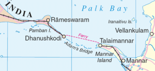
Mannar Island, formerly spelt Manar Island, which lies off the north-western coast of Sri Lanka, is part of Mannar District, Sri Lanka. It is linked to the main island of Sri Lanka by a causeway and the Mannar Bridge, which carries the A14 highway, and a railway bridge. It has an area of about 130 square kilometres (50 sq mi), mainly covered with vegetation and sand.
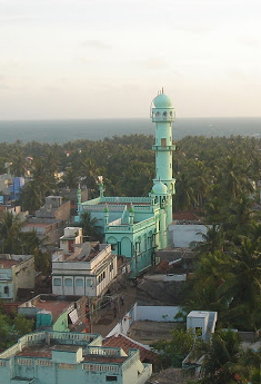
Pudumadam is a village located in the Ramanathapuram district of the Indian state of Tamil Nadu. Situated near the old National Highway 49, which connects Kochi and Dhanushkodi, Pudumadam serves as a vital gateway to the picturesque Pamban Island. The village is approximately 25 kilometers away from the city of Ramanathapuram and 37 kilometers away from the renowned pilgrimage site of Rameswaram. The nearest train station is Uchippuli, located just 4 kilometers away from Pudumadam.
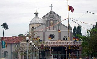
Vankalai or Vangalai or Vangkaalai is a predominantly fishing and farming village situated in Mannar District of the Northern Province of Sri Lanka. It lies along the Naanaattan Road with the sea on its west connecting to the Indian Ocean. The shores from Vankalai 20 km south to the ancient Tamil subsidiary port of Kudiramalai formed the world's most famous pearl fishing banks in the classical and medieval periods. Its northern boundary is the historic Hindu shrine of Thiru Ketheeswaram.
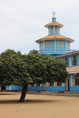
Pesalai is a village in Mannar District, situated on the northern coast of Mannar Island, Sri Lanka. Most of the people in Pesalai are Roman Catholics, and there are also some Hindus and Muslims. Pesalai has 3 GN divisions: Pesalai North, Pesalai South, and Pesalai West. It has a population of about 8,000, 97% of which are Sri Lankan Tamils, and the remaining 3% are Moors. There are around 2,610 families and 7,350 people in Pesalai, including Kataspathri, Siruthoppu, and Murukankovil.

The Shrine of Our Lady of Madhu is a Roman Catholic Marian shrine in Mannar district of Sri Lanka. With a history of more than 400 years, the shrine acts as a center of pilgrimage and worship for Sri Lankan Catholics. The site is considered as the holiest Catholic shrine in the island and is a well known place of devotion for both Tamil and Sinhalese Catholics. The church has been a symbol of unity not just between Tamils and Sinhalese but also between people of different religions, including Buddhists, Hindus and Protestants.
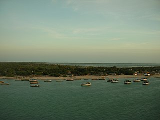
Pamban Island, also known as Rameswaram Island, is an island located between peninsular India and Sri Lanka, on the Rama Setu archipelago. The second largest island in the latter, Pamban Island belongs to India and forms the Rameswaram taluk of the Ramanathapuram district of the state of Tamil Nadu. It is the largest island in Tamil Nadu by area. The principal town in the island is the pilgrimage centre of Rameswaram.

Talaimannar is a settlement in Sri Lanka located on the northwestern coast of Mannar Island.

Mannar District is one of the 25 districts of Sri Lanka, the second level administrative division of the country. The district is administered by a District Secretariat headed by a District Secretary appointed by the central government of Sri Lanka. The capital of the district is Mannar, which is located on Mannar Island.
Kudiramalai is a cape and ancient port town on the west coast of Sri Lanka.
Manthai is a coastal town and an ancient harbor situated in the Mannar district, of the Northern Province of Sri Lanka. Manthai functioned as the main port of the Anuradhapura Kingdom throughout its history.
Arippu Fort was built by the Portuguese and was handed over to the Dutch in 1658. The small bastion fort is located in Arippu, which is 16 km (9.9 mi) away from Mannar Island. The fort is nearly square in shape, with two bastions.


