Kisiljevo

Last updated
Kisiljevo
Кисиљево
Village
CountryFlag of Serbia.svg  Serbia
Time zone CET (UTC+1)
  Summer (DST) CEST (UTC+2)

Kisiljevo (Serbian Cyrillic: Кисиљево) is a village in north-east Serbia (Braničevo District), located at municipality Veliko Gradište (Велико Градиште). The village is populated with 704 inhabitants (2002. census). [1] Kisiljevo is mentioned extensively in the novel An Uncertain Place by Fred Vargas. The town was once famous for its story about Petar Blagojevich, a man who was reportedly thought to have been a vampire who killed 9 people.

The Serbian Cyrillic alphabet is an adaptation of the Cyrillic script for Serbo-Croatian, developed in 1818 by Serbian linguist Vuk Karadžić. It is one of the two alphabets used to write standard modern Serbian and Montenegrin, the other being Latin. In Croatian and Bosnian, only the Latin alphabet is used.

Braničevo District District of Serbia in Southern and Eastern Serbia

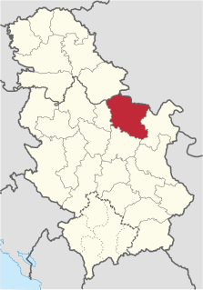
The Braničevo District is one of nine administrative districts of Southern and Eastern Serbia. It expands in the north-eastern parts of Serbia. According to the 2011 census results, it has a population of 180,480 inhabitants. The administrative center of the district is Požarevac.

Veliko Gradište Town and municipality in Southern and Eastern Serbia, Serbia

Veliko Gradište is a town and municipality located in the Braničevo District of the eastern Serbia. It is situated the right bank of the Danube river and left bank of the Pek river. In 2011, the town has a total population of 6,204, while the municipality has 17,610.

Related Research Articles

Mileševo (Bečej) Village in Vojvodina, Serbia

Mileševo is a village in Serbia. It is situated in the Bečej municipality, South Bačka District, Vojvodina province. The village has a Hungarian ethnic majority and its population numbering 1,118 people.

Księżpol Village in Lublin, Poland

Księżpol is a village in Biłgoraj County, Lublin Voivodeship, in eastern Poland. It is the seat of the gmina called Gmina Księżpol. It lies approximately 15 kilometres (9 mi) south of Biłgoraj and 93 km (58 mi) south of the regional capital Lublin.

Berlovine Village in Serbia

Berlovine is a village in Serbia. It is situated in the Ljubovija municipality, in the Mačva District of Central Serbia. The village had a population of 276 in 2002, all of whom were ethnic Serbs.

Trawy Village in Masovian, Poland

Trawy is a village in the administrative district of Gmina Korytnica, within Węgrów County, Masovian Voivodeship, in east-central Poland. It lies approximately 20 kilometres (12 mi) west of Węgrów and 55 km (34 mi) north-east of Warsaw.

Kao, Niger is a village and rural commune in Niger.

Jakalj Village in Šumadija, Serbia

Jakalj is a village in the municipality of Bajina Bašta, Serbia. According to the 2002 census, the village has a population of 472 people.

Borovac is a village in the municipality of Bujanovac, Serbia. According to the 2002 census, the town has a population of 166 people.

Vana-Jõgeva is a village in Jõgeva Parish, Jõgeva County in eastern Estonia.

Budoši Village in Republika Srpska, Bosnia and Herzegovina

Budoši is a village in the municipality of Trebinje, Republika Srpska, Bosnia and Herzegovina.

Makovište Village in Zlatibor District, Serbia

Makovište is a village in the municipality of Kosjerić, western Serbia. According to the 2002 census, the village has a population of 893 people.

Manni is a village in Märjamaa Parish, Rapla County in western Estonia.

Kovači (Raška) Village in Raška District, Serbia

Kovači is a village in the municipality of Raška, Serbia. According to the 2002 census, the village has a population of 283 people.

Šipačina Village in Raška District, Serbia

Šipačina is a village in the municipality of Raška, Serbia. According to the 2002 census, the village has a population of 252 people.

Dupeljevo is a village in the municipality of Vranje, Serbia. According to the 2002 census, the village has a population of 55 people.

Mijovce Village in Pčinja District, Serbia

Mijovce is a village in the municipality of Vranje, Serbia. According to the 2002 census, the village has a population of 67 people.

Suvi Do (Žagubica) Village in Braničevo District, Serbia

Suvi Do is a village in the municipality of Žagubica, Serbia. According to the 2002 census, the village has a population of 1320 people.

Mala Vrbica is a village in the municipality of Stragari, Serbia. According to the 2002 census, the village has a population of 249 people.

Veliki Šenj is a village in the municipality of Stragari, Serbia. According to the 2002 census, the village has a population of 350 people.

Ovsište Village in Šumadija District, Serbia

Ovsište is a village in the municipality of Topola, Serbia. According to the 2002 census, the village has a population of 630 people.

Lojanice Village in Mačva District, Serbia

Lojanice is a village in the municipality of Vladimirci, Serbia. According to the 2002 census, the village has a population of 641 people.

References

  1. Popis stanovništva, domaćinstava i Stanova 2002. Knjiga 1: Nacionalna ili etnička pripadnost po naseljima. Republika Srbija, Republički zavod za statistiku Beograd 2003. ISBN   86-84433-00-9

Coordinates: 44°44′N21°25′E / 44.733°N 21.417°E / 44.733; 21.417

Geographic coordinate system Coordinate system

A geographic coordinate system is a coordinate system that enables every location on Earth to be specified by a set of numbers, letters or symbols. The coordinates are often chosen such that one of the numbers represents a vertical position and two or three of the numbers represent a horizontal position; alternatively, a geographic position may be expressed in a combined three-dimensional Cartesian vector. A common choice of coordinates is latitude, longitude and elevation. To specify a location on a plane requires a map projection.