Hibbard is an unincorporated community in Union Township, Marshall County, Indiana.

Alro SA, established in 1963, is one of the biggest aluminium companies in Romania and in Europe. It started operation in 1965. Alro's primary aluminium facilities are located in Slatina and currently are a smelter and processing facilities. It also includes a cast house, hot and cold rolling mills and an extrusion shop.

Jūrkalne is a village in Latvia. It is the centre of a parish of the same name within Ventspils Municipality on the Baltic coast. Its former German name was Feliksberg (Felixberg), but its former Latvian name was Medeņciems (Meddenzeem).
Bobovište is a village in Serbia, in the municipality of Aleksinac in Nisava district. According to the census of 2002, there were 1,074 people.

Lonjin is a village in Serbia. It is situated in the Ljubovija municipality, in the Mačva District of Central Serbia. The village had a Serb ethnic majority and a population of 337 in 2002.
Darosava is a village in the municipality of Aranđelovac, Serbia. According to the 2002 census, the village has a population of 2023 people.
Brzan is a village in the municipality of Batočina in the Šumadija District of Serbia. The population was 1,754 in the 2011 census.
Crni Kao is a village in the municipality of Batočina, Serbia. According to the 2011 census, the village has a population of 410 people.

Dobrovodica is a village in the municipality of Batočina, Serbia. According to the 2011 census, the village has a population of 381 people.

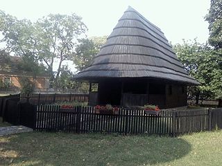
Gradac is a village in the municipality of Batočina, Serbia. According to the 2011 census, the village has a population of 206 people. The Gradac Cave located in the village is part of the Cultural Heritage of Serbia list, inscribed in 1979.

Nikšić is a village in the municipality of Batočina, Serbia. According to the 2011 census, the village had a population of 176 people.
Prnjavor is a village in the municipality of Batočina, Serbia. According to the 2011 census, the village has a population of 166 people.
Planina is a village in the municipality of Krupanj, Serbia. According to the 2002 census, the village has a population of 204 people.
Borovac is a village in the municipality of Bujanovac, Serbia. According to the 2002 census, the town has a population of 166 people.
Dubravica is a village in the municipality of Požarevac, Serbia.
Selo Kostolac or Stari Kostolac is a village in the municipality of Kostolac, city of Požarevac, Serbia. According to the 2002 census, the village has a population of 1,313 people.
Nabrđe is a village in the municipality of Požarevac, Serbia. According to the 2002 census, the village has a population of 346 people.
Gradište is a village in Serbia in the municipality Merošina in Nisava district. According to the census of 2002, there were 596 people. In the near Gradiste, is the archeological site Kulina.
Donja Rača is a village in the municipality of Rača, Serbia. According to the 2002 census, the village has a population of 1008 people.

Trska is a village in the municipality of Rača, Serbia. According to the 2002 census, the village has a population of 389 people.

