Slaughter Creek is a 6.7-mile-long (10.8 km) saltwater creek that drains into the Little Choptank River. The creek is 0.3 miles (0.5 km) wide at its mouth. It separates Taylors Island, Maryland from the mainland.

Noragyugh is an historic neighborhood in Kentron District of Yerevan, Armenia. A plan is in place to destroy the historic district and turn it into a business center, known as "New Yerevan".
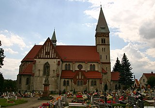
Baba is a village in the administrative district of Gmina Mogilno, within Mogilno County, Kuyavian-Pomeranian Voivodeship, in north-central Poland.
Karczewo is a village in the administrative district of Gmina Rajgród, within Grajewo County, Podlaskie Voivodeship, in north-eastern Poland.

Höytala, old name Oytala is a village in the Zaqatala Rayon of Azerbaijan. The village forms part of the municipality of Maqov.

Krępica is a village in the administrative district of Gmina Burzenin, within Sieradz County, Łódź Voivodeship, in central Poland. It lies approximately 5 kilometres (3 mi) north-west of Burzenin, 13 km (8 mi) south of Sieradz, and 57 km (35 mi) south-west of the regional capital Łódź.
Teodozjów is a village in the administrative district of Gmina Czerniewice, within Tomaszów Mazowiecki County, Łódź Voivodeship, in central Poland.
Szalenik is a settlement in the administrative district of Gmina Lubycza Królewska, within Tomaszów Lubelski County, Lublin Voivodeship, in eastern Poland, close to the border with Ukraine. The village is located in the historical region Galicia.
Przecinka is a village in the administrative district of Gmina Tomaszów Lubelski, within Tomaszów Lubelski County, Lublin Voivodeship, in eastern Poland.
Zuxuloba is a village in the Qusar Rayon of Azerbaijan. The village forms part of the municipality of Şirvanovka.
Pustkowie Jędrzejewskie is a village in the administrative district of Gmina Krotoszyn, within Krotoszyn County, Greater Poland Voivodeship, in west-central Poland. It lies approximately 12 kilometres (7 mi) east of Krotoszyn and 93 km (58 mi) south-east of the regional capital Poznań.
Starzyny is a village in the administrative district of Gmina Rokietnica, within Poznań County, Greater Poland Voivodeship, in west-central Poland. It lies approximately 3 kilometres (2 mi) south of Rokietnica and 16 km (10 mi) north-west of the regional capital Poznań.
Kinno is a village in the administrative district of Gmina Orchowo, within Słupca County, Greater Poland Voivodeship, in west-central Poland.
Ligota Bialska is a village in the administrative district of Gmina Biała, within Prudnik County, Opole Voivodeship, in south-western Poland. It lies approximately 2 kilometres (1 mi) north-east of Biała Prudnicka, 13 km (8 mi) north-east of Prudnik, and 34 km (21 mi) south-west of the regional capital Opole.
Targowisko Dolne is a village in the administrative district of Gmina Lubawa, within Iława County, Warmian-Masurian Voivodeship, in northern Poland. It lies approximately 15 km (9 mi) south-east of Iława and 62 km (39 mi) south-west of the regional capital Olsztyn.
Zimna is a settlement in the administrative district of Gmina Pisz, within Pisz County, Warmian-Masurian Voivodeship, in northern Poland. It lies approximately 18 kilometres (11 mi) south-west of Pisz and 85 km (53 mi) south-east of the regional capital Olsztyn.
Radosław is a village in the administrative district of Gmina Sławno, within Sławno County, West Pomeranian Voivodeship, in north-western Poland. It lies approximately 6 kilometres (4 mi) north of Sławno and 177 km (110 mi) north-east of the regional capital Szczecin.
Miałka is a village in the administrative district of Gmina Ińsko, within Stargard County, West Pomeranian Voivodeship, in north-western Poland. It lies approximately 4 kilometres (2 mi) west of Ińsko, 33 km (21 mi) east of Stargard, and 61 km (38 mi) east of the regional capital Szczecin.
Trường Giang is a commune (xã) and village in Lục Nam District, Bắc Giang Province, in northeastern Vietnam.
Vestla is a village in Saaremaa Parish, Saare County in western Estonia.


