Koniska, Minnesota | |
|---|---|
 Koniska  Koniska | |
| Coordinates: 44°50′42″N94°13′01″W / 44.84500°N 94.21694°W | |
| Country | United States |
| State | Minnesota |
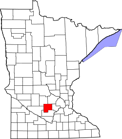
| County | McLeod |
| Township | Rich Valley |
| Elevation | 1,043 ft (318 m) |
| Time zone | UTC-6 (Central (CST)) |
| • Summer (DST) | UTC-5 (CDT) |
| Area code | 320 |
| GNIS feature ID | 1817777 [1] |
Koniska is an unincorporated community in McLeod County, in the U.S. state of Minnesota. [1]