Plato, Minnesota | |
---|---|
Coordinates: 44°46′21″N94°02′23″W / 44.77250°N 94.03972°W [1] | |
Country | United States |
State | Minnesota |
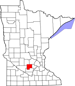
County | McLeod |
Area | |
• Total | 0.35 sq mi (0.91 km2) |
• Land | 0.35 sq mi (0.90 km2) |
• Water | 0.01 sq mi (0.01 km2) |
Elevation | 994 ft (303 m) |
Population | |
• Total | 329 |
• Density | 948.13/sq mi (366.30/km2) |
Time zone | UTC-6 (Central (CST)) |
• Summer (DST) | UTC-5 (CDT) |
ZIP code | 55370 |
Area code | 320 |
FIPS code | 27-51460 [4] |
GNIS feature ID | 2396225 [1] |
Plato is a city in southeastern McLeod County, Minnesota, United States. The population was 329 at the 2020 census. [3]
A post office called Plato has been in operation since 1858. [5] The city was named for Plato, a Greek philosopher. [6]
Plato lies one half mile north of U.S. Highway 212 on a county road between Glencoe, the McLeod county seat, 5 miles (8 km) to the west, and Norwood Young America 6 miles (10 km) to the east. Downtown Minneapolis is 48 miles (77 km) to the east.
According to the U.S. Census Bureau, the city has a total area of 0.35 square miles (0.91 km2), of which 0.005 square miles (0.013 km2), or 1.42%, are water. [2] Buffalo Creek flows past the northwest corner of the community and the dry Kinneson Lakebed lies to the east and northeast. [7]
Census | Pop. | Note | %± |
---|---|---|---|
1880 | 49 | — | |
1890 | 130 | 165.3% | |
1900 | 232 | 78.5% | |
1910 | 238 | 2.6% | |
1920 | 251 | 5.5% | |
1930 | 242 | −3.6% | |
1940 | 283 | 16.9% | |
1950 | 263 | −7.1% | |
1960 | 280 | 6.5% | |
1970 | 303 | 8.2% | |
1980 | 390 | 28.7% | |
1990 | 355 | −9.0% | |
2000 | 336 | −5.4% | |
2010 | 320 | −4.8% | |
2020 | 329 | 2.8% | |
U.S. Decennial Census [8] |
At the 2010 census, [9] there were 320 people, 139 households and 97 families residing in the city. The population density was 914.3 inhabitants per square mile (353.0/km2). There were 146 housing units at an average density of 417.1 per square mile (161.0/km2). The racial makeup of the city was 98.1% White, 0.3% Native American, 0.6% Asian, and 0.9% from other races. Hispanic or Latino of any race were 0.9% of the population.
There were 139 households, of which 23.0% had children under the age of 18 living with them, 61.9% were married couples living together, 4.3% had a female householder with no husband present, 3.6% had a male householder with no wife present, and 30.2% were non-families. 23.7% of all households were made up of individuals, and 8.7% had someone living alone who was 65 years of age or older. The average household size was 2.30 and the average family size was 2.72.
The median age was 44.6 years. 18.7% of residents were under the age of 18; 3.7% were between the ages of 18 and 24; 28.2% were from 25 to 44; 31.6% were from 45 to 64; and 17.8% were 65 years of age or older. The population was 50.6% male and 49.4% female.
At the 2000 census, [4] there were 336 people, 144 households and 99 families residing in the city. The population density was 985.0 inhabitants per square mile (380.3/km2). There were 145 housing units at an average density of 425.1 per square mile (164.1/km2). The racial makeup of the city was 98.81% White, 0.60% Asian, and 0.60% from two or more races.
There were 144 households, of which 29.9% had children under the age of 18 living with them, 61.1% were married couples living together, 7.6% had a female householder with no husband present, and 31.3% were non-families. 22.9% of all households were made up of individuals, and 11.8% had someone living alone who was 65 years of age or older. The average household size was 2.33 and the average family size was 2.76.
22.6% of the population were under the age of 18, 6.3% from 18 to 24, 32.1% from 25 to 44, 24.1% from 45 to 64, and 14.9% who were 65 years of age or older. The median age was 38 years. For every 100 females, there were 97.6 males. For every 100 females age 18 and over, there were 94.0 males.
The median household income was $55,179 and the median family income was $62,917. Males had a median income of $36,250 compared with $29,018 for females. The per capita income was $24,434. None of the families and 2.8% of the population were living below the poverty line, including no under eighteens and 7.1% of those over 64.
Correll is a city in Big Stone County, Minnesota, United States. The population was 34 at the 2010 census. Correll was named for David N Correll, a railroad official who founded the city in 1881.
Hanska is a city in Brown County, Minnesota, United States. The population was 402 at the 2010 census.
Chickamaw Beach is a city in Cass County, Minnesota, United States. The population was 114 at the 2010 census. It is part of the Brainerd Micropolitan Statistical Area.
Twin Lakes is a city in Freeborn County, Minnesota, United States, near Albert Lea. The population was 134 at the 2020 census.
Wanamingo is a community in Goodhue County, Minnesota, United States, incorporated as a city. It lies along the North Fork of the Zumbro River. The population was 1,086 at the 2010 census.
Biscay is a city in McLeod County, Minnesota, United States. The population was 113 at the 2020 census, unchanged from 2010.
Brownton is a city in McLeod County, Minnesota, United States. The population was 731 at the 2020 census.
Stewart is a city in McLeod County, Minnesota, United States. The population was 571 at the 2010 census.
Bock is a city in Mille Lacs County, Minnesota, United States. The population was 106 at the 2010 census.
Racine is a city in Racine Township, Mower County, Minnesota, United States. The population was 442 at the 2010 census.
Goodridge is a small city in Pennington County, Minnesota, United States. The population was 112 at the 2020 census. The city is located within Goodridge Township, but is politically independent.
Sanborn is a city in Redwood County, Minnesota, United States. The population was 339 at the 2010 census.
Orr is a city in Saint Louis County, Minnesota, United States. The population was 211 at the 2020 census.
Clarissa is a city in Todd County, Minnesota, United States. The population was 681 at the 2010 census. It dropped to 661 inhabitants by the 2020 census.
West Union is a city in Todd County, Minnesota, United States. The population was 111 at the 2010 census. By the 2020 Decennial Census the population had declined to 92.
Oak Park Heights is a city in Washington County, Minnesota, United States. The population was 4,849 at the 2020 census.
Dakota is a city in Winona County, Minnesota, United States. The population was 295 at the 2020 census.
Silver Lake is a city in McLeod County, Minnesota, United States. The population was 866 at the 2020 census.
Genola is a city in Morrison County, Minnesota, United States. The population was 70 at the 2020 census.
Minnesota Lake is a city in Blue Earth and Faribault counties in the State of Minnesota. The population was 661 at the 2020 census. The bulk of the city is in Faribault County; a small part extends into Blue Earth County.