Koyuk River

Last updated
Koyuk River
Kuyuk
Serpentine Tors 2007-013 NPS1.jpg
Part of the Bering Land Bridge National Preserve, in the Koyuk River Valley
Relief map of USA Alaska.png
Red pog.svg
Location of the mouth of the Koyuk River in Alaska
Native nameKuuyuk (Inuit)
Location
Country United States
State Alaska
District Nome Census Area
Physical characteristics
Sourcesmall lake 3 miles (4.8 km) north of Kuzitrin Lake
  location Bering Land Bridge National Preserve, Seward Peninsula
  coordinates 65°25′44″N163°13′00″W / 65.42889°N 163.21667°W / 65.42889; -163.21667 [1]
  elevation1,526 ft (465 m) [2]
Mouth Norton Bay
  location
Koyuk
  coordinates
64°55′45″N161°08′03″W / 64.92917°N 161.13417°W / 64.92917; -161.13417 [1]
  elevation
0 ft (0 m) [1]
Length115 mi (185 km) [1]

The Koyuk River (also spelled, Kuyuk) [3] (Inupiaq: Kuuyuk; Yup'ik: Kuiguk) is a river on the Seward Peninsula of western Alaska, in the United States. [1] The river originates in the interior of the peninsula, at the Lost Jim Lava Flow of the Bering Land Bridge National Preserve, where it flows southeast towards the mouth of Norton Bay on Norton Sound. The native village of Koyuk is located at its mouth. The two major tributaries are the Peace and Salmon rivers; other tributaries include Dime and Sweepstakes. [4]

Contents

Etymology

Its Inuit named as Tebenkof Eskimos, reported by Captain Tebenkov (1852, map 2), IRN, as Kvyguk or Kvieguk. The Western Union Telegraph Expedition spelled the name Koikpak ("big river"). The Seward map of 1867 gives Koipak, and later as Kayuk, Koyuk, and Kuyuk. The Kanguksuk is also known as the Left Fork of the Kviguk (Koyuk). The present spelling comes from Alfred Hulse Brooks', 1900 United States Geological Survey. [5] [6]

Geography

The Koyuk River, one of the largest in the Seward Peninsula, [7] [8] originates in a lake (no designated name) bounded on the north by the Bendeleben Mountains, in the upper reaches of the Bering Land Bridge National Preserve, in Northwest Alaska. [9] The upper reach is also reported as being made up of flat lava fields to the north of the mountains. [10]

The 115-mile (185 km) long river flows southeast for 90 miles (140 km), then south for another 25 miles (40 km). [1] The river empties into Norton Bay, which it enters via a tidal estuary downstream of the river's confluence with the East Fork Koyuk River near the village of Koyuk. The last stretch of the river, [9] is in a southeasterly direction as it joins the bay, [10] and flows through the tundra wetland area. The catchment in the middle and upper reaches has a horse-shoe shape, and the hills surrounding the valley lie in an elevation range of 2,000 to 3,000 feet (610 to 910 m); the two prominent mountains are the Bendeleben Mountains and Domes of Granite Mountain, the latter named after the granite geological formations.

In its initial reaches, the river has steep slopes with rapids in the upper most reaches having shallow depth of flows. The river widens as it flows down with more flow additions from tributaries which join it and the width of the river attains 820 feet (250 m), with a slow moving stretch of the river recording a 5-foot (1.5 m) depth of water. [9] On both banks of the river rock exposures derived lava flows are bedded on a horizontal direction; the rockfall from these exposures has filled the river bed with boulders. [11] While the lava beds were noted in the upper region of the river and also in the valley, geological formations in the valley were mapped by Walter Curran Mendenhall, the fifth director of the US Geological Survey. He reported these formations as basalts of Pleistocene or Late Pleistocene age. [12] Gold, platinum, and radioactive minerals were reported by the U.S. Bureau of Mines in 1973, as well as lode and placer claims, along a 10-mile (16 km) wide stretch of the river. [13]

Basin

The river becomes a broad estuary subject to tidal effect extending for long stretch upstream forming a flat mud- and sand-filled basin. The basin area measure approximately 2,000 square miles (5,200 km2). [14] The Bering Land Bridge National Preserve is in the uppermost part of the basin. Its drainage includes southeastern Seward Peninsula through Norton Bay.

History

A study of the archaeological remains at the Lyatayak site, south of Cape Denbigh and south of Koyuk, indicated that the area was inhabited 6000 to 8000 years ago. [9] The recorded history of Koyuk is traced to Lieutenant L.A. Zagoskin of the Imperial Russian Navy during the 1840s. In 1865, William Wennis of the Western Union Telegraph expedition reported that the Koyuk was deserted on account of possibly the smallpox epidemic wiping out the entire population of the village and that the village had been abandoned for 13 years. The Yupik-speaking [15] Unali Eskimos and the Melemute Eskimos resettled in Koyuk during the 1860s to take advantage of caribou herding. In 1879, a trading post for furs was established at the river's mouth by the Alaska Commercial Company. [16] During the gold rush, there was intense activity in the region but hardly any gold was found though claims had been staked at many places within the Koyuk River valley. By 1900, the village had declined to the level of subsistence economy, depending on fishing and hunting caribou and moose and picking on berries. [9]

Wildlife

Caribou reindeer Caribou.jpg
Caribou reindeer

Under the Alaska National Interest Lands Conservation Act (ANILCA) (P.L 96-487) the Koyuk River is categorized as "Freshwater Aquatic Herbaceous" and is one out of 25 nominated as the National Wild and Scenic Rivers. The river and the basin draining it is rich of wild life species, which consists of five fish species, 22 mammals species and 46 bird species. [17]

The flora of the river watershed, in their descending order of distribution are: closed needleleaf forest dominating the riparian zone; closed tall shrub scrub is also part of the riparian zone, and open-air low shrub scrub with willows and grasses as dominant vegetation. The wet graminoid herbaceous habitat lies between the river riparian and higher ground. The mesic graminoid herbaceous forms the hilly tussock tundra. [17] The dominant vegetation in the valley is of tundras, except in the basin area below Knowles Creek, where it consists of tree species of willows, spruce and birch. [9]

The river is well known for its fishing resources. the fish species reported are Chinook salmon (Oncorhynchus tshawytscha), sockeye salmon (Oncorhynchus nerka), coho salmon (Oncorhynchus kisutch), steelhead/rainbow trout (Oncorhynchus mykiss), Dolly Varden trout (Salvelinus malma), northern pike (Esox lucius), grayling (Thymallus thymallus), Dolly Varden trout (Salvelinus malma malma), and Arctic char (Salvelinus alpinus). [17] [18] Some of the important mammals reported in the river basin are moose ( Alces alces ), grizzly bear (Ursus arctos horribilis), black bear (Ursus americanus), caribou (Rangifer tarandus), wolves (Canis lupus), lynx, red fox, beaver, and snowshoe hare (Lepus americanus). [17] [18] Some of the important bird species reported in the river watershed are: bald eagles, glaucous gulls, spruce grouse, northern flying squirrel, song birds, ravens, waterfowl, lesser golden-plover, whimbrel and Lapland longspur. [17]

Tourism

There are a network of trails in the basin, prominent among these are the Koyuk River-Buckland route and the Koyuk-Kiwalik route. [3] The river is also popular for water sports such as kayaking and rafting. [18]

See also

Related Research Articles

<span class="mw-page-title-main">Seward Peninsula</span> Peninsula on the western coast of Alaska

The Seward Peninsula is a large peninsula on the western coast of the U.S. state of Alaska whose westernmost point is Cape Prince of Wales. The peninsula projects about 200 mi (320 km) into the Bering Sea between Norton Sound, the Bering Strait, the Chukchi Sea, and Kotzebue Sound, just below the Arctic Circle. The entire peninsula is about 210 mi (330 km) long and 90–140 mi (145–225 km) wide. Like Seward, Alaska, it was named after William H. Seward, the United States Secretary of State who fought for the U.S. purchase of Alaska.

<span class="mw-page-title-main">Unalakleet River</span> River in Alaska, United States

The Unalakleet River in the U.S. state of Alaska flows southwest 90 miles (145 km) from the Kaltag Mountains to near the town of Unalakleet, on Norton Sound of the Bering Sea.

<span class="mw-page-title-main">Dolly Varden trout</span> Species of fish

The Dolly Varden trout is a species of salmonid fish native to cold-water tributaries of the Pacific Ocean in Asia and North America. It belongs to the genus Salvelinus, or true chars, which includes 51 recognized species, the most prominent being the brook, lake and bull trout, as well as Arctic char. Although many populations are semi-anadromous, fluvial and lacustrine populations occur throughout its range. It is considered by taxonomists as part of the Salvelinus alpinus or Arctic char complex, as many populations of bull trout, Dolly Varden trout and Arctic char overlap.

<span class="mw-page-title-main">Bering Land Bridge National Preserve</span>

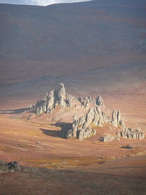
The Bering Land Bridge National Preserve is one of the most remote Protected areas of the United States, located on the Seward Peninsula. The National Preserve protects a remnant of the Bering Land Bridge that connected Asia with North America more than 13,000 years ago during the Pleistocene ice age. The majority of this land bridge now lies beneath the waters of the Chukchi and Bering Seas. During the glacial epoch this bridge was a migration route for people, animals, and plants whenever ocean levels fell enough to expose the land bridge. Archeologists disagree whether it was across this Bering Land Bridge, also called Beringia, that humans first migrated from Asia to populate the Americas, or whether it was via a coastal route.

<span class="mw-page-title-main">Kiwalik River</span> River in Alaska, United States

The Kiwalik River is a stream on the Seward Peninsula in the U.S. state of Alaska. The headwaters of the river originate in the eastern portion of the peninsula, around Granite Mountain. The river flows north to its mouth at Kiwalik Lagoon, Chukchi Sea. The start of the 20th century mining town of Candle is found on its western bank at the confluence of Candle Creek. The ore minerals and materials found in the river basin are galena, gold, pyrite, scheelite, silver and sphalerite, and the primary commodities are tungsten, lead and zinc.

<span class="mw-page-title-main">Imuruk Basin</span> Estuary on Seward Peninsula, Alaska, U.S.

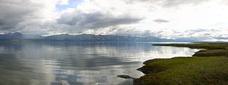
The Imuruk Basin is an approximately 90 sq mi (230 km2), 17 mi (27 km) long shallow estuary located on the Seward Peninsula in the U.S. state of Alaska. The estuary's drainage basin covers about one quarter of the peninsula. The basin is fed by the Kuzitrin, Kruzgamepa, Agiapuk, and Cobblestone Rivers and is drained by the Tuksuk Channel, which empties into Grantley Harbor.

<span class="mw-page-title-main">Fish River (Alaska)</span> River in Alaska, United States

The Fish River is a waterway in the U.S. state of Alaska. The 47-mile-long (76 km) river rises in the Bendeleben Mountains and flows south to Golovnin Lagoon, before emptying into Golovnin Bay, Norton Sound, and the Bering Sea. The basin formed by the Fish River is known for its placer gold deposits, and in particular, the Niukluk River and its tributaries; production from this tributary valley is reported to be more than from any other place in the region. A galena mine existed 40 miles (64 km) from the sea, worked on occasion by a San Francisco corporation with a few hundred tons of ore taken to the city for smelting and refining for silver. Walter Curran Mendenhall found obscure fossils on Fish River at White Mountain.

The Tubutulik River is a waterway in the U.S. state of Alaska. The 25-mile (40 km) long river is situated on the Seward Peninsula. It flows southeastwards to the Kwiniuk Inlet at the northwestern end of Norton Bay, 25 miles (40 km) southwest of Koyuk in the Bering Sea. Its Inuit name was reported as "Tubuktulik" in 1849 by Capt. Mikhail Dmitrievich Tebenkov of the Imperial Russian Navy. Exploration for placer gold occurred in the Council district area where the river valley is located, and in 1898, mining commenced. The production was substantial and ranked second only to that of Nome.

<span class="mw-page-title-main">Bendeleben Mountains</span>

The Bendeleben (/ˈbɛn.dəˌleɪ.bɨn/) Mountains are a mountain range on the heart of the Seward Peninsula in Nome Census Area, Alaska, United States. This range forms a major divide between drainage basins draining into the Pacific Ocean and the Arctic Ocean. The tallest peak, Mount Bendeleben is 3,730 feet (1,140 m) at the summit, and is located on the west end. Bits of the range go into the Bering Land Bridge National Preserve, but most of the peaks remain unclaimed. The Tubutulik River flows in the area.

The Kruzgamepa River is a 55-mile (89 km) tributary of the Kuzitrin River on the Seward Peninsula in the U.S. state of Alaska. The river begins at Salmon Lake, elevation 447 feet (136 m), and descends to 20 feet (6.1 m) above sea level at its mouth. In turn, the Kuzitrin River empties into the Imuruk Basin. The basin drains via the bay of Port Clarence to the Bering Sea.

Eldorado River is a waterway on the Seward Peninsula in the U.S. state of Alaska. It is situated 14 miles (23 km) west of Solomon. This river has its source within a few miles of Salmon Lake, from which it is separated by a low divide. It flows southeast through a broad gravel-filled valley for 30 miles (48 km) to Flambeau River before emptying into Safety Sound. Its headwaters reach the limestones of the Nome series and much of its course lies in a chlorite-albite-schist belt. The Eldorado River provides a southerly drainage into the Bering Sea.

Flambeau River is a waterway on the Seward Peninsula in the U.S. state of Alaska. It has a broad, basin-shaped valley, and terminates as a tributary to Safety Sound. Its name is first recorded by Edward Chester Barnard of the United States Geological Survey (1900). The nearby gold prospect deposit site, "Flambeau River", is named after the waterway.

<span class="mw-page-title-main">York Mountains</span> Mountains on the Seward Peninsula

York Mountains are located on the Seward Peninsula in the U.S. state of Alaska. They extend inland from the Bering Sea to the rocky cape of the same name. On the seaward sides, the streams have incised canyon-like valleys. Eastward, the York Mountains are extended by the highlands lying north of Port Clarence. Their western flanks fall off rather abruptly to the York PIateau. The general aspect of these mountains is rugged. The York Mountains and several other highland masses form isolated groups in the northern half of the peninsula, while in the southern half of the peninsula, the Kigluaik, Bendeleben, and Darby mountains form a broken range along a crescentic axis.

Bonanza River (Inupiaq: Kiwaliq) is a waterway on the Seward Peninsula in the U.S. state of Alaska. The headwaters lie close to Venetia Creek and the Koksuktapaga River. It flows southeast for 25 miles (40 km) before reaching Safety Sound, as do the Flambeau and Eldorado Rivers, and then through Safety Inlet to Norton Sound. The village of Solomon is approximately 2 miles (3.2 km) away. Across the divide of West Creek, in the Bonanza River drainage, and lying above the West Creek schists, is a series of green chloride schists and sills of greenstone; these chloritic schists are the prevailing rocks of the divide between Eldorado and Bonanza rivers. In its general character, it is similar to the Eldorado River. Also called Bonanza Cal, later maps indicate California Creek to be a principal tributary of Bonanza River. According to Alfred Hulse Brooks, the Eskimo name is Ki-ul-uk.

<span class="mw-page-title-main">Nome River</span> River in Alaska, United States

Nome River is a waterway on the Seward Peninsula in the U.S. state of Alaska. It has its source in a narrow valley in the southern margin of the Kigluaik Mountains, 4.5 miles (7.2 km) west of Salmon Lake.

Cape Mountain (Inupiaq: Kiŋigin) is located 3 miles (4.8 km) southeast of Cape Prince of Wales on the Seward Peninsula in the U.S. state of Alaska. It was named by the surveyor, Alfred Hulse Brooks, in 1900.

Bluestone River is a waterway located on the Seward Peninsula in the U.S. state of Alaska. A tributary of the Tuksuk Channel from the south, Bluestone is a north-flowing stream situated 11 miles (18 km) southeast of Teller. It was named in 1900 by Edward Chester Barnard, topographer of the United States Geological Survey.

<span class="mw-page-title-main">Grantley Harbor</span>

Grantley Harbor is a waterway located at the bay of Port Clarence, Alaska, on the Seward Peninsula in the U.S. state of Alaska. The inner harbor at the entrance to the northeast corner of the bay was named after Lord Grantley.

<span class="mw-page-title-main">Noxapaga River</span> River in Alaska, United States

Noxapaga River is a 56-mile (90 km) tributary of the Kuzitrin River on the Seward Peninsula in the U.S. state of Alaska. Heading in the Bering Land Bridge National Preserve, it flows northwest for 4 miles (6 km), then west for 22 miles (35 km), then south for 30 miles (48 km) to its mouth on the larger river. Tributaries include the creeks of Aurora, Berry, Black, Bluff, Boulder, Buzzard, Frost, Garfield, Goodall, Goose, Grouse, Last Chance, Little Garfield, Mascot, Money, Peuk, Stony, Turner, and Winona.

<span class="mw-page-title-main">Imuruk Lake</span> Lake in the state of Alaska, United States

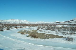
Imuruk Lake is the largest body of fresh water in Seward Peninsula in the U.S. state of Alaska. It measures 31 square miles (80 km2) and has a drainage basin of 102 square miles (260 km2), It lies on top of a lava plateau at an elevation of 960 feet (290 m). The drainage basin is relatively flat, as the maximum elevation is only about 1,600 feet (490 m). A low gap in the divide between the lake and the head of the right fork of Goodhope River rises only a few feet above the lake. The Fairhaven Ditch takes practically all its water from the lake. Serpentine Hot Springs flow to the Serpentine River, 47 miles (76 km) northwest of Imuruk Lake.

References

  1. 1 2 3 4 5 6 "Koyuk River". Geographic Names Information System. United States Geological Survey. January 1, 2000. Retrieved September 26, 2013.
  2. Derived by entering source coordinates in Google Earth.
  3. 1 2 Burch, Ernest S. (2005). Alliance and Conflict: The World System of the Inũpiaq Eskimos. U of Nebraska Press. pp. 276, 296–. ISBN   978-0-8032-6238-6.
  4. Smith, Sumner Stewart (1917). The mining industry in the territory of Alaska during the calendar year 1916 (Public domain ed.). Govt. Print. Off. pp. 56–. Retrieved 27 March 2013. full text
  5. Bulletin of the United States Geological Survey (Public domain ed.). U.S. Government Printing Office. 1902. pp. 251–. Retrieved 23 March 2013.
  6. Baker, Marcus (1902). Geographic Dictionary of Alaska. U.S. Government vffice. pp. 251–.
  7. Brooks, Alfred Hulse; Abbe, Cleveland; Goode, Richard Urquhart (1906). The Geography and Geology of Alaska: A Summary of Existing Knowledge. U.S. Government Printing Office. pp. 93–.
  8. Geological Survey (U.S.) (1911). Bulletin – United States Geological Survey (Public domain ed.). The Survey. pp.  10. Retrieved 27 March 2013.
  9. 1 2 3 4 5 6 DeVaughn, Melissa (2011). Alaska AdventureGuide. Menasha Ridge Press. pp. 69–60. ISBN   978-0-89732-907-1.
  10. 1 2 Geological Survey Bulletin. U.S. Government Printing Office. 1913. pp. 1–.
  11. Brooks, Alfred Hulse; Collier, Arthur James; Mendenhall, Walter Curran; George Burr Richardson (1901). Geological Survey (U.S.) (ed.). Reconnaissances in the Cape Nome and Norton Bay regions, Alaska, in 1900 (Public domain ed.). Government Printing Office. pp.  191, 198, 212–. Retrieved 23 March 2013.
  12. Geological Survey (U.S.) (1902). Professional paper – United States Geological Survey. The Survey. pp. 1–.
  13. United States. Heritage Conservation and Recreation Service (1980). A proposal for protection of eleven Alaskan rivers. The Service. p. 63.
  14. United States. Bureau of Reclamation (1952). Alaska: A Reconnaissance Report on the Potential Development of Water Resources in the Territory of Alaska for Irrigation, Power Production, and Other Beneficial Uses. U.S. Government Printing Office. p. 172.
  15. Sturtevant, William C (1978). Handbook of North American Indians: Arctic . Government Printing Office. pp.  303–. ISBN   978-0-16-004580-6.
  16. Bockstoce, John R. (2009). Furs and Frontiers In the Far North: The Contest Among Native and Foreign Nations for the Bering Strait Fur Trade. Yale University Press. pp. 306–. ISBN   978-0-300-15490-0.
  17. 1 2 3 4 5 "Wildlife of the Koyuk Watershed". Bureau of Land Management, Alaska. Retrieved 26 March 2013.
  18. 1 2 3 "Koyuk River Hunting and Fishing...Enjoy One Of The Many Scenic Rivers in Alaska!". Alaska Fishing and Hunting Guides Directory. Archived from the original on 10 April 2013. Retrieved 26 March 2013.