Lake Altaussee, also known as Altausseersee, is a mountain lake located at the southwestern foot of the Totes Gebirge in the Styrian part of the Salzkammergut. It lies at 712 m above sea level. The center of the municipality of Altaussee is located on the western shore. The Altaussee Traun, which flows into the Danube via the Traun, serves as the outlet of the lake. The largely undeveloped shores and adjacent wetlands of Lake Altaussee provide habitats for numerous animal and plant species and have been under nature conservation since 1959. The Austrian Federal Forests own Lake Altaussee, which is a popular excursion destination due to its beautiful location. Every third year, the lake hosts the Daffodil Festival, Austria's largest flower festival.[1]
The Totes Gebirge surround Lake Altaussee in a horseshoe shape. The Loser (1873m above sea level ) lies to the north, with steep flanks that drop sharply to the lakeshore. To the east, the Trisselwand (1754m sea level) features a rock face that rises approximately 600 meters high. On the northeastern shore, the Seewiese marks the beginning of a trough valley that leads over the Hochklapfsattel to the plateau of the Totes Gebirge. To the south, the Tressenstein (1201m above sea level) follows, while the village of Altaussee in the hilly area of the Aussee Basin is situated to the west. The shores are rocky and steep, particularly in the north, while in other areas, they are partly pebbly, flat and largely undeveloped.[1]
The lake stretches from west-southwest to east-northeast, covering a length of 2.6km with a maximum width of 1km, and a surface area of around 2.1km2. With an average depth of 35 m, the lake basin has steep slopes, except for the northeastern part, where the slope gradually decreases from approximately 40m depth, leading to a relatively large bottom zone with a maximum depth of 53m. The deepest point is a spring funnel near the north bank, which reaches a depth of 73m, while the water volume measures 72.7 million cubic meters.[2][3]
The lake can be reached via the Altausseerstraße L702. The lake is surrounded by a 7.4km long circular hiking trail Uferpromenade.[4]
Hydrology
The nature reserve in Styria with the ID NSG 03 a.
The hydrological catchment area of Lake Altaussee encompasses a total area of 54km2, entirely located within the Totes Gebirge. The lake's primary source of water is from karst springs located at the lake's bottom, which receive underground flow from debris and rock crevices. These springs have an average total discharge of 3750 L/s. Additionally, there are a few small spring outlets along the shores with a combined discharge of approximately 20 L/s.[5] Lake Altaussee demonstrates typical fluctuations in discharge commonly associated with karst springs. In the northeast, there is a small dead ice hole called Lake Osterseen, which is filled by groundwater corresponding to the water level of Lake Altaussee. The Altaussee Traun, the lake's outlet, exits in the southwest at the Seeklause, where a bridge spans the outflow. It carves its path between the rock barrier of the Plattenkogel and the alluvial fan of the Augstbach, which acts as a natural dam for the lake.[6]
lake at high tide with a flooded lake meadow in April 2012
Originally, the Augstbach stream flowed into Lake Altaussee 250m north of the lake outlet. However, due to the issue of saline water from the nearby salt mine repeatedly reaching the lake through this stream, the stream bed was artificially relocated before 1530. Since then, the Augstbach has been redirected to flow westward, past Lake Altaussee, and into the Traun River approximately 150m downstream from the lake outlet.[7]
After heavy and prolonged rainfalls, a hydrological karst phenomenon known as "the Liagern" can be witnessed in the Seewiese area. This event occurs due to the presence of two cave entrances situated at different elevations. During this spectacle, vast amounts of water accumulate within a cave in the middle section of the Loserwand. The resulting overpressure causes a large jet of water to shoot out of the cave portal of the Liager hole in a high arc. The process, with some interruptions, only takes about an hour, and the bulk quantities can reach 3000 L/s. The waterfall turns into a torrent in the area of the wall, which tumbles down to the lake and, together with the strong underground inflow, causes the lake level to rise by up to 60cm within just 12 hours.[6]
Geology
Tectonic
Topographic map of the Altaussee Lake.
Lake Altaussee is a component of the Northern Limestone Alps, which lies on the southwestern edge of the Totengebirge cover (Tirolic period), characterized by its abundance of Mesozoic limestones and dolomites from the Triassic and Jurassic periods. Within the western part of the Totes Gebirge, lies the Schönberg group, which is geologically distinct from the Priel group due to a deep incursion furrow. The Wildensee line is a geological structure that stretches from Lake Altaussee, traverses the Hochklapfsattel, extends to Wildensandee Lake, and continues over the Rinnerboden to Offensee Lake. The base of the Loser mountain is composed predominantly of Dachstein limestone, while the Plattenkogel showcases Pedata limestone or dolomite formations, both originating from the Triassic period. The Trisselwand and Tressenstein areas exhibit the presence of Oberalmer Formation and Tressensteinkalk, which formed during the Jurassic period. Scattered around the lake, one can observe remnants of terminal and lateral moraines, offering glimpses into the region's glacial history and the shaping of its surrounding landscape.[8]
Former glaciation and formation
During the ice ages, the Altaussee glacier flowed from the Totes Gebirge plateau, flowing over the Aussee basin and reaching the Traun glacier near Bad Goisern. The glacier's movement was instrumental in sculpting the valley's over-deepened basin of Lake Altaussee. About 16,000 years ago, a powerful readvance of the glacier occurred and filled the basin once again, giving it its current form. Simultaneously, as the over-deepened basin was being freed from the ice, a lake began to form at the edge of the ice body. This phase, marked by the presence of a high debris formation around Lake Altaussee's basin, indicates the interaction between the ice body and the lake basin. As the ice eventually disappeared entirely, the alluvial cone adjusted to accommodate the present lake level. Originally, the lake area was likely more extensive, stretching over the Seewiese and reaching the Osterseen. Over the course of the post-glacial period, the lake basin constantly changed its shape as a result of silting up. It is expected that, over tens of thousands of years, the lake basin will eventually vanish once again, further transforming the landscape.[9][10]
Climate
The lake often freezes over completely in winter, as here in December 2007.
The climate data show a temperature and precipitation distribution typically found in the Northern Limestone Alps: Cool and precipitation-rich summers, with a maximum of 16.2°C and 220mm in July, respectively, and winters with low precipitation, with a minimum temperature of -2.2°C in January. Precipitation shows a secondary maximum from December to January. Overall, the annual precipitation was 2041mm with an annual average temperature of 7.1°C. The Schönberg group, located at the edge of the Totes Gebirge, benefits from frequent cloud accumulation, resulting in above-average precipitation in that area. A comparison with Bad Mitterndorf, situated on the southern side of the Totes Gebirge and approximately 12km away, highlights the barrier effect of the Totes Gebirge at a similar altitude. Bad Mitterndorf receives annual precipitation of 1222mm at an elevation of 803m above sea level. In terms of snow cover duration, the nearby town of Bad Aussee, located 3km away, experiences approximately 126 days of winter snow cover.[11]
Source: Hydrographic Service Styria, Office of the Styrian Provincial Government, data from 1998 to 2019.
Limnology
Circulation
Especially in summer, the lake is used for swimming because of the mild water temperatures
Lake Altaussee is classified as a dimictic lake. In spring after the ice melts, the water body mixes and brings oxygen-rich water into the depths. In the summer half-year, a distinct thermocline forms, and only the surface layer warms up, in autumn mixing occurs again, followed by ice formation. Strict stratification conditions are present in Lake Altaussee. The epilimnion has only a very small thickness of about two meters. The metalimnion lies at a depth of about five meters. The uniformly temperate hypolimnion begins at 10 meters. The strikingly high position of the metalimnion is due to the relatively wind-protected location and only moderate flooding of the lake. After the spring circulation, surface water temperatures gradually increase, reaching a long-term average of 16.3°C in August. However, between 2000 and 2006, the mean August temperature was higher at 18.4°C, nearly 2°C above the long-term average. The highest recorded water temperature in the lake was 21.8°C during the summer of 2003. At depths below 15 meters, temperatures average around 4.6°C. Throughout the summer stagnation phase, the hypolimnion warms up by an average of only 0.3°C. The lake is typically covered by ice for an average of 57 days each year.[12]
Trophy
The lake has a low concentration of nutrients and is thus oligotrophic. Measurements in the years 2000 to 2006 showed an average phosphorus content of 6.7μg/L. Due to the discharge of untreated wastewater, a eutrophication trend could be detected in the years 1963 to 1973 and the oxygen saturation above ground was already decreasing. In addition, bacteriological tests revealed the presence of salmonella. As a result, remediation measures began, which were completed in 1980 with the construction of a regional association sewage treatment plant with a third treatment stage in the municipal area of Bad Aussee. The hygienic situation of the bathing areas improved rapidly and the oligotrophic condition of the lake could be maintained. Several supply and disposal pipes run through the lake, connecting the rest areas at the Seewiese and the beach café located on the southern shore to the sewage system. Due to the low phytoplankton concentration and low algae growth, the average summer visibility depth is 8.9 meters.[13]
Plankton
According to chlorophyll studies, algae growth in Lake Altaussee is relatively low. Cryptophyceae and diatoms are the principal phytoplankton community components, with species from the genus Cyclotella standing out. In particular, Cyclotella Styria is a unique species found exclusively in Lake Altaussee and Lake Grundlsee. The zooplankton community, on the other hand, exhibits significantly higher biomass. Among the rotifers, the species Kellicottia longispina, Keratella cochlearis, and Keratella hiemalis were frequently observed. The crustacean plankton in Lake Altaussee is largely composed of species such as Cyclops abyssorum, Eudiaptomus gracilis, Daphnia hyalina, and Eubosmina longispina.[14]
Flora and vegetation
Mirror pondweed ( Potamogeton lucens ) is the most common aquatic plant in the lake, south shore 2013
The potential natural vegetation on the riparian slopes is a spruce-fir-beech forest (Aposerido-Fagetum). However, centuries of prioritizing spruce as a fuel source for the salt flats have led to a significant depletion and displacement of fir and beech trees. Snow heath-red pine forests (Erico-Pinetum) can only be found in the rockiest, driest regions. In the Seewiese, a treeless area created by mowing and grazing, there are tall perennials such as meadowsweet ( Filipendula ulmaria ), ring thistle ( Carduus personata ), and monkshood (Aconitum napellus ).[15] In the meadow around the hunting lodge, many star daffodils (Narcissus radiiflorus) bloom in the second half of May. On the shore edge of the lake meadow grows the very rare shore buttercup (Ranunculus reptans). It is found in Austria and on the shores of Lake Constance. On the very dry, steep, and south-exposed slopes of the “Bumpy Stone Walls” in the shore area grows the mountain laserwort (Laserpitium siler), the only host plant of the mountain cumin summer work (Orobanche laserpitii-sileris), which is highly uncommon in Austria. This full parasite reaches flowering there only in wet years.[16]
In Lake Altaussee, mirror pondweed (Potamogeton lucens), alpine pondweed (Potamogeton alpinus), crested pondweed (Stuckenia pectinate), Berchtold's dwarf pondweed (Potamogeton berchtoldii) and hairy-leaved water crowfoot (Ranunculus trichophyllus) occur in larger stands in places in the shallower shore areas. Grass pondweed (Potamogeton gramineus) grows only locally in the reed stand (Phragmites australis) on the north bank and marsh pond thread (Zannichellia palustris) on the bank near the church. Dense stonewort algae lawns on the former alluvial cone of the Augstbach are conspicuous.[7]
Fauna
The fish population of Lake Altaussee is composed of the following species: burbot (Lota lota), chub (Squalius cephalus), minnow (Phoxinus phoxinus), perch (Perca fluviatilis), lake Trout (Salmo trutta) and arctic Char (Salvelinus alpinus).[4] The perch is not native to the lake. The common pond mussel (Anodonta anatina) lives sporadically on the former alluvial cone of the Augstbach. The green jelly spherule (Ophrydium versatile) is also common.[7]
About 6 species of waterfowl have been recorded in the area. In addition to the common annual birds’ coot (Fulica atra), mute swan (Cygnus olor), mallard (Anas platyrhynchos), and tufted duck (Aythya fuligula), the great crested grebe (Podiceps cristatus) is also among the breeding birds. The great egret (Ardea alba) also lives at the lake.[17]
Nature Conservation
With its largely undeveloped shores with nearby marshes and wooded steep slopes, the lake provides habitats for many animal and plant species and the area has been under nature protection since 1959. The Altaussee Nature Reserve (NSG-a03) spans 242 hectares and extends to an altitude of 1600m above sea level. In 2006, the Totes Gebirge European Protected Area with Lake Altaussee European Protected Area No. 35 was designated under the Habitats and Birds Directives as part of the Natura 2000 network.[18]
Research
The shallow pools of the Seewiese are an important habitat for young fish
The Walter Munk Foundation for the Oceans supports research projects in the field of limnology, ecology, and underwater archaeology at Lake Altaussee. Together with the University of Natural Resources and Applied Life Sciences Vienna, a high-resolution multibeam echo sounder was used to create a detailed 3D model of the lake bottom in 2019. It shows, among other things, sediment formations of various kinds, large boulders, crater-shaped underwater springs, and around 100 standing tree trunks with heights of one to about fifteen meters distributed over the entire lake. In the summer of 2022, a 10-meter-tall white fir (Abies alba) was recovered from the lake. By combining dendrochronology and radiocarbon methods, the age could be accurately determined. The tree has 247 annual rings and died in 859 AD. The rootstock of the fir can be visited on the north bank. How the approximately 100 tree trunks got into the lake - for example, through a tectonic event, or whether they grew in the site - require further investigation.[19]
Economy
Fishing
The Fisherman's Cross on the west bank
Lake fishing in Altaussee has a documented history dating back to the 13th century. The fishing activities were under the authority of the sovereign lordship of Pflindsberg, and only a selected group of residents from the village of Fischerndorf had the privilege to engage in fishing. These individuals were obligated to pay fishing fees, which granted them the right to fish. The fishing operations were organized by guilds, as indicated by the name Fischerndorf. The allocation of fishing rights was based on the size of the land owned by the entitled farmers. In Altaussee, fishing rights are passed down through generations and are considered hereditary. The Austrian Federal Forests hold the lake, but the rights of the fishermen are registered in the land register and have been owned by the local families for generations. Fishing in the lake is still conducted professionally to this day.[20]
Lake Altaussee is renowned for its large char and trout populations, with Arctic char accounting for approximately 90% of the total catch.[4] The shallow and flowing water on the lake side of the Seeklause serves as a crucial spawning area for lake trout, which spawn from October to December. To prevent the fish from migrating into the Traun River, grids are installed under the bridge during the spawning season. Additionally, there is a spawning sanctuary (Laichschonstätte) located at the Lechthütte on the southeast bank. The char in Lake Altaussee spawn from October to November on gravel banks that are free of silt, typically at a depth of around 20 meters. To support the char population, a portion of the fish is captured using nets during what is known as "leaching batches." The eggs are then stripped and fertilized to cultivate young fish. During the summer, these young fish are released back into the lake.[21] The fishermen's cross, located on the western shore, used to serve as a guide to locate the spawning grounds and the best fishing spots for Arctic char. Fishermen would navigate with a flatboat to a specific point where the alignment of the Granzling, the tip of the flatboat, the fisherman's cross, and the Dietrichskogel formed a line. The cross needed to be positioned on the horizon of the Dietrichskogel. In the past, the fisherman's cross was a freestanding structure easily visible from all directions. However, it is now obscured by tall trees.[22]
The perch (Perca fluviatilis) was not originally native to the lake but entered the water body at the end of the 1980s for yet unexplained reasons. As a foreign fish species, it changed the aquatic ecosystem and caused damage to the population of minnows and Arctic char, on whose spawn it feeds. To restore the balance, attempts are being made to reduce the population of the perch. One method involves placing submerged spruce branches, where the perch lay their eggs, and then removing the branches to destroy the fish eggs.[23]
Shipping
The Altaussee 2019
The company Stern Schifffahrt GmbH, based in Gmunden, operates shipping on Lake Altaussee. Boats run regularly between the Madlmaier landing stage in Altaussee and the Seewiese landing stage on the northeast shore. On May 7, 2011, the Altaussee, Austria's first solar-electric powered catamaran, began operating on the lake.[24] The boat has room for 80 passengers. Since 2018, the company has also been offering flatboat trips including skippers. Combustion engines are prohibited on ships and boats in Lake Altaussee, as well as on all lakes in the inner Salzkammergut region. However, there are some exceptions to this rule, including professional fishing, liner shipping, and vehicles used by rescue and fire departments.[25]
Tourism
Lake Altaussee is a popular destination for excursions because of its beautiful location. In Altaussee exists a distinctive tourist infrastructure with accommodation and catering establishments. The hunting lodge Seewiese on the northeast shore was originally owned by the Hohenlohe-Schillingsfürst family and is now run as an inn. It contains a small natural history museum on the second floor, which focuses on Lake Altaussee and the numerous fossils found in the region.[26] To the south of the Seewiese, an inn dating from the 1900s was purchased by Dietrich Mateschitz and rebuilt in local style in May 2018. Most of the shore is freely accessible. Public bathing jetties are located at the Seeklausanger parking lot and at the Seepark in Altaussee. Lake Altaussee is also suitable for ice skating and curling, as it often freezes over completely in winter. During the Daffodil Festival at the end of May/beginning of June, which lasts several days, a boat parade takes place every third year on Lake Altaussee. Here, sculptures decorated with star daffodils are put on display.[27]
History
Lake Altaussee around 1910
At the outlet of Lake Altaussee, like other lakes in the inner Salzkammergut, there existed a hermitage specifically used for wood drifting. With relatively modest means, this location allowed for the storage of large quantities of water. The first mention of this hermitage dates back to the forest survey of 1561. In 1633, a new building was constructed, entirely made of wood at the time. The reconstruction of the Seeklause using ashlars began in 1781. Additionally, an external rake was built around 1300 to gather the floated wood. However, after the brewing operation in Aussee market in 1867, the rake fell into disuse. The final wood drifting event on the Altaussee Traun occurred in 1882. Presumably, the Klause was destroyed during a flood in 1899. Subsequent to the catastrophic floods of 1897 and 1899, the remaining traces of the rake were eliminated as part of the shore reinforcement measures.[28]
In the last days of the Second World War, a truck was sunk on the north bank. Today, this consists only of fragments scattered over an area of about 20 × 40 m.
Lake Altaussee in Art
Rudolf von Alt: Lake Altaussee with Trisselwand, 1839
As the nobility began to settle in Ausseerland, Altaussee also attracted more and more writers, painters, and musicians. From the middle of the 19th century, Altaussee developed into a "home of writers". Raoul Auernheimer, in his autobiography "Das Wirtshaus zur verlorenen Zeit", compares the lake to an inkwell into which “the poets sitting around in circles dipped their quills”. The influence of the lake is documented in the Altaussee Literature Museum.[29]
The lake and the hunting lodge Seewiese were filming locations for the James Bond film Spectre in 2015.[30]
Related Research Articles
The Salzkammergut is a resort area in Austria, stretching from the city of Salzburg eastwards along the Alpine Foreland and the Northern Limestone Alps to the peaks of the Dachstein Mountains. The main river of the region is the Traun, a right tributary of the Danube.
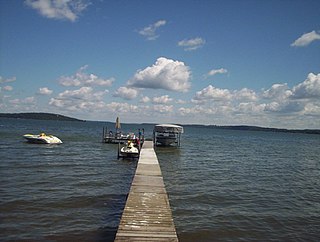
Attersee, also known as Kammersee, English sometimes Lake Atter, is the largest lake of the Salzkammergut region in the Austrian state of Upper Austria. It is Austria's third largest lake by area, surpassed only by Lake Constance and Lake Neusiedl, which, however, both of those larger lakes extend beyond national borders.
Bad Aussee is a town in the Austrian state of Styria, located at the confluence of the three sources of the Traun River in the Ausseerland region. Bad Aussee serves as the economic and cultural center of the Styrian part of the Salzkammergut lakes region. With a population of 4,862, the town is said to be the geographical midpoint of Austria, symbolized by a stone monument in the centre of town.
Traun is a river in the Austrian state of Upper Austria. Its source is in the Totes Gebirge mountain range in Styria. It flows through the Salzkammergut area and the lakes Hallstätter See and Traunsee. The Traun is a right tributary of the Danube, which it meets near the city of Linz. Other towns along the river are Bad Aussee, Bad Ischl, Gmunden, Wels and Traun. The Traun is 155.9 km (96.9 mi) long, and has a basin area of 4,257 km2 (1,644 sq mi). Its average discharge at the mouth is 150 m3/s (5,300 cu ft/s).
Lake Toplitz is a lake situated in a dense mountain forest high up in the Austrian Alps, 98 km (61 mi) from Salzburg in western Austria. It is surrounded by cliffs and forests in the Salzkammergut lake district, within the Totes Gebirge. The Toplitzsee water contains no oxygen below a depth of 20 m. Fish can survive only in the top 18 m, as the water below 20 m is salty, although bacteria and worms that can live without oxygen have been found below 20 m.
Green Lake — also known as Big Green Lake — is a lake in Green Lake County, Wisconsin, United States. Green Lake has a maximum depth of 237 ft (72 m), making it the deepest natural inland lake in Wisconsin and the second largest by volume. The lake covers 29.72 km2 and has an average depth of 30.48 m (100.0 ft). Green Lake has 43.94 km (27.30 mi) of diverse shoreline, ranging from sandstone bluffs to marshes.
Altaussee is a municipality and spa town in the district of Liezen in Styria, Austria. The small village is nestled on the shores of the Lake Altaussee, beneath the Loser Plateau. Occupying an area of 92 km², Altaussee is home to 1,777 people. The municipality includes two cadastral communities: Altaussee and Lupitsch. The designated climatic spa is within the Salzkammergut region. Altaussee has the biggest salt deposits of Austria, which are still mined today.
Grundlsee is a municipality in the Liezen District of Styria, Austria. The municipality includes 151.54 km ² large parts of the Ausseerland and the Dead Mountains. The village is located directly on Grundlsee lake.
The Loser Plateau is part of the Totes Gebirge mountain range in the Salzkammergut of Austria. It is most easily accessed up a toll road from the town of Altaussee. It is a Nature Reserve, notable for its caves and unspoilt alpine Karst ecosystem. Hunting permits are issued to control Chamois.
Vårbyfjärden is a strait in south-eastern Lake Mälaren south-west of Stockholm in Sweden.
Mashapaug Lake is a 297-acre (1.20 km2) lake surrounded by Bigelow Hollow State Park and Nipmuck State Forest in the town of Union in northeastern Connecticut. The lake has a maximum depth of 39.5 feet, and an average depth of 15 feet. Its normal surface elevation is 706 feet (215 m). The lake is very popular with fishermen and boaters from the area, and can also be used for swimming.
Vättern is the second largest lake by surface area in Sweden, after Vänern, and the sixth largest lake in Europe. It is a long, finger-shaped body of fresh water in south central Sweden, to the southeast of Vänern, pointing at the tip of Scandinavia. Being a deep lake at 128 metres (420 ft) below sea level at its deepest point, Vättern is about 1/3 the surface area of Vänern but in spite of this contains roughly 1/2 of its water.
The Spechtensee is a lake in Styria, Austria.
Gleinkersee is a mountain lake in Upper Austria located in the municipality of Spital am Pyhrn, north of the mountain area Totes Gebirge. Its elevation is 806 m (2,644 ft) above sea level of the Adriatic Sea. The name refers to the former owner of the lake, Gleink Abbey near Steyr.
Ånnsjön is a lake in Åre Municipality in Jämtland County, Sweden. By road it is located 154 kilometres (96 mi) northwest of Östersund. The lake and surrounding wetlands are rich in fish, water birds and other wildlife. There are remains of human habitation in the region since the Stone Age, including petroglyphs that are among the oldest in Sweden. In the late 19th century there were attempts to drain the wetlands for use in agriculture and forestry, but this is now being reversed. The lake and surroundings is a protected Natura 2000 area, and attracts many birdwatchers.
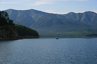
Zaybaykalsky National Park covers the middle section of the eastern shore of Lake Baikal, the west slope of the Barguzin mountains to the east, the Ushkany Islands, and the only large peninsula on the lake, Svyatoy Nos. Of the 2,690 km2 (1,040 sq mi) of the park, 38.8 km2 are protected water areas of the lake itself.
Stainach-Pürgg is a municipality since 2015 in the Liezen District of Styria, Austria.
Marianne "Mariandl" Feldhammer was an Austrian resistance activist during the Nazi years. She was one of the most important women in the "Willy-Fred" group around Sepp Plieseis. She was the only woman who knew the way to the so-called "Hedgehog" used by anti-Nazi partisans, to which by the end of the war she had herself made several deliveries of food and/or messages.
Edith Kristan-Tollmann nee Edith Kristan was an Austrian geologist and paleontologist. A prolific scientist with an interest in micropalaeontology and especially the foraminifera of the Triassic and the Jurassic eras, Kristan-Tollmann published widely in her field. She is also known for originating with her husband Alexander Tollmann a thoroughly documented theory of the evolution of human legend and social structures as a result of a massive impact event which struck multiple points on earth. The latter has become known as Tollmann's hypothetical bolide.
Lake Grundlsee is situated at the southern foot of the Totes Gebirge in Austria, in the Styrian part of the Salzkammergut. It lies at an altitude of 708 m above sea level. The municipal seat of Grundlsee is located on the northwest shore. The outflow of the Grundlsee is the Grundlsee Traun, which drains into the Danube via the Traun. With an area of 4.22 km2, Grundlsee is the largest lake in Styria. Its location, situated in a beautiful setting, has made it an important tourist destination and a popular bathing lake, as well as a diving and sailing area. The Daffodil Festival, Austria's largest flower festival, occurs every third year at Grundlsee. A professional fisherman manages the lake. The most prevalent fish species is the lake char, which is marketed as the Lake Aussee lake char.
"steiermark.at"(PDF), Office of the Styrian Provincial Government, Department of Water Supervision (ed.): 1st Styrian lake report. Graz 2008
Harald Lobitzer, Geologische Spaziergänge: Ausseerland – Salzkammergut. Hrsg.: Verlag der Geologischen Bundesanstalt in Wien mit dem Kammerhofmuseum Bad Aussee. Wien 2011, ISBN978-3-85316-063-3
"geologie.ac.at"(PDF), Gerhard W. Mandl, Dirk van Husen, Harald Lobitzer: Erläuterungen zu Blatt 69 Bad Ischl. Hrsg: Geologische Bundesanstalt. Wien 2012
Wolfgang Adler, Alexander Mrkvicka: Hrsg.: Naturhistorisches Museum Wien. Wien 2005.
This page is based on this Wikipedia article Text is available under the CC BY-SA 4.0 license; additional terms may apply. Images, videos and audio are available under their respective licenses.