Lake Malawi, also known as Lake Nyasa in Tanzania and Lago Niassa in Mozambique, is an African Great Lake and the southernmost lake in the East African Rift system, located between Malawi, Mozambique and Tanzania.
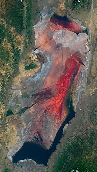
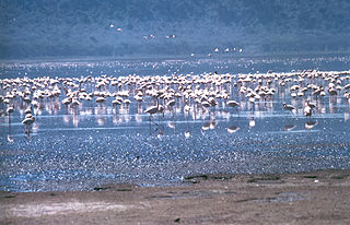
Lake Natron is a salt or alkaline lake located in north Ngorongoro District of Arusha Region in Tanzania at the border with Kenya. It is in the Gregory Rift, which is the eastern branch of the East African Rift. The lake is within the Lake Natron Basin, a Ramsar Site wetland of international significance. It is the only regular breeding area for Africa's lesser flamingoes, although this habitat is not protected and is under threat from planned development projects.

Lake Naivasha is a freshwater lake in Kenya, outside the town of Naivasha in Nakuru County, which lies north west of Nairobi. It is part of the Great Rift Valley. The name derives from the local Maasai name ɛnaɨpɔ́sha , meaning "that which heaves," a common Maasai word for bodies of water larger enough to have wave action when it is windy or stormy. Naivasha arose as the British attempt to pronounce the Maasai name. Literally, Lake Naivasha means "Lake Lake."
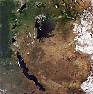
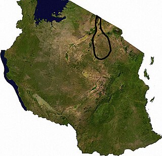
The African Great Lakes are a series of lakes constituting the part of the Rift Valley lakes in and around the East African Rift. The series includes Lake Victoria, the third-largest freshwater lake in the world by area; Lake Tanganyika, the world's second-largest freshwater lake by volume and depth; Lake Malawi, the world's eighth-largest freshwater lake by area; and Lake Turkana, the world's largest permanent desert lake and the world's largest alkaline lake. Collectively, they contain 31,000 km3 (7,400 cu mi) of water, which is more than either Lake Baikal or the North American Great Lakes. This total constitutes about 25% of the planet's unfrozen surface fresh water. The large rift lakes of Africa are the ancient home of great biodiversity, and 10% of the world's fish species live in this region.
The Rift Valley lakes are a series of lakes in the East African Rift valley that runs through eastern Africa from Ethiopia in the north to Malawi in the south, and includes the African Great Lakes in the south. These include some of the world's oldest lakes, deepest lakes, largest lakes by area, and largest lakes by volume. Many are freshwater ecoregions of great biodiversity, while others are alkaline "soda lakes" supporting highly specialised organisms.

Lake Magadi is the southernmost lake in the Kenyan Rift Valley, lying in a catchment of faulted volcanic rocks, north of Tanzania's Lake Natron. During the dry season, it is 80% covered by soda and is well known for its wading birds, including flamingos.

Ngorongoro Conservation Area is a protected area and a UNESCO World Heritage Site located in Ngorongoro District, 180 km (110 mi) west of Arusha City in Arusha Region, within the Crater Highlands geological area of northern Tanzania. The area is named after Ngorongoro Crater, a large volcanic caldera within the area. The Ngorongoro Conservation Area Authority administers the conservation area, an arm of the Tanzanian government, and its boundaries follow the boundary of the Ngorongoro District in Arusha Region. The western portion of the park abuts the Serengeti National Park, and the area comprising the two parks and Kenya's Maasai Mara game reserve is home to Great Migration, a massive annual migration of millions of wildebeest, zebras, gazelles, and other animals. The conservation area also contains Olduvai Gorge, one of the most important paleoanthropological sites in the world.

Babati Rural District is a district of Manyara Region of Tanzania, East Africa. The administrative capital of the district is Babati town, 172 km (107 mi) south of Arusha. The district covers an area of 6,069 km2 (2,343 sq mi), a large proportion (640 km2) of which is covered by the water bodies of Lake Babati, Lake Burunge and Lake Manyara. The district is bordered to the north by Arusha Region, to the south east by Simanjiro District, to the south by Dodoma Region, to the south west by Hanang District, and to the north west by Mbulu District. Babati Urban District is located within the district.

Arusha Region is one of Tanzania's 31 administrative regions and is located in the north of the country. The region's capital and largest city is the city of Arusha. The region is bordered by Kajiado County and Narok County in Kenya to the north, the Kilimanjaro Region to the east, the Manyara and Singida Regions to the south, and the Mara and Simiyu regions to the west. Arusha Region is home to Ngorongoro Conservation Area, a UNESCO World Heritage Site. The region is comparable in size to the combined land and water areas of the state of Maryland in the United States.
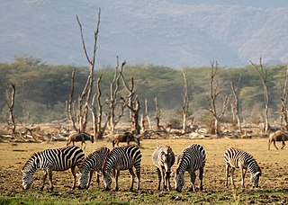
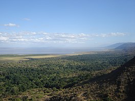
Lake Manyara National Park is a protected area in Tanzania's Arusha and Manyara Regions, situated between Lake Manyara and the Great Rift Valley. It is administered by the Tanzania National Parks Authority, and covers an area of 325 km2 (125 sq mi) including about 230 km2 (89 sq mi) lake surface. More than 350 bird species have been observed on the lake.

Oreochromis is a large genus of oreochromine cichlids, fishes endemic to Africa and the Middle East. A few species from this genus have been introduced far outside their native range and are important in aquaculture. Many others have very small ranges; some are seriously threatened, and O. ismailiaensis and O. lidole possibly are extinct. Although Oreochromis primarily are freshwater fish of rivers, lakes and similar habitats, several species can also thrive in brackish waters and some even survive in hypersaline conditions with a salinity that far surpasses that of seawater. In addition to overfishing and habitat loss, some of the more localized species are threatened by the introduction of other, more widespread Oreochromis species into their ranges. This is because they—in addition to competing for the local resources—often are able to hybridize.

Lake Elmenteita is a soda lake, in the Great Rift Valley, about 120 km northwest of Nairobi, Kenya.
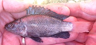
Oreochromis amphimelas is a species of tilapia cichlid endemic to north–central Tanzania, where it is found in Lake Manyara and a number of other saline lakes with closed basins. Maximum recorded size is 28 cm (11 in) in standard length.
Mto wa Mbu is an administrative ward and town in the Monduli district of the Arusha Region of Tanzania. According to the 2012 census, the ward had a total population of 11,405. The name Mto wa Mbu means " The river of Mosquitoes " in the Swahili Language.

Tanzania contains some 20 percent of the species of Africa's large mammal population, found across its reserves, conservation areas, marine parks, and 17 national parks, spread over an area of more than 42,000 square kilometres (16,000 sq mi) and forming approximately 38 percent of the country's territory. Wildlife resources of Tanzania are described as "without parallel in Africa" and "the prime game viewing country". Serengeti National Park, the country's second largest national park area at 14,763 square kilometres (5,700 sq mi), is located in northern Tanzania and is famous for its extensive migratory herds of wildebeests and zebra while also having the reputation as one of the great natural wonders of the world. The Ngorongoro Conservation Area, established in 1959, is a UNESCO World Heritage Site and inhabited by the Maasai people. Its Ngorongoro Crater is the largest intact caldera in the world.

The Great Rift Valley is part of an intra-continental ridge system that runs through Kenya from north to south. It is part of the Gregory Rift, the eastern branch of the East African Rift, which starts in Tanzania to the south and continues northward into Ethiopia. It was formed on the "Kenyan Dome" a geographical upwelling created by the interactions of three major tectonics: the Arabian, Nubian, and Somalian plates. In the past, it was seen as part of a "Great Rift Valley" that ran from Madagascar to Syria. Most of the valley falls within the former Rift Valley Province.
A half-graben is a geological structure bounded by a fault along one side of its boundaries, unlike a full graben where a depressed block of land is bordered by parallel faults.

The Tarangire River is a perennial river located in central Manyara Region in the eastern branch of the East African Rift Valley, within northern Tanzania.
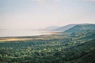
The Lake Manyara Biosphere Reserve is a UNESCO Biosphere Reserve in the depression of the East African Rift Valley in the Lake Manyara Basin in Arusha Region of northern Tanzania. The reserve is managed by Tanzanian Lake Manyara National Park.
The TarangireEcosystem is a geographical region in northern Tanzania, Africa. It extends between 2.5 and 5.5 degrees south latitudes and between 35.5 and 37 degrees east longitudes.