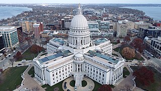
Madison is the capital city of the state of Wisconsin and the county seat of and largest city in Dane County. As of the 2020 census, the population was 269,840, making it the second-most populous city in Wisconsin after Milwaukee, and the 80th-most populous in the United States. Madison is named for American Founding Father and President James Madison.

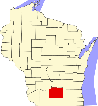
Dane County is a county in the U.S. state of Wisconsin. As of the 2020 census, the population was 561,504, making it the second-most populous county in Wisconsin after Milwaukee. The county seat is Madison, which is also the state capital.

McFarland is a village in Dane County, Wisconsin, situated on the shores of Lake Waubesa to the southeast of Madison. As of the 2020 U.S. Census, the village has a population of 9,325. Spanning just under five square miles and encompassing roughly 43.50 miles of roads, it is part of the Madison Metropolitan Statistical Area.
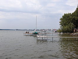
Monona is a city in Dane County, Wisconsin, United States. A suburb of the state capital, Madison, the city lies on the southeastern shore of Lake Monona, from which the city gets its name. The population was 8,624 at the 2020 census.

Monona Terrace is a convention center on the shores of Lake Monona in Madison, Wisconsin.
Lake Wingra is a small lake located inside the city limits of the U.S. city of Madison, Wisconsin. The smallest of the five major lakes drained by the Yahara River in Dane County, Lake Wingra is bordered by the University of Wisconsin–Madison Arboretum on the south and west and the City of Madison on the remaining shoreline. The lake is considered an important fishery and is known for spring runs of large muskellunge. Henry Vilas Zoo, Wingra Boats, Wingra Park, and Edgewood College are located on the Lake's northern shoreline. The majority of the shoreline is publicly owned.

Lake Mendota is a freshwater eutrophic lake that is the northernmost and largest of the four lakes in Madison, Wisconsin. The lake borders Madison on the north, east, and south, Middleton on the west, Shorewood Hills on the southwest, Maple Bluff on the northeast, and Westport on the northwest. Lake Mendota acquired its present name in 1849 following a proposal by a surveyor named Frank Hudson, who claimed to be familiar with local Native American languages; Lyman C. Draper, the first corresponding secretary of the Wisconsin Historical Society, proposed that 'Mendota' could have been a Chippewa word meaning 'large' or 'great.'

The Yahara River is a tributary of the Rock River in southern Wisconsin. It is about 62 miles (100 km) long, and drains an area of 536 square miles (1,390 km2). Via the Rock River, it is part of the watershed of the Mississippi River. The Yahara River links the lakes around which the city of Madison was built.
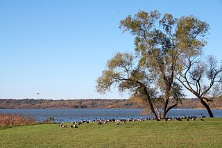
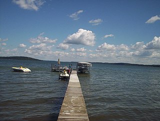
Lake Waubesa is one of the four major lakes in Dane County, Wisconsin that surround the city of Madison. The lake has a surface area of 2,074 acres (8.39 km2) and a max depth of 38 ft (12 m).
This is a list of the National Register of Historic Places listings in Dane County, Wisconsin. It aims to provide a comprehensive listing of buildings, sites, structures, districts, and objects in Dane County, Wisconsin listed on the National Register of Historic Places.

The flag of Madison, Wisconsin, includes a sky blue background with a diagonal white stripe that goes from the bottom left corner to the top right which symbolizes Lake Mendota, Lake Monona and the isthmus between them. At the center of the flag is a black cross, which symbolizes the four lakes, as well as the cross shape of the Wisconsin State Capitol. The gold circle in the middle represents the Wisconsin State Capitol's dome.
Morrisonville is an unincorporated community in the village of Windsor, in Dane County, Wisconsin, United States, approximately 18 miles (29 km) north of Madison. The Yahara River flows through the community. The main road running through Morrisonville is County Trunk DM, which connects from State Highway 51 approximately 8 miles (13 km) to the village of Dane, Wisconsin. At each entrance into the town on DM is a welcome sign calling Morrisonville "Frogtown U.S.A."

State Trunk Highway 113 is a state highway in the U.S. state of Wisconsin. It runs in north–south in south central Wisconsin from Madison to Baraboo, following the Chicago and North Western Railway. The highway uses the Merrimac Ferry, the last ferry in the Wisconsin state highway system, to cross the Wisconsin River at Merrimac. Over the length of the road, it runs through Dane, Columbia, and Sauk counties.
Green Lake — also known as Big Green Lake — is a lake in Green Lake County, Wisconsin, United States. Green Lake has a maximum depth of 237 ft (72 m), making it the deepest natural inland lake in Wisconsin and the second largest by volume. The lake covers 29.72 km2 and has an average depth of 30.48 m (100.0 ft). Green Lake has 43.94 km (27.30 mi) of diverse shoreline, ranging from sandstone bluffs to marshes.

The Madison Isthmus is where the downtown and near east potion of Madison, Wisconsin is situated, between Lake Mendota and Lake Monona. It is located between Madison's northeast side to the east and the University of Wisconsin campus to the west.

Lake Kegonsa State Park is a state park of Wisconsin, United States, on the northeast shore of Lake Kegonsa. It is located in Dane County southeast of Madison, Wisconsin. The park consists of forest, prairie, and wetlands. Known for its campground, beach, and approximately 5 miles (8.0 km) of hiking trails, the park offers swimming, fishing, water-skiing, sailing, and a boat landing.
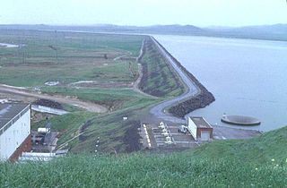
O'Neill Forebay is a forebay to the San Luis Reservoir created by the construction of O'Neill Dam across San Luis Creek approximately 12 miles (19 km) west of Los Banos, California, United States, on the eastern slopes of the Pacific Coast Ranges of Merced County.
Red Cedar Lake is a lake in Barron and Washburn counties, Wisconsin, United States. The lake covers an area of 1,841 acres (7.45 km2) and reaches a maximum depth of 53 ft (16 m). The community of Mikana, Wisconsin is located on the lake's western shore. Fish species enzootic to Red Cedar Lake include bluegill, largemouth bass, northern pike, smallmouth bass, and walleye.

Trout Lake is in Vilas County, Wisconsin, near the towns of Boulder Junction and Arbor Vitae, Wisconsin. With a surface area of 6.208 sq mi (16.079 km2) and a volume of 0.058 cu mi (0.240 km3), Trout Lake is one of the largest lakes in Vilas County. It has 16.1 mi (25.9 km) of shoreline, a large portion of which is undeveloped. There are also seven islands within the lake: Miller Island, Zimmerman Island, Haunted Island, Easter Island, Fisk Island, Chocolate Drop Island, and an unnamed island. It is a dimictic oligotrophic lake that supports a large number of sport fish, which has made it a popular angling destination.