Lake Zumbro Hydroelectric Generating Plant

Last updated
Lake Zumbro Hydroelectric Generating Plant
Lake Zumbro Dam.jpg
The Lake Zumbro Hydroelectric Generating Plant and Dam viewed from the north
CountryUnited States
LocationOff County Road 21 at north end of Lake Zumbro, Mazeppa Township, Minnesota
Coordinates 44°12′46″N92°28′46″W / 44.21278°N 92.47944°W / 44.21278; -92.47944
Purpose Power
StatusOperational
Construction began1917 (1917)
Opening date1919 (1919)
Construction cost$1,019,160.95 (equivalent to $23,279,224in 2022)
Built by Omaha Structural Steel Bridge Company
Designed by Hugh Lincoln Cooper
Owner(s)City of Rochester, Minnesota
Operator(s)Rochester Public Utilities
Dam and spillways
Type of dam Gravity dam
Impounds Zumbro River
Height (foundation)66 ft (20 m)
Length904 ft (276 m)
Width (crest)7 ft (2.1 m)
Width (base)70 ft (21 m)
Spillways 1
Spillway typeUncontrolled
Spillway length426 ft (130 m)
Reservoir
Creates Lake Zumbro
Surface area714.55 acres
Maximum water depth43 ft (13 m)
Type Run-of-the-river
Hydraulic head 55 ft (17 m)
Turbines 2 × Francis-type
Installed capacity 2.3 MW
Annual generation 12.5 GW·h
Lake Zumbro Hydroelectric Generating Plant
Zumbropowerdamsign.jpg
Sign on the Lake Zumbro Hydroelectric Generating Plant
Area2 acres (0.81 ha)
Built1917–1919
Architectural style Neoclassical
MPS Minnesota Hydroelectric Generating Facilities MPS
NRHP reference No. 91000243 [1]
Designated NRHPMarch 14, 1991

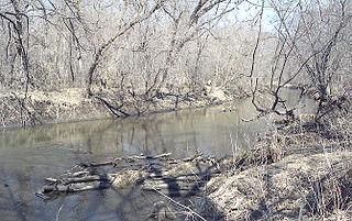
The Lake Zumbro Hydroelectric Generating Plant, also known as the City of Rochester Municipal Hydro-Electric Plant, is a hydroelectric facility on the Zumbro River in Mazeppa and Zumbro Townships in the U. S. State of Minnesota. The facility consists of a gravity dam and a powerhouse, and formerly included three houses for the plant operators. The houses were removed in the 1960s when the dam was retrofitted to allow remote operation of the generating equipment from Rochester. The impoundment created is called Lake Zumbro. This dam spans 904 feet (276 m) and is 66 feet (20 m) high, creating a reservoir with about 55 feet (17 m) of hydraulic head. [2]

Contents

The idea of building a hydroelectric plant on the Zumbro River north of Rochester had been discussed at least as far back as 1904, when several entrepreneurs surveyed the river, going so far as to buy land for a dam site. An effort was made to secure funding for a 60-foot (18 m) dam and transmission line to enable sale of electricity to the city, but the city council declined the arrangement as they did not feel that Rochester's power consumption would justify it. In 1915, a bond issue for a new hydroelectric plant was put before the city council, possibly spurred by the recent loss of the coal-fired municipal power plant in a fire. Voters overwhelmingly approved a $360,000 (equivalent to $8,222,961in 2022) bond issue in a special election held in January, 1916. [3]

The facility was designed by pioneering hydroelectric engineer Hugh Lincoln Cooper (1865–1937), a Minnesota native with strong ties to the city of Rochester, and was built from 1917 to 1919. [2] It is still operated by its original owner, Rochester Public Utilities (RPU), to supply power to Rochester, Minnesota, 15 miles (24 km) to the south. The Lake Zumbro Hydroelectric Generating Plant was listed on the National Register of Historic Places in 1991 for its state-level significance in the theme of engineering. [4] It was nominated as a representative work of Cooper—one of the nation's leading hydroelectric engineers in the early 20th century—and his only project in his home state of Minnesota. [2]

On the night of August 24, 2019, a pontoon boat with three people on board went over the dam. They were casting off from the lake shore after patronizing a business below the dam but got caught on the lip of the spillway. A fourth person jumped off and swam to a buoy, where she yelled for help, while the other three went over the edge in the boat. It lodged right-side-up near the base of the dam, causing the people on board only minor injuries. Firefighters, sheriff's deputies, and civilian boaters rescued all four individuals. The Wabasha County Sheriff's Office ascribed the incident to alcohol and darkness, charging the driver with boating while intoxicated. [5] [6]

See also

Related Research Articles

<span class="mw-page-title-main">Wabasha County, Minnesota</span> County in Minnesota, United States

Wabasha County is a county in the U.S. state of Minnesota. As of the 2020 census, the population was 21,387. Its county seat is Wabasha.

<span class="mw-page-title-main">Lake Travis</span> Reservoir in central Texas, USA

Lake Travis is a reservoir on the Colorado River in central Texas in the United States.

The Salt River Project (SRP) encompasses two separate entities: the Salt River Project Agricultural Improvement and Power District, an agency of the state of Arizona that serves as an electrical utility for the Phoenix metropolitan area, and the Salt River Valley Water Users' Association, a utility cooperative that serves as the primary water provider for much of central Arizona. It is one of the primary public utility companies in Arizona.

The Sacramento Municipal Utility District (SMUD) is a community-owned electric utility serving Sacramento County and parts of Placer County. It is one of the ten largest publicly owned utilities in the United States, generating the bulk of its power through natural gas and large hydroelectric generation plants. SMUD's green power (renewable) energy output was estimated as 33.8% in 2020.

<span class="mw-page-title-main">Lake Chelan Dam</span> Dam in Chelan, Washington

Lake Chelan Dam officially known as the Lake Chelan Hydroelectric Project is located approximately 32 miles (51 km) north of the city of Wenatchee in Chelan County. The dam is located at the lower or southeasterly end of 50.4 miles long Lake Chelan, and is within the limits of the city of Chelan. The powerhouse is located near the community of Chelan Falls. The reservoir has 677,400 acre-feet (835,600,000 m3) of usable water storage. The 10-year average generation for the Project is 365,000 megawatt hours.

<span class="mw-page-title-main">Zumbro River</span> River in the United States of America

The Zumbro River is a tributary of the Mississippi River in the Driftless Area of southeastern Minnesota in the United States. It is 64.6 miles (104.0 km) long from the confluence of its principal tributaries and drains a watershed of 1,428 square miles (3,700 km2). The river's name in English is a change from its French name Rivière des Embarras due to its mouth near Pine Island in the Mississippi River; the pronunciation changed from [dez‿ɑ̃.ba.ʁɑ] to. The Dakota name for this river is Wapka Wazi Oju, having reference to the grove of great white pines at Pine Island.

<span class="mw-page-title-main">Wilson Dam</span> Dam on the Tennessee River, Alabama

Wilson Dam is a dam on the Tennessee River between Lauderdale and Colbert counties in Alabama. Completed in 1924 by the United States Army Corps of Engineers, it impounds Wilson Lake, and is one of nine Tennessee Valley Authority (TVA) dams on the Tennessee River. It was declared a National Historic Landmark on November 13, 1966, for its role as the first dam to come under the TVA's administration. The dam is named for Woodrow Wilson.

<span class="mw-page-title-main">Lake Rabun</span> Reservoir in Rabun County, Georgia

Lake Rabun is a twisty 835-acre (3.4 km2) reservoir with 25 miles (40 km) of shoreline located in the Northeastern corner of the U.S. state of Georgia in Rabun County. It is the third lake in a six-lake series that follows the original course of the Tallulah River. The series begins with Lake Burton as the northernmost lake, followed by Lake Seed, Lake Rabun, Lake Tallulah Falls, Lake Tugalo, and Lake Yonah. Lake Rabun was built in a deep valley located along a 10-mile (16 km) section of the Tallulah River.

<span class="mw-page-title-main">Childs-Irving Hydroelectric Facilities</span> United States historic place

Childs-Irving Hydroelectric Facilities consisted of two 20th-century power plants, a dam, and related infrastructure along or near Fossil Creek in the U.S. state of Arizona. The complex was named an Historic Mechanical Engineering Landmark in 1971 and was added to the National Register of Historic Places 20 years later. Decommissioned in 2005, the plants no longer produce electricity, and much of the infrastructure—including the dam, the Irving Power Plant, and thousands of feet of concrete flumes—have been removed, and the creek's original flow has been restored.

<span class="mw-page-title-main">Croton Dam (Michigan)</span> Dam in Newaygo County, Michigan

Croton Dam is an earth-filled embankment dam and powerplant complex on the Muskegon River in Croton Township, Newaygo County, Michigan. It was built in 1907 under the direction of William D. Fargo by the Grand Rapids - Muskegon Power Company, a predecessor of Consumers Energy. The 40-foot-high (12 m) dam impounds 7.2 billion U.S. gallons (6 billion imp. gal/27 billion L) of water in its 1,209-acre (489 ha) reservoir and is capable of producing 8,850 kilowatts at peak outflow. It was listed on the National Register of Historic Places in 1979.

<span class="mw-page-title-main">Mossyrock Dam</span> Dam in Washington state

Mossyrock Dam is a concrete arch-gravity dam on the Cowlitz River near Mossyrock in Lewis County, Washington, United States. The reservoir created by the dam is called Riffe Lake. The primary purpose of the dam is hydroelectric production while flood control is a secondary function. The dam is the tallest in Washington state and its hydroelectric power station supplies 40% of Tacoma Power's electricity.

The Dix Dam is a dam on the Dix River located between Mercer and Garrard County, Kentucky. It was constructed to generate hydroelectricity and prevent flooding of the Kentucky River but is better known for creating Herrington Lake.

<span class="mw-page-title-main">National Register of Historic Places listings in Wabasha County, Minnesota</span>

This is a list of the National Register of Historic Places listings in Wabasha County, Minnesota. It is intended to be a complete list of the properties and districts on the National Register of Historic Places in Wabasha County, Minnesota, United States. The locations of National Register properties and districts for which the latitude and longitude coordinates are included below, may be seen in an online map.

<span class="mw-page-title-main">Power Plant and Dam No. 5 (Potomac River)</span> United States historic place

Power Plant and Dam No. 5, also known as Honeywood Dam, comprises a dam on the Potomac River, originally built for the Chesapeake and Ohio Canal, and a power plant built to take advantage of the river's flow to generate hydroelectric power. The dam is included in Chesapeake and Ohio Canal National Historical Park.

<span class="mw-page-title-main">Long Lake Dam</span> Dam in Lincoln / Stevens counties, Washington

Long Lake Dam is a concrete gravity dam on the Spokane River, between Lincoln County and Stevens County about 30 miles (48 km) northwest of Spokane in eastern Washington. It forms Long Lake (Washington), a 23.5 mi (37.8 km) long reservoir, and has a hydroelectric generating capacity of 71 megawatts. The dam was built by Washington Water Power, which operates five other dams along the Spokane.

<span class="mw-page-title-main">Abiquiu Dam</span> Dam in Rio Arriba County, New Mexico

Abiquiu Dam is a dam on the Rio Chama, located about 60 miles (97 km) northwest of Santa Fe in Rio Arriba County, New Mexico, USA. Built and operated by the U.S. Army Corps of Engineers (USACE), the dam is an earth embankment structure 354 feet (108 m) high and 1,800 feet (550 m) long, containing 11.8 million cubic yards of fill. The dam forms Abiquiu Lake, one of the largest lakes in New Mexico, with a full storage capacity of 1,369,000 acre-feet (1,689,000 dam3) and 5,200 acres (2,100 ha) of water. To date, the reservoir has never filled to capacity, with a record high of 402,258 acre-feet (496,178 dam3), 29.4% of full pool, on June 22, 1987. The dam's primary purpose is flood control, in addition to irrigation and municipal water storage, and hydroelectric generation.

<span class="mw-page-title-main">Shepaug Dam</span>

Shepaug Dam is a dam located between Newtown in Fairfield County and Southbury in New Haven County, Connecticut.

Moccasin Dam is a small dam on Moccasin Creek in Tuolumne County, California, in the town of Moccasin, west of Yosemite. It holds the Moccasin Reservoir. The dam, reservoir and associated hydroelectric power plant are part of the Hetch Hetchy Project, which provide water and power to the city of San Francisco. The dam is located near the junction of Highway 120 and Highway 49.

References

  1. "National Register Information System". National Register of Historic Places . National Park Service. July 9, 2010.
  2. 1 2 3 Hess, Jeffrey A. (October 1989). "National Register of Historic Places Registration Form: Lake Zumbro Hydroelectric Generating Plant". National Park Service. Retrieved 2016-04-02.
  3. Kroska, Nicholas (1988). Serving the community : the history of Rochester Public Utilities. Rochester, MN: Rochester Public Utilities.
  4. "Lake Zumbro Hydroelectric Generating Plant". Minnesota National Register Properties Database. Minnesota Historical Society. 2009. Retrieved 2015-06-19.
  5. "Sheriff: Alcohol, darkness factors after pontoon goes over Lake Zumbro Dam". KIMT 3 News. 2019-08-26. Archived from the original on 2019-12-02. Retrieved 2019-08-27.
  6. Murphy, Esme (2019-08-26). "Pontoon Driver Could Be Charged After Boating Over Lake Zumbro Dam". WCCO CBS Minnesota. Retrieved 2019-08-27. (news item, with image of boat hung up on top of dam)