Lambs Knoll

Last updated
Lambs Knoll
1Lambs Knoll.JPG
Lambs Knoll
Highest point
Elevation 1,758 ft (536 m)
Coordinates N 39.448712 and W -77.62749.
Geography
Location Washington County / Frederick County, Maryland
Parent range South Mountain
Blue Ridge Mountains
Climbing
First ascent unknown
Easiest route drive up

Lambs Knoll is a peak of South Mountain on the border of Washington County and Frederick County in the state of Maryland, United States. The 1,758 feet (536 m) peak is the second tallest on South Mountain in Maryland behind Quirauk Mountain.

South Mountain (Maryland and Pennsylvania)

South Mountain is the northern extension of the Blue Ridge Mountain range in Maryland and Pennsylvania. From the Potomac River near Knoxville, Maryland, in the south, to Dillsburg, Pennsylvania, in the north, the 70-mile-long (110 km) range separates the Hagerstown and Cumberland valleys from the Piedmont regions of the two states. The Appalachian National Scenic Trail follows the crest of the mountain through Maryland and a portion of Pennsylvania.

Washington County, Maryland County in the United States

Washington County is located in the western part of the U.S. state of Maryland. As of the 2010 census, the population was 147,430. Its county seat is Hagerstown. Washington County was the first county in the United States to be named for the Revolutionary War general George Washington. Washington County is one of three Maryland counties recognized by the Appalachian Regional Commission as being part of Appalachia.

Frederick County, Maryland County in Maryland

Frederick County is located in the northern part of the U.S. state of Maryland. As of the 2010 U.S. Census, the population was 240,336. The county seat is Frederick.

Contents

Geography

The peak is located to the south of Fox and Turner's Gaps, and marks the beginning of geographic change in South Mountain from a solitary narrow ridge to a broad highland plateau, as it nears the convergence with Catoctin Mountain.

Foxs Gap

Fox's Gap, also known as Fox Gap, is a wind gap in the South Mountain Range of the Blue Ridge Mountains, located in Frederick County and Washington County, Maryland. The gap is traversed by Reno Monument Road. The Appalachian Trail also crosses the gap along the ridgeline.

Turners Gap

Turner's Gap is a wind gap in the South Mountain Range of the Blue Ridge Mountains, located in Frederick County and Washington County, Maryland. The gap is traversed by U.S. Route 40 Alternate, the old National Pike. The Appalachian Trail also crosses the gap along the ridgeline.

Catoctin Mountain mountain in United States of America

Catoctin Mountain, along with the geologically associated Bull Run Mountains, forms the easternmost mountain ridge of the Blue Ridge Mountains, which are in turn a part of the Appalachian Mountains range. The ridge runs northeast/southwest for about 50 miles (80 km) departing from South Mountain near Emmitsburg, Maryland, and running south past Leesburg, Virginia, where it disappears into the Piedmont in a series of low-lying hills near Aldie, Virginia. The ridge forms the eastern rampart of the Loudoun and Middletown valleys.

The Appalachian Trail passes just to the southeast of the summit but a spur trail leads from it to the crest near an old fire tower and former Federal military microwave communications facility and concrete tower, now used by the FAA. Just south of the peak the AT passes by White Rocks which provides the best views from the mountain. The Potomac Appalachian Trail Club maintained Bear Springs Cabin is located on the eastern slope of the mountain.

Appalachian Trail Hiking trail in the USA

The Appalachian National Scenic Trail, generally known as the Appalachian Trail or simply the A.T., is a marked hiking trail in the Eastern United States extending between Springer Mountain in Georgia and Mount Katahdin in Maine. The trail is about 2,200 miles (3,500 km) long, though the exact length changes over time as parts are modified or rerouted. The Appalachian Trail Conservancy describes the Appalachian Trail as the longest hiking-only trail in the world. More than 2 million people are said to take a hike on part of the trail at least once each year.

The Potomac Appalachian Trail Club (PATC) is a volunteer organization that works to maintain hiking trails in the Washington, D.C. area of the United States. PATC was founded in 1927 to protect and develop the local section of the then new Appalachian Trail. It has expanded its mission to oversee over 1,050 miles (1,690 km) of trails, 47 shelters and 39 cabins in Virginia, Maryland, West Virginia, Pennsylvania and Washington, D.C.

History

Lambs Knoll was referred to as Lamb's Old Field in the 19th century and is likely named for Milton and Mary Lamb who are believed to have farmed the mountains summit in the 1830s. The old nomenclature persisted through the civil war and possibly in to the 20th century. The first published use of the modern name came in 1934 when the Civilian Conservation Corps erected a fire tower on the summit. The fire tower was manned through the late 1940s and used by hikers to obtain views of the Middletown and Hagerstown valleys until it was fenced off by the state of Maryland in the 1980s.

American Civil War Civil war in the United States from 1861 to 1865

The American Civil War was a war fought in the United States from 1861 to 1865, between the North and the South. The Civil War is the most studied and written about episode in U.S. history. Primarily as a result of the long-standing controversy over the enslavement of black people, war broke out in April 1861 when secessionist forces attacked Fort Sumter in South Carolina shortly after Abraham Lincoln had been inaugurated as the President of the United States. The loyalists of the Union in the North proclaimed support for the Constitution. They faced secessionists of the Confederate States in the South, who advocated for states' rights to uphold slavery.

Civilian Conservation Corps public work relief program

The Civilian Conservation Corps (CCC) was a public work relief program that operated from 1933 to 1942 in the United States for unemployed, unmarried men. Originally for young men ages 18–25, it was eventually expanded to ages 17–28. Robert Fechner was the first director of the agency, succeeded by James McEntee following Fechner's death. The CCC was a major part of President Franklin D. Roosevelt's New Deal that provided unskilled manual labor jobs related to the conservation and development of natural resources in rural lands owned by federal, state, and local governments. The CCC was designed to provide jobs for young men and to relieve families who had difficulty finding jobs during the Great Depression in the United States. Maximum enrollment at any one time was 300,000. Through the course of its nine years in operation, 3 million young men participated in the CCC, which provided them with shelter, clothing, and food, together with a wage of $30 per month.

Middletown Valley valley in Maryland, United States of America

Middletown Valley, also historically known as Catoctin Valley, is a valley in western Frederick County in the state of Maryland.

Related Research Articles

Tuscarora Trail

The 252-mile (406 km) Tuscarora Trail is a long distance trail in the Ridge and Valley Appalachians that passes through the US states of Virginia, West Virginia, Maryland, and Pennsylvania. In the south, the Tuscarora begins at a junction with the Appalachian Trail (AT) near Mathews Arm Campground, 0.4-mile (0.64 km) south of the AT's crossing of Skyline Drive at MP 21.1 in Shenandoah National Park in Virginia. In the north, it rejoins the Appalachian Trail at the top of Blue Mountain just west of the Susquehanna River and Harrisburg, Pennsylvania, creating a 435 mi (700.1 km) circuit known as the Tuscalachian Loop. The Tuscarora Trail was built as an alternative parallel route for the Appalachian Trail. It was built farther west, in a more wild corridor, because it was feared that development would force closure of the AT, before passage of the National Scenic Trails Act of 1968.

Backbone Mountain ridge of the Allegheny Mountains of the central Appalachian Mountain Range, in the U.S. states of West Virginia and Maryland

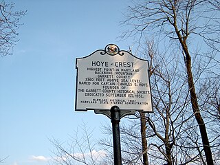
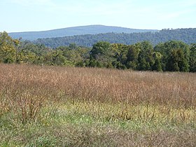
Backbone Mountain is a ridge of the Allegheny Mountains of the central Appalachian Mountain Range. It is situated in the U.S. states of West Virginia and Maryland and forms a portion of the Eastern Continental Divide. In the state of Maryland, Backbone Mountain reaches an elevation of 3,360 feet or 1,024 metres, making it Maryland’s highest point.

Allegheny Front

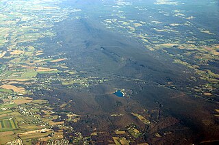
The Allegheny Front is the major southeast- or east-facing escarpment in the Allegheny Mountains in southern Pennsylvania, western Maryland, and eastern West Virginia, USA. The Allegheny Front forms the boundary between the Ridge-and-Valley Appalachians to its east and the Appalachian Plateau to its west. The Front is closely associated with the Appalachian Mountains' Eastern Continental Divide, which in this area divides the waters of the Ohio/Mississippi river system, flowing to the Gulf of Mexico, from rivers flowing into Chesapeake Bay and from there into the Atlantic Ocean.

Slide Mountain (Ulster County, New York) Highest peak of New Yorks Catskill Mountains

Slide Mountain is the highest peak in the Catskill Mountains of the U.S. state of New York. It is located in the town of Shandaken in Ulster County. While the 4,180-foot (1,270 m) contour line on topographic maps is generally accepted as its height, the exact elevation of the summit has never been officially determined by the U.S. Coast and Geodetic Survey, and many informal surveys suggest the mountain may actually top 4,200 feet above sea level.

Blue Ridge Mountain mountain in West Virginia, United States of America

Blue Ridge Mountain, also known as Blue Mountain, is the colloquial name of the westernmost ridge of the Blue Ridge Mountains in northern Virginia and the Eastern Panhandle of West Virginia. The Appalachian Trail traverses the entire length of the mountain along its western slope and crest.

The Appalachian National Scenic Trail spans fourteen U.S. states during its roughly 2,200 miles (3,500 km)-long journey: Georgia, North Carolina, Tennessee, Virginia, West Virginia, Maryland, Pennsylvania, New Jersey, New York, Connecticut, Massachusetts, Vermont, New Hampshire, and Maine. It begins at Springer Mountain, Georgia, and follows the ridgeline of the Appalachian Mountains, crossing many of its highest peaks and running with only a few exceptions almost continuously through wilderness before ending at Mount Katahdin, Maine.

Great Indian Warpath

The Great Indian Warpath (GIW)—also known as the Great Indian War and Trading Path, or the Seneca Trail—was that part of the network of trails in eastern North America developed and used by Native Americans which ran through the Great Appalachian Valley. The system of footpaths extended from what is now upper New York to deep within Alabama. Various Indians traded and made war along the trails, including the Catawba, numerous Algonquian tribes, the Cherokee, and the Iroquois Confederacy. The British traders' name for the route was derived from combining its name among the northeastern Algonquian tribes, Mishimayagat or "Great Trail", with that of the Shawnee and Delaware, Athawominee or "Path where they go armed".

Wills Mountain mountain in United States of America

Wills Mountain is a quartzite-capped ridge in the Ridge and Valley physiographic province of the Appalachian Mountains in Pennsylvania and Maryland, United States, extending from near Bedford, Pennsylvania, to near Cumberland, Maryland. It is the northernmost of several mountain ridges included within the Wills Mountain Anticline.

Quirauk Mountain mountain in United States of America

Quirauk Mountain is the highest point on South Mountain. The 2,145-foot (654 m) peak is located in northeastern Washington County, Maryland. It lies just southwest of Fort Ritchie Military Reservation in the village of Cascade and about 1/2 mile southeast of the community of Blue Mountain. The Appalachian Trail and South Mountain State Park are about 1/2 mile to the west of the mountain's summit.

Wesser Bald mountain in North Carolina, United States of America

Wesser Bald is a summit located in Macon County, North Carolina, near the community of Wesser. A wooden fire tower at the summit provides hikers with unimpeded views of the Great Smoky Mountains National Park and also the Nantahala Mountains. The Appalachian Trail traverses the summit from roughly north to south with the Nantahala Outdoor Center lying to the north within the Nantahala Gorge and Tellico gap just to the south. Tellico gap has unimproved road access. The climb from Tellico Gap takes an average of 20 minutes. Also, a third route, the blue trail, departs from the end of Wesser Creek Road and follows Wesser Creek up to a point just south of the summit to a fork with the Appalachian Trail. The summit is located at 4,627 ft (1,410 m). and is within Nantahala National Forest. A map detailing the highway routes to access Tellico Gap is available at the Nantahala Outdoor Center. Observable landforms include Wayah Bald, the Nantahala Gorge, and Clingmans Dome among others. The Wesser Fire Tower provides unparalleled 360 degree views of the Smokies in a short 1.5 mile hike from Tellico Gap on the Appalachian Trail, with an elevation gain of about 767 feet. The Fire Tower was originally reported as destroyed during the forest fires which ravaged the Nantahala Forest in November, 2016 but it was later learned that it survived.

Balsam Lake Mountain Westernmost of the Catskill High Peaks in U.S. state of New York

Balsam Lake Mountain is one of the Catskill Mountains, located in the Town of Hardenburgh, New York, United States. It is the westernmost of the range's 35 High Peaks. Its exact height has not been determined, but the highest contour line on topographic maps, 3,720 feet (1,130 m), is usually given as its elevation.

Alander Mountain mountain in United States of America

Alander Mountain, 2,239 feet (682 m), is a prominent peak of the south Taconic Mountains; it is located in southwest Massachusetts and adjacent New York. Part of the summit is grassy and open and part is covered with scrub oak and shrubs; the sides of the mountain are wooded with northern hardwood tree species. Views from the top include the southern Taconic Mountains, the Hudson River Valley including the Catskills. Several trails traverse Alander Mountain, most notably the 15.7 mi (25.3 km) South Taconic Trail, which passes just beneath the summit.

Tower Mountain, 2,193 feet (668 m), is a prominent peak in the Taconic Mountains of western Massachusetts. The mountain is located in Pittsfield State Forest and is traversed by the 35 mi (56 km) Taconic Crest hiking trail and the 12.1 mi (19.5 km) multi-use Taconic Skyline Trail. The summit is partially open with views to the west; the slopes are wooded with northern hardwood tree species.

Mount Tremper mountain in United States of America

Mount Tremper, officially known as Tremper Mountain and originally called Timothyberg, is one of the Catskill Mountains in the U.S. state of New York. It is located near the hamlet of Phoenicia, in the valley of Esopus Creek.

Rocky Run Shelter

The Rocky Run shelter(s) are backcountry shelters located on the Appalachian Trail near Boonsboro, Maryland. They are situated next to the Rocky Run spring and a steep hill side. The original Rocky Run shelter sleeps six people, has a flat floor, and provides enough space to sit up. The new shelter can sleep up to sixteen and features a wood floor and a plywood-floored loft, as well as a covered front deck and large windows which flood the shelter with light. Accommodations available include two decks, a grill pit, porch swing, and semi-enclosed privy.

Poke-O-Moonshine Mountain mountain in United States of America

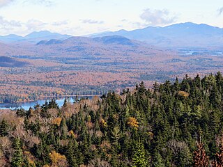
Poke-O-Moonshine Mountain, spelled Pokamoonshine on U.S. Geological Survey maps, and sometimes known as just Poke-O, is a minor peak of the Adirondack Mountains. The name is believed to be a corruption of the Algonquin words pohqui, meaning 'broken', and moosie, meaning 'smooth'. It is located in the town of Chesterfield, New York, United States, on New York state Forest Preserve land, part of the Taylor Pond Wild Forest complex within the Adirondack Park. Due to its location next to the pass through which most travelers from the north enter the range, it has been called the "gateway to the Adirondacks".

Owls Head Mountain

Owls Head Mountain is a 2,812-foot (857 m) mountain in Long Lake, New York in the Adirondack Park.

References

Coordinates: 39°26′55″N77°37′39″W / 39.44861°N 77.62750°W / 39.44861; -77.62750

Geographic coordinate system Coordinate system

A geographic coordinate system is a coordinate system that enables every location on Earth to be specified by a set of numbers, letters or symbols. The coordinates are often chosen such that one of the numbers represents a vertical position and two or three of the numbers represent a horizontal position; alternatively, a geographic position may be expressed in a combined three-dimensional Cartesian vector. A common choice of coordinates is latitude, longitude and elevation. To specify a location on a plane requires a map projection.