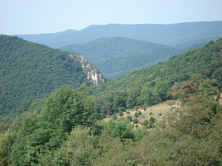
The Appalachian Mountains, often called the Appalachians, are a mountain range in eastern to northeastern North America. The term "Appalachian" refers to several different regions associated with the mountain range, and its surrounding terrain. The general definition used is one followed by the United States Geological Survey and the Geological Survey of Canada to describe the respective countries' physiographic regions. The U.S. uses the term Appalachian Highlands and Canada uses the term Appalachian Uplands; the Appalachian Mountains are not synonymous with the Appalachian Plateau, which is one of the provinces of the Appalachian Highlands.

The Boston Mountains is a Level III ecoregion designated by the Environmental Protection Agency (EPA) in the U.S. states of Arkansas and Oklahoma. Part of the Ozarks, the Boston Mountains are a deeply dissected plateau. The ecoregion is steeper than the adjacent Springfield Plateau to the north, and bordered on the south by the Arkansas Valley. The Oklahoma portion of the range is locally referred to as the Cookson Hills. There are several theories of how the mountains were named, though apparently none are related to the Massachusetts city.

The Allegheny Front is the major southeast- or east-facing escarpment in the Allegheny Mountains in southern Pennsylvania, western Maryland, eastern West Virginia, and western Virginia. The Allegheny Front forms the boundary between the Ridge-and-Valley Appalachians to its east and the Appalachian Plateau to its west. The Front is closely associated with the Appalachian Mountains' Eastern Continental Divide, which in this area divides the waters of the Ohio/Mississippi river system, flowing to the Gulf of Mexico, from rivers flowing into Chesapeake Bay and from there into the Atlantic Ocean.

South Mountain is the northern extension of the Blue Ridge Mountain range into Maryland and Pennsylvania. From the Potomac River near Knoxville, Maryland in the south to Dillsburg, Pennsylvania in York County, Pennsylvania in the north, the 70-mile-long (110 km) range separates the Hagerstown and Cumberland valleys from the Piedmont regions of the two states.

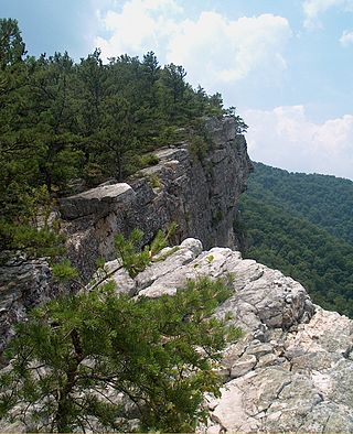
North Fork Mountain is a quartzite-capped mountain ridge in the Ridge and Valley physiographic province of the Allegheny Mountains, also known as the High Alleghenies or Potomac Highlands, of eastern West Virginia. Kile Knob, at 4,588 feet, is the mountain's highest point, and Panther Knob and Pike Knob are nearly as high.

Wills Mountain is a quartzite-capped ridge in the Ridge and Valley physiographic province of the Appalachian Mountains in Pennsylvania and Maryland, extending from near Bedford, Pennsylvania, to near Cumberland, Maryland. It is the northernmost of several mountain ridges included within the Wills Mountain Anticline.

Roan Mountain is a 6,277 ft (1,913 m) mountain straddling the North Carolina/Tennessee border in the Unaka Range of the Southern Appalachian Mountains in the Southeastern United States. The range's highpoint, Roan is clad in a dense stand of Southern Appalachian spruce-fir forest, and includes the world's largest natural rhododendron garden, and the longest stretch of grassy bald in the Appalachian range. The Roan Highlands also contain the highest quality remaining stretch of Fraser fir forest throughout the tree's entire range. The Cherokee National Forest and Pisgah National Forest converge atop the mountain, with Roan Mountain State Park located near its northern base. The Appalachian Trail traverses most of the Roan's crest. The Roan High Knob Shelter is the highest back-country shelter on the entire 2,174-mile (3,499 km) trail.

Blue Knob is a summit in the eastern United States with a broad dome that is the northernmost 3,000-footer in the Allegheny Mountains. It is the highest point in Bedford County, Pennsylvania.

Martin Hill is a mountain ridge which connects Tussey Mountain to its east and Evitts Mountain to its west. Martin Hill is located in the Martin Hill Wild Area, which is a part of the Buchanan State Forest, in Bedford County, Pennsylvania, United States. The summit of Martin Hill is one of the few in the Commonwealth which is void of any towers or transmitters; such equipment is located instead on a lesser nearby summit in the same mountain complex. Martin Hill is the second highest in Pennsylvania's Ridge and Valley Appalachians, the highest being Wills Mountain to its west at 2,780 ft (850 m).

The Pemigewasset Wilderness is a 45,000-acre (182 km2) federally designated Wilderness Area in the heart of New Hampshire's White Mountains. It is a part of the White Mountain National Forest. It is New Hampshire's largest wilderness area.

Woody's Knob, at an elevation of 4,170 feet, is a summit or "knob" in the Blue Ridge Mountains and one of the highest points in the unincorporated village of Little Switzerland and in Mitchell County, North Carolina.

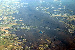
The Bear Pond Mountains are a subrange in the Appalachian Mountains, that straddle Pennsylvania and Maryland in the United States. These mountains are a part of the Ridge and Valley Appalachians and reach their highest point at Cross Mountain (Pennsylvania) 2,062 feet (628 m). A unique geologic feature known as the "Punchbowl" occurs in this range. This feature was created by the weathered shales of the Ordovician age in the center of a south-plunging anticline, having been eroded to expose a large amphitheater-like feature (punchbowl). Cross and Hearthstone Mountain are made of hard resistant quartzite of the Tuscarora Formation of the Silurian age, which form the walls of the bowl.
White Rock, 2,550 feet (780 m), is the high point on a 7 mi (11 km) ridgeline in the Taconic Mountains. The ridge is located in the tri-state corner of New York, Massachusetts, and Vermont in the towns of Petersburgh, Williamstown, and Pownal. The ridge has several distinct knobs; those with names are, from south to north: White Rocks, 2,365 feet (721 m); Smith Hill, 2,330 feet (710 m); White Rock, the high point 2,550 feet (780 m); and Bald Mountain 2,485 feet (757 m). The Snow Hole, located along the ridgeline between Bald Mountain and the White Rock, is a crevasse in which snow can be found well into the summer.

Spruce Mountain, located in eastern West Virginia, is the highest ridge of the Allegheny Mountains. The whale-backed ridge extends for only 16 miles (26 km) from northeast to southwest, but several of its peaks exceed 4,500 feet (1,400 m) in elevation. The summit, Spruce Knob, is the highest Allegheny Mountain point both in the state and the entire range, which spans four states.


