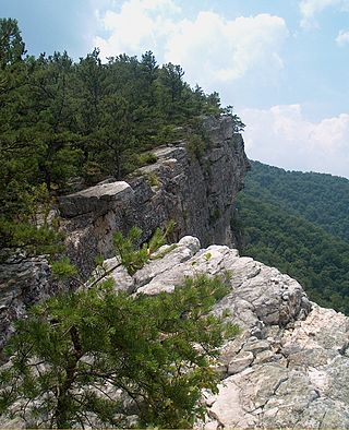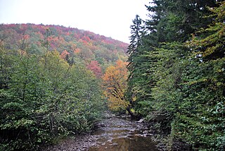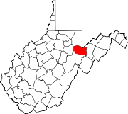
Tucker County is a county in the U.S. state of West Virginia. As of the 2020 census, the population was 6,762, making it West Virginia's fourth-least populous county. Its county seat is Parsons. The county was created in 1856 from a part of Randolph County, then part of Virginia. In 1871, a small part of Barbour County, was transferred to Tucker County. The county was named after Henry St. George Tucker, Sr., a judge and Congressman from Williamsburg, Virginia.

Randolph County is a county located in the U.S. state of West Virginia. As of the 2020 census, the population was 27,932. Its county seat is Elkins. The county was founded in 1787 and is named for Edmund Jennings Randolph.

The Monongahela National Forest is a national forest located in the Allegheny Mountains of eastern West Virginia, USA. It protects over 921,000 acres of federally managed land within a 1,700,000 acres proclamation boundary that includes much of the Potomac Highlands Region and portions of 10 counties.

The Allegheny Front is the major southeast- or east-facing escarpment in the Allegheny Mountains in southern Pennsylvania, western Maryland, eastern West Virginia, and western Virginia. The Allegheny Front forms the boundary between the Ridge-and-Valley Appalachians to its east and the Appalachian Plateau to its west. The Front is closely associated with the Appalachian Mountains' Eastern Continental Divide, which in this area divides the waters of the Ohio/Mississippi river system, flowing to the Gulf of Mexico, from rivers flowing into Chesapeake Bay and from there into the Atlantic Ocean.

The Dolly Sods Wilderness is a U.S. Wilderness Area in the Allegheny Mountains of eastern West Virginia and is part of the Monongahela National Forest of the U.S. Forest Service.

The Tygart Valley River — also known as the Tygart River — is a principal tributary of the Monongahela River, approximately 135 miles (217 km) long, in east-central West Virginia in the United States. Via the Monongahela and Ohio rivers, it is part of the watershed of the Mississippi River, draining an area of 1,329 square miles (3,440 km2) in the Allegheny Mountains and the unglaciated portion of the Allegheny Plateau.

The Black Fork is a principal tributary of the Cheat River in the Allegheny Mountains of eastern West Virginia, USA. It is a short stream, about four miles (6 km) in length, formed by the confluence of two other streams not far above its mouth. It was traditionally considered one of the five Forks of Cheat.

The Dry Fork is a 39.1-mile-long (62.9 km) tributary of the Black Fork of the Cheat River in the Allegheny Mountains of eastern West Virginia, USA. Via the Black Fork, the Cheat, and the Monongahela and Ohio rivers, it is part of the watershed of the Mississippi River. The Dry Fork flows for much of its length in the Monongahela National Forest and drains mostly rural and forested areas. It was traditionally considered one of the five Forks of Cheat.
The Potomac Highlands of West Virginia centers on five West Virginian counties in the upper Potomac River watershed in the western portion of the state's Eastern Panhandle, bordering Maryland and Virginia. Because of geographical proximity, similar topography and landscapes, and shared culture and history, the Potomac Highlands region also includes Pocahontas, Randolph, and Tucker counties, even though they are in the Monongahela River or New River watersheds and not that of the Potomac River.

Cheat Mountain is an exceptionally high and rugged ridge situated in the Allegheny Mountains of eastern West Virginia, USA. It is about 50 miles (80 km) long and more than five miles (8 km) wide at its widest. Its highest point is at its southernmost end at Thorny Flat, which has an elevation of 4,848 feet (1,478 m). Several other knobs rise above 4,000 feet (1,200 m) along its length.

North Fork Mountain is a quartzite-capped mountain ridge in the Ridge and Valley physiographic province of the Allegheny Mountains, also known as the High Alleghenies or Potomac Highlands, of eastern West Virginia. Kile Knob, at 4,588 feet, is the mountain's highest point, and Panther Knob and Pike Knob are nearly as high.

Canaan Valley is a large bathtub-shaped upland valley in northeastern Tucker County, West Virginia, USA. Within it are extensive wetlands and the headwaters of the Blackwater River which spills out of the valley at Blackwater Falls. It is a well-known and partially undeveloped scenic attraction and tourist draw. Since 1994, almost 70% of the Valley has become the Canaan Valley National Wildlife Refuge, the nation's 500th National Wildlife Refuge, with Canaan Valley Resort State Park and Blackwater Falls State Park nearby.

Laurel Fork is a 37.8-mile-long (60.8 km) river in eastern West Virginia, USA. It is a tributary of the Dry Fork; via the Dry Fork, the Black Fork, and the Cheat, Monongahela and Ohio rivers, it is part of the watershed of the Mississippi River, draining an area of 60 square miles (160 km2) in the Allegheny Mountains. With the Dry Fork, the Glady Fork, the Shavers Fork and the Blackwater River, it is considered to be one of the five principal headwaters tributaries of the Cheat River.

The Sinks of Gandy — also called the Sinks of Gandy Creek, or simply "The Sinks" — are a modestly celebrated cave and underground stream at Osceola in eastern Randolph County, West Virginia, United States. The Sinks are on private property within the Monongahela National Forest.

Germany Valley is a scenic upland valley high in the Allegheny Mountains of eastern West Virginia originally settled by German farmers in the mid-18th century. It is today a part of the Spruce Knob–Seneca Rocks National Recreation Area of the Monongahela National Forest, although much ownership of the Valley remains in private hands.

Osceola is a former logging community in eastern Randolph County, West Virginia, USA. It was located within what is now the Monongahela National Forest on Gandy Creek at the southern extremity of Little Middle Mountain and Yokum Knob.

Hu Maxwell was a local historian, novelist, editor, poet, and author of several histories of West Virginia counties.

Shavers Mountain, is a high and rugged ridge situated in the Allegheny Mountains of eastern West Virginia. It is about 35 miles (56 km) long, north to south, and several of its peaks exceed 4,000 feet (1,200 m) in elevation. Shavers Mountain is notable for being "bookended", at its northern and southern ends, by two exceptional natural areas: the Otter Creek Wilderness and the Gaudineer Scenic Area, respectively, both of which preserve small stands of old growth forest on the mountain.
The West Virginia Maneuver Area (WVMA) was a vast, five-county training ground in the Allegheny Mountains of eastern West Virginia used by the U.S. Army during World War II to train soldiers in low-altitude mountain operations. This area was selected due to its similarity to the mountainous terrain of Italy and other areas within the European Theater of Operations.

Sods is a term used in the Allegheny Mountains of eastern West Virginia for a mountain top meadow or bog, in an area that is otherwise generally forested. The term is similar to that of a "grass bald", a more widespread designation applied throughout the central and southern Appalachian region.


