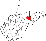
The Dry Fork is a 39.1-mile-long (62.9 km) tributary of the Black Fork of the Cheat River in the Allegheny Mountains of eastern West Virginia, USA. Via the Black Fork, the Cheat, and the Monongahela and Ohio rivers, it is part of the watershed of the Mississippi River. The Dry Fork flows for much of its length in the Monongahela National Forest and drains mostly rural and forested areas. It was traditionally considered one of the five Forks of Cheat.

Sleepy Creek is a 44.0-mile-long (70.8 km) tributary of the Potomac River in the United States, belonging to the Chesapeake Bay's watershed. The stream rises in Frederick County, Virginia, and flows through Morgan County, West Virginia before joining the Potomac near the community of Sleepy Creek.

St. George is an unincorporated community and former county seat of Tucker County, West Virginia.
Mill Creek is a 14.5-mile-long (23.3 km) tributary of Opequon Creek, belonging to the Potomac River and Chesapeake Bay watersheds, located in Berkeley County in West Virginia's Eastern Panhandle. Its name reflects its past as a popular site for various types of mills, beginning with one constructed by Morgan Morgan in the mid-18th century near his cabin in present-day Bunker Hill.

Mill Creek is a 14.0-mile-long (22.5 km) tributary stream of the South Branch Potomac River, belonging to the Potomac River and Chesapeake Bay watersheds. The stream is located in Hampshire County in West Virginia's Eastern Panhandle. Mill Creek flows into the South Branch west of Romney Bridge near Vanderlip along the Northwestern Turnpike.
The Colonial District is a high school conference in the state of Virginia that includes schools in the Greater Richmond Region. Colonial District schools compete in the 5A, 4A, 3A, and 2A divisions.

Ridings Mill is an unincorporated community in southern Frederick County, Virginia. Ridings Mill takes its name from the mill on West Run there. The community is located to the east of Middletown at the crossroads of Ridings Mill and Huttle Roads. Named for the mill located on West Run on Ridings Mill Road, this is a rural area consisting mainly of farms.

The Great Indian Warpath (GIW)—also known as the Great Indian War and Trading Path, or the Seneca Trail—was that part of the network of trails in eastern North America developed and used by Native Americans which ran through the Great Appalachian Valley. The system of footpaths extended from what is now upper New York to deep within Alabama. Various Indians traded and made war along the trails, including the Catawba, numerous Algonquian tribes, the Cherokee, and the Iroquois Confederacy. The British traders' name for the route was derived from combining its name among the northeastern Algonquian tribes, Mishimayagat or "Great Trail", with that of the Shawnee and Delaware, Athawominee or "Path where they go armed".

Hu Maxwell was a local historian, novelist, editor, poet, and author of several histories of West Virginia counties.

Colvin Run Mill is in Great Falls, Virginia. Built c. 1811, Colvin Run Mill is the sole surviving operational 19th-century water-powered mill in the Washington, D.C. metropolitan area, and its restored mechanism is a nationally significant example of automated technologies pioneered in milling and later adopted across American industry. Down the gravel path of the park is the miller's house, home to the families who ran the mill. In 1883, Addison Millard moved his family here when he bought the old mill. Addison, his wife Emma, and some of their 20 children lived there. When Addison died, the family stayed and operated the mill until 1934.

Rutherford is an unincorporated community in Fairfax County, Virginia, United States. It lies South of Virginia State Highway 236, North of Virginia State Route 620, East of Olley Lane, and West of Guinea Road. This is west of Annandale, east of the independent city of Fairfax.

Mill Run is a ghost town in Pocahontas County, West Virginia, United States. Mill Run was located on the Greenbrier River 2 miles (3.2 km) south-southwest of Hillsboro. Mill Run appeared on USGS maps as late as 1923.
Mill Run, West Virginia may refer to:

The North River is a tributary of the Cacapon River, belonging to the Potomac River and Chesapeake Bay watersheds. The river is located in Hampshire and Hardy counties in the U.S. state of West Virginia's Eastern Panhandle. The mouth of the North River into the Cacapon is located at Forks of Cacapon. From its headwaters to its mouth, the North River spans 52.4 miles (84.3 km) in length.
Mill Run is a 9.1-mile-long (14.6 km) tributary stream of the South Branch Potomac River, belonging to the Potomac River and Chesapeake Bay watersheds. The stream is located in Hampshire County in the Eastern Panhandle of the U.S. state of West Virginia. Mill Run rises on Nathaniel Mountain and flows northeast, then northwest into the South Branch south of Romney near Hampshire Park on South Branch River Road.

Laneville is an unincorporated community in Tucker County, West Virginia, USA. It lies on Red Creek along the southern border of the Dolly Sods Wilderness in the Monongahela National Forest.

Pleasant Run is an unincorporated community in Tucker County, West Virginia.


