Lake Champlain is a natural freshwater lake in North America. It mostly lies between the US states of New York and Vermont, but also extends north into the Canadian province of Quebec.

Crown Point is a town in Essex County, New York, United States, located on the west shore of Lake Champlain. The population was 2,024 at the 2010 census. The name of the town is a direct translation of the original French name, Pointe à la Chevelure.

Ticonderoga is a town in Essex County, New York, United States. The population was 5,042 at the 2010 census. The name comes from the Mohawk tekontaró:ken, meaning "it is at the junction of two waterways".

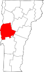
Cornwall is a town in Addison County, Vermont, United States. It was founded November 3, 1761. The population was 1,207 at the 2020 census.

Orwell is a town in Addison County, Vermont, United States. The population was 1,239 at the 2020 census. Mount Independence was the largest fortification constructed by the American colonial forces. The 300-acre (1.2 km2) site is now one of Vermont's premier state-operated historic sites.

Shoreham is a town in Addison County, Vermont, United States. The population was 1,260 at the 2020 census.

Ticonderoga is a hamlet in the southeast part of the town of Ticonderoga, in Essex County, New York, United States. The name is derived from the Haudenosaunee term for "between the two waters", the two waters being Lake George and Lake Champlain. The hamlet became a census-designated place (CDP) in 2008. As of the 2010 census, the population was 3,382, out of a total 5,042 residents in the town of Ticonderoga.
Chimney Point is a peninsula in the town of Addison, Vermont, which juts into Lake Champlain forming a narrows. It is one of the earliest settled and most strategic sites in the Champlain Valley.
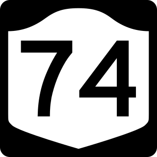
New York State Route 74 (NY 74) and Vermont Route 74 (VT 74) are state highways in the northeastern United States, connected by one of the last remaining cable ferries in North America. Together they extend for 34 miles (55 km) through Essex County, New York, and Addison County, Vermont. NY 74 begins at exit 28 off Interstate 87 (I-87) in the hamlet of Severance in the Adirondack Mountains region of the northern part of New York State. It extends 20.44 miles (32.89 km) to the western shore of Lake Champlain in Ticonderoga. There, the seasonal Fort Ticonderoga–Larrabees Point Ferry carries cars across the state border into Vermont, where VT 74 starts at the lake's eastern shore and terminates 13.26 miles (21.34 km) later at a junction with VT 30 in the town of Cornwall.

Long Wharf is a historic American pier in Boston, Massachusetts, built between 1710 and 1721. It once extended from State Street nearly a half-mile into Boston Harbor; today, the much-shortened wharf functions as a dock for passenger ferries and sightseeing boats.

Ticonderoga station is an Amtrak intercity train station in Ticonderoga, New York. It is served by the single daily round trip of the Adirondack. The station is located about 2 miles (3.2 km) east of downtown Ticonderoga and 0.2 miles (0.32 km) west of the Fort Ticonderoga–Shoreham Ferry landing. It has one low-level side platform on the west side of the single track.

The steamboat Ticonderoga is one of two remaining side-paddle-wheel passenger steamers with a vertical beam engine of the type that provided freight and passenger service on America's bays, lakes and rivers from the early 19th to the mid-20th centuries. Commissioned by the Champlain Transportation Company, Ticonderoga was built in 1906 at the Shelburne Shipyard in Shelburne, Vermont on Lake Champlain.

Rouses Point station is an Amtrak intercity train station in Rouses Point, New York, served by the single daily round trip of the Adirondack. The station building is a former Delaware and Hudson Railway constructed in 1889, with a one low-level side platform on the east side of the track. It was added to the National Register of Historic Places in 2005 as Rouses Point Railroad Station.
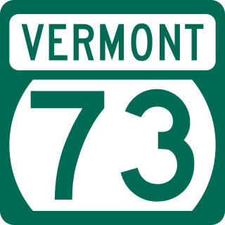
Vermont Route 73 (VT 73) is a 36.674-mile-long (59.021 km) east–west state highway in central Vermont, United States. It extends from VT 74 in Shoreham in the west to VT 100 in Rochester in the east. The route runs through parts of Addison, Rutland, and Windsor counties. The portion of VT 73 west of VT 22A is town-maintained and internally designated by VTrans as Major Collector 156 while the remainder of VT 73 is maintained by the state.

The Crown Point Road, or the Crown Point Military Road, is a historic road built in 1759-60, mostly in what is now the United States state of Vermont. It was built by British Army and colonial militia forces to connect Fort Crown Point near the southern end of Lake Champlain to the Fort at Number 4 in what is now Charlestown, New Hampshire. It was the first major road in Vermont, spurring development along its route after the French and Indian War. Fragments of the road are still visible in largely period condition, or have been paved over, while others have disappeared into the forest. Sections of the road located in Weathersfield have been listed on the National Register of Historic Places.
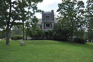
The Hawley's Ferry House, also known just as the Hawley House, is a historic house on the shore of Lake Champlain in Kingsland Bay State Park, Ferrisburgh, Vermont. Built about 1790, it is one of the few surviving 18th-century buildings on the Vermont side of the lake. It was listed on the National Register of Historic Places in 1978.
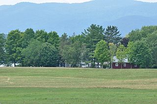
Hand's Cove is a historically significant geographic feature on the eastern shore of Lake Champlain in Shoreham, Vermont. It was from this area that colonial forces led by Ethan Allen and Benedict Arnold crossed the lake for the Capture of Fort Ticonderoga, early in the American Revolutionary War. It is also home to the only known colonial-era blockhouse in the state. It was listed on the National Register of Historic Places in 1980.

The Battery Street Historic District encompasses one of the oldest developed areas of Burlington, Vermont. With a history dating to 1790, this area, south of downtown Burlington and initially bounded roughly by Main, St. Paul, and Maple Streets, and Lake Champlain, this area includes a mix of residential, commercial, and industrial uses, with architecture spanning from its early period to the 20th century, including one of the city's oldest houses. The district was listed on the National Register of Historic Places in 1977, and has twice been enlarged, extending west to South Union Street.

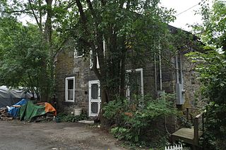
The District Six Schoolhouse is a historic school building on Elmendorf Road in Shoreham, Vermont. Built about 1833 and now converted into a residence, this modest stone structure is one of Vermont's oldest surviving district schoolhouses. It was listed on the National Register of Historic Places in 1977.
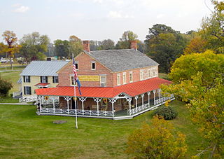
Chipman's Point is a historic 19th-century ferry complex on Chipman Point Road in Orwell, Vermont. The complex includes two early 19th-century stone warehouses, a former Lake Champlain ferry landing site, and the foundational remains of the Chipman Point Hotel. It was listed on the National Register of Historic Places in 1996.