Vergennes is a city located in the northwest quadrant of Addison County, Vermont. The municipality is bordered by the towns of Ferrisburgh, Panton and Waltham. As of the 2020 census, the population was 2,553. It is the smallest of Vermont's nine cities in terms of population, though the city of Winooski covers a smaller area. It was the first city chartered in the state of Vermont.

Middlebury is the main settlement in the town of Middlebury in Addison County, Vermont, United States, and a census-designated place (CDP). The population was 7,304 at the 2020 census, out of a total population of 9,152 in the town of Middlebury. Most of the village is listed on the National Register of Historic Places as the Middlebury Village Historic District.

Fell's Point is a historic waterfront neighborhood in southeastern Baltimore, Maryland, United States. It was established around 1763 and is located along the north shore of the Baltimore Harbor and the Northwest Branch of the Patapsco River. The area has many antique, music and other stores, restaurants, coffee bars, a municipal markethouse with individual stalls, and over 120 pubs. Located 1.5 miles east of Baltimore's downtown central business district and the Jones Falls stream, Fells Point has a maritime past and the air of a seafaring town. It also has the greatest concentration of drinking establishments and restaurants in the city.

Springfield is a historic neighborhood of Jacksonville, Florida, United States, located to the north of downtown. Established in 1869, it experienced its greatest growth from the early 1880s through the 1920s. The Springfield Historic District is listed in the National Register of Historic Places, and contains some of the city's best examples of 19th and early 20th century architecture.

Otter Creek is the longest river entirely contained within the borders of Vermont. Roughly 112 miles (180 km) long, it is the primary watercourse running through Rutland County and Addison County. The mouth of the river flows into Lake Champlain.

The Phoenix Iron Works, located in Phoenixville, Pennsylvania, was a manufacturer of iron and related products during the 19th century and early 20th century. Phoenix Iron Company was a major producer of cannons for the Union Army during the American Civil War. The company also produced the Phoenix column, an advance in construction material. Company facilities are a core component of the Phoenixville Historic District, a National Register of Historic Places site that was in 2006 recognized as a historic landmark by ASM International.

The Waterville Village Historic District encompasses most of the history 19th and early 20th-century village center of Waterville, Vermont. The village grew from beginnings late in the 18th century to serve as a modest civic, commercial, and residential hub for the rural community. It was added to the National Register of Historic Places in 2007.
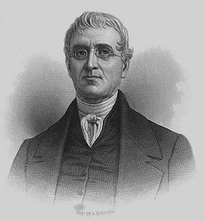
Cyrus Alger was a United States arms manufacturer and inventor.

The Furnace Grove Historic District encompasses the remains of a historic 19th-century iron processing facility near Bennington, Vermont. Located on the north side of Vermont Route 9 east of the town center, its production peaked in the 1830s, and was afterward converted into a gentleman's farm. Surviving elements of its past include the remains of iron smelting furnaces, housing, and agricultural outbuildings. The district was listed on the National Register of Historic Places in 1997.
The Pittsford Green Historic District encompasses the heart of the traditional village center of Pittsford, Vermont. Centered on a stretch of United States Route 7, the village's development began in the late 18th century, and now consists almost entirely of buildings from the 19th century. The district was listed on the National Register of Historic Places in 1982.

The Wallingford Main Street Historic District encompasses the historic portions of the village of Wallingford, Vermont. An essentially linear district extending along Main Street on either side of School Street, it has a well-preserved array of 19th and early-20th century residential, commercial, and civic buildings. It was listed on the National Register of Historic Places in 1984.

The Bethel Village Historic District encompasses the historic core of the village of Bethel in the town of Bethel, Vermont, USA. The L-shaped district extends along Main and Church Streets, including many of the village's commercial and civic buildings, as well as a significant number of 19th and early 20th-century residences. The district was listed on the National Register of Historic Places in 1976, and was slightly enlarged in 1990.
The Vergennes Residential Historic District encompasses a neighborhood south of downtown Vergennes, Vermont that encapsulates an architectural cross-section of the city's 19th and early 20th-century residential history. Set on Water, Maple, and Green Streets, it includes houses built and occupied by a diversity of the city's economic classes, from mill owners to laborers. The district was listed on the National Register of Historic Places in 2003.

The Frog Hollow Stone Mill, or just the Stone Mill, is a historic industrial building at 3 Mill Street in Middlebury, Vermont. Built in 1840, it is an important local reminder of the town's industrial past, and was listed on the National Register of Historic Places in 1973. It presently houses a restaurant, a public market, a co-working space and four lodging units.

The Springfield Downtown Historic District encompasses the historic central business district of the town of Springfield, Vermont. Located in a narrow valley on the banks of the Black River, the town's architecture is primarily reflective of its importance as a manufacturing center in the late 19th and early-to-mid 20th centuries, with a cluster of commercial buildings surrounded by residential and industrial areas. It was listed on the National Register of Historic Places in 1983, and enlarged slightly in 1986.

The Battery Street Historic District encompasses one of the oldest developed areas of Burlington, Vermont. With a history dating to 1790, this area, south of downtown Burlington and initially bounded roughly by Main, St. Paul, and Maple Streets, and Lake Champlain, this area includes a mix of residential, commercial, and industrial uses, with architecture spanning from its early period to the 20th century, including one of the city's oldest houses. The district was listed on the National Register of Historic Places in 1977, and has twice been enlarged, extending west to South Union Street.

The Main Street–College Street Historic District encompasses a historically fashionable residential area of Burlington, Vermont. Principally located along Main and College Streets between South Winooski and South Williams Streets, the area was one of the city's most exclusive residential areas from the early 19th century to the early 20th century, and includes a diversity of high quality architecture from that period. It was listed on the National Register of Historic Places in 1988.

The St. Johnsbury Historic District encompasses much of the historic civic and commercial center of St. Johnsbury, Vermont. Representing a significant expansion of the Railroad Street Historic District and the St. Johnsbury Main Street Historic District, it captures the historical tension and competition between Main Street and Railroad Street for primacy as the town's most important civic and commercial areas. The district was listed on the National Register of Historic Places in 1980.

The St. Johnsbury Main Street Historic District encompasses the historic civic and cultural center of the town of St. Johnsbury, Vermont. Organized along the town's Main Street, it includes high-quality architecture spanning the 19th and early 20th centuries, and includes the National Historic Landmark St. Johnsbury Athenaeum. Many of the district's buildings were designed by Lambert Packard, a prominent local architect. The district was listed on the National Register of Historic Places in 1975, and was enlarged slightly in 1976. It was subsumed into the larger St. Johnsbury Historic District in 1980.

Potrero Point is an area in San Francisco, California, east of San Francisco's Potrero Hill neighborhood. Potrero Point was an early San Francisco industrial area. The Point started as small natural land feature that extends into Mission Bay of San Francisco Bay. The Point was enlarged by blasted and cuts on the nearby cliffs. The cut material was removed and used to fill two square miles into the San Francisco bay, making hundreds of acres of flat land. The first factories opened at Potrero Point in the 1860s. Early factories were powder magazine plant, the Pacific Rolling Mill Company and small shipyards. The large Union Iron Works and its shipyards were built at the site, stated in 1849 by Peter Donahue. To power the factories and neighborhood coal and gas-powered electricity works were built, later the site became Pacific Gas and Electric Company (PG&E).